
U Bein Bridge, Amarapura’s long teak line over Taungthaman Lake
Published on 09/18/2026 at 19:57 | Editorial responsibility: Rafael Müller, Editor-in-Chief AD HOC NEWS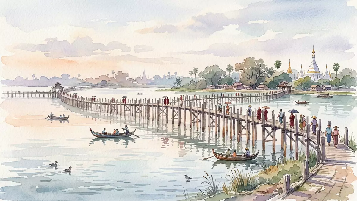
U Bein Bridge stretches as a long, narrow line of teak across Taungthaman Lake beside Amarapura in Myanmar, turning a practical footway into a distinctive walk over water that has become inseparable from the lake and the former royal city’s setting.
A nineteenth-century teak bridge tied to Amarapura
U Bein Bridge crosses Taungthaman Lake on the edge of Amarapura, a historic settlement in the Mandalay Region of central Myanmar that served as a royal capital during the Konbaung dynasty.Taungthaman Lake near Amarapura The bridge takes its name from U Bein, an Amarapura official who oversaw its construction in the mid-nineteenth century when the town held that royal role.named after U Bein
Construction of U Bein Bridge is dated to around 1850, in the decades when Amarapura and Mandalay marked successive centres of power in the Burmese kingdom, and the span has become associated with that nineteenth-century reshaping of the region.built between 1849 and 1851 The bridge is a pedestrian crossing rather than a roadway, carrying people and small-scale daily life from one shore of the lake to the other as it has done since the Konbaung period.
A long, low line of timber over water
Seen from the bank, U Bein Bridge reads as a slightly curving sequence of timber posts and beams stretching out across Taungthaman Lake, with the deck set only modestly above the water so that the crossing feels close to the lake’s surface.narrow teak footway across Taungthaman Lake The bridge’s total length is given as about 1.2 km (around 0.75 mi), which makes the walk a substantial traverse in its own right rather than a quick step between banks.1.2-kilometre bridge
The structure is built predominantly from teak, with the walkway formed by wooden planks resting on a long line of upright supports sunk into the lakebed, many of them timber and some supplemented by other materials where repairs have been made.wooden crossing on teak pillars The deck carries a single narrow lane for pedestrians, punctuated by simple rest points and raised sections that mark changes in the lake and the approach to the shore, so that the bridge reads as one continuous wooden causeway between dry land and shallow water.
Daily life and lake landscape along the crossing
U Bein Bridge links Amarapura with settlements and pagodas on the far side of Taungthaman Lake, and the crossing passes areas of cultivated land, temple compounds and small lakeside communities that use the footway as part of their regular movements.connects Amarapura with a small suburb village Monks, residents and visitors share the narrow deck, which gives a direct line above water while remaining woven into the fabric of the lakeside districts and their paths.
The lake itself shapes much of what is visible from the bridge: patches of cultivated shoreline, boats moving under or beside the spans, and seasonal changes in water level that alter how close the timber deck lies to the surface.stretching across Taungthaman Lake In clear conditions the bridge’s long profile is mirrored by the water, and the combination of repeated wooden supports and open lake vistas gives the walk across U Bein Bridge a strong sense of progression from the built edge of Amarapura to the quieter reaches beyond the far shore.
Visiting U Bein Bridge: what travellers from Western Europe should know
- U Bein Bridge spans Taungthaman Lake beside Amarapura in Myanmar’s Mandalay Region, south of Mandalay city, and is reached by road from Mandalay and the surrounding settlements.
- The crossing itself is a long, narrow timber footbridge with simple planked surfaces and sections without side barriers, so walking it involves sharing a single lane above water with other pedestrians.
- The terrain around the lake includes low embankments, unpaved paths and steps leading up to the bridge at either end, so footwear suited to uneven ground is useful for exploring both approaches and the deck.
- Myanmar’s official language is Burmese and the currency is the kyat.
- Entry requirements depend on your nationality; UK travellers can check the FCDO travel advice at gov.uk/foreign-travel-advice, Irish travellers the Department of Foreign Affairs at ireland.ie.
Searching for U Bein Bridge on social platforms
These links open searches for U Bein Bridge on each platform.
Frequently asked questions about U Bein Bridge
Where is U Bein Bridge located?
U Bein Bridge spans Taungthaman Lake beside Amarapura in the Mandalay Region of central Myanmar, a short distance south of Mandalay city.
What should visitors expect when walking across U Bein Bridge?
Visitors walk along a long, narrow teak footway carried on timber supports above Taungthaman Lake, sharing a single lane without extensive side barriers and moving between low embankments at each shore.
What makes U Bein Bridge distinctive compared with other crossings?
The bridge’s combination of nineteenth-century teak construction, its mid-lake setting at Taungthaman Lake and its near-1.2 km length give it a characteristic profile and a prolonged walk above water tied closely to Amarapura’s landscape.


