
Fish River Canyon’s layered desert gorge near Hobas
Published on 09/02/2026 at 20:02 | Editorial responsibility: Rafael Müller, Editor-in-Chief AD HOC NEWS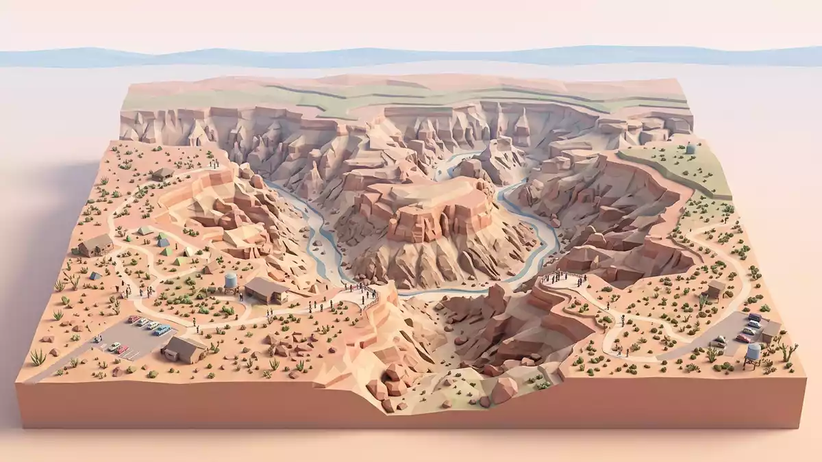
South of Hobas in southern Namibia, Fish River Canyon presents a broad, stepped gorge where the Fish River has incised a deep trench into the desert plateau. From the main viewpoints near Hobas, the canyon’s layered walls reveal rocks that formed in very different chapters of Earth history, turning the landscape into a cross-section of time that reaches back more than a billion years.
A desert canyon carved through ancient rock
Fish River Canyon lies in southern Namibia, in the arid interior north of the Orange River and inland from the Atlantic coast, where the Fish River has cut down through a plateau of exposed bedrock. The gorge belongs to the Ai-Ais Richtersveld Transfrontier Park, a protected area jointly managed by Namibia and South Africa that links the canyon to the dry mountains and river valleys further south.Ai-Ais Richtersveld Transfrontier Park The section near Hobas offers road access to several rim viewpoints, where the upper canyon opens out in a broad sweep before narrowing into the lower trench.
From above, the canyon reads as two related forms: an upper canyon several kilometres wide and relatively shallower, and a lower canyon where the river occupies a twisting channel cut far into the older rocks beneath.upper canyon and lower canyon The overall system extends for more than 100 km from near Seeheim towards the hot springs of Ai-Ais, with the deepest reaches approaching around 550 m (1,804 ft) below the plateau.161 km long and up to 550 m deep The gorge near Hobas sits within this longer canyon, offering a concentrated view of its stepped rock architecture.
Layered geology written into the canyon walls
The walls of Fish River Canyon display a distinct contrast between younger sedimentary rocks and much older metamorphic basement, making the gorge an accessible example of how different rock units stack and meet. Along the rim and upper walls, flat-lying sandstones, shales and dark limestones of the Nama Group form broad, horizontal bands, representing sediments laid down in shallow seas during the late Precambrian and early Cambrian periods.sandstone, shale and limestone of the Nama Group Below these, lighter-toned gneisses and related metamorphic rocks of the Namaqua Metamorphic Complex appear where the canyon has cut deeper, exposing basement that formed roughly 1,300 million years ago.Namaqua Metamorphic Complex around 1,300 million years old
Across the cliffs, darker igneous intrusions cut through both sedimentary and metamorphic rocks as narrow bands. These dolerite or diabase dykes date to around 770 million years ago and stand out as straight, darker lines that cross-cut the older strata.diabase dykes about 770 million years old In some profiles, the contact between the flat-lying Nama sediments and the tilted metamorphic basement beneath can be seen clearly, marking a nonconformity that represents a long gap in recorded time between the two rock packages.nonconformable contact in exposed profiles For visitors at Hobas, this juxtaposition of horizontal younger strata over older, deformed basement rock gives the canyon a distinctive, tiered appearance.
Glaciation, uplift and the making of the canyon
The story recorded in Fish River Canyon’s rocks begins long before the present gorge took shape. Around 350 million years ago, during the Dwyka ice age, southward-moving glaciers carved an early valley along the line of what would become the Fish River, then filled it with glacial sediments, sandstones and shales of the Karoo Supergroup.Dwyka ice age and Karoo Supergroup Later erosion stripped away most of these deposits and the overlying Karoo rocks, leaving the older Nama and Namaqua units exposed in and around the present canyon.
Geological studies link the modern canyon form to the break-up of the Gondwana supercontinent and subsequent uplift of the African landmass, which began roughly 130 million years ago.modern canyon began to form around 130 million years ago As South America and Africa separated and Africa rose, the gradient of the Fish River increased, allowing it to incise deeper into the plateau and cut through the hard gneisses to form the lower canyon.continental separation and increased gradient The result is the present deeply sinuous gorge, where a comparatively small river has carved a large canyon over immense spans of time.
Visiting Fish River Canyon: what travellers from Western Europe should know
- Fish River Canyon lies in southern Namibia, south of Hobas and inland from the Orange River; the rim viewpoints near Hobas are reached by road within the Ai-Ais Richtersveld Transfrontier Park.
- The terrain around the viewpoints consists of desert plateau cut by steep canyon walls, with unfenced drops, rocky ground and uneven paths between parking areas and the main lookouts.
- The canyon rim near Hobas stands hundreds of metres above the riverbed, and any walk away from the main viewpoints crosses exposed, dry terrain with little shade.
- The Fish River region is part of southern Namibia, where the official language is English and the currency is the Namibian dollar.
- Entry requirements depend on your nationality; UK travellers can check the FCDO travel advice at gov.uk/foreign-travel-advice, Irish travellers the Department of Foreign Affairs at ireland.ie.
Searching for Fish River Canyon on social platforms
These links open searches for Fish River Canyon on each platform.
Frequently asked questions about Fish River Canyon
Where is Fish River Canyon in relation to Hobas?
Fish River Canyon lies south of Hobas in southern Namibia, within the Ai-Ais Richtersveld Transfrontier Park, with rim viewpoints near Hobas accessible by road.
What should visitors expect when they reach the canyon?
Visitors at Hobas encounter desert plateau ending abruptly at a deep, stepped gorge, with wide views over layered rock walls and a distant river in the lower canyon.
What makes Fish River Canyon distinctive among desert landscapes?
The canyon combines a long, deep river gorge with clearly exposed contacts between flat-lying Nama sediments, older Namaqua metamorphic basement and dark igneous dykes, all visible from its rim.


