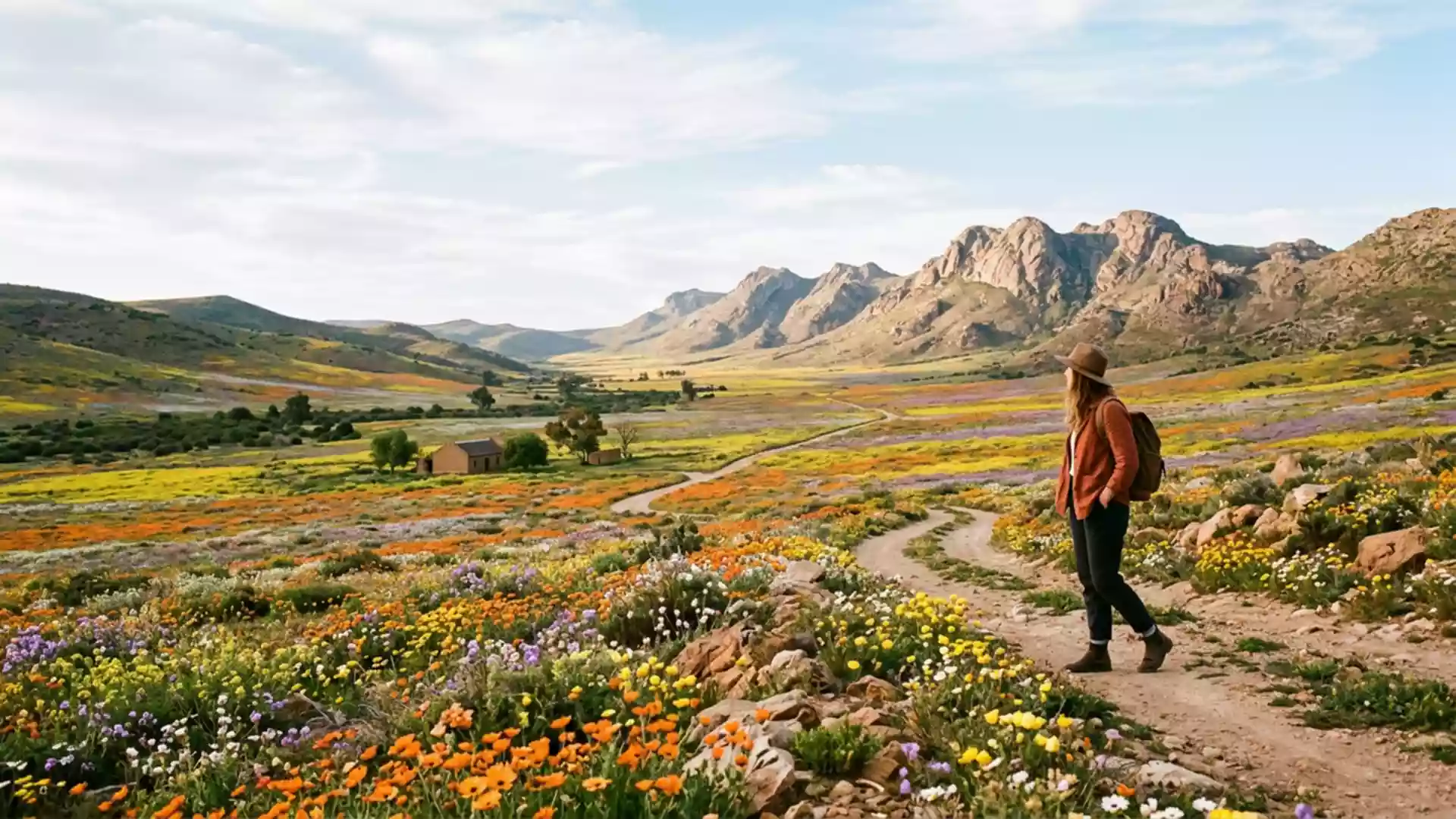
Namaqualand’s seasonal blooms and rugged hills around Springbok
Published on 09/10/2026 at 18:01 | Editorial responsibility: Rafael Müller, Editor-in-Chief AD HOC NEWS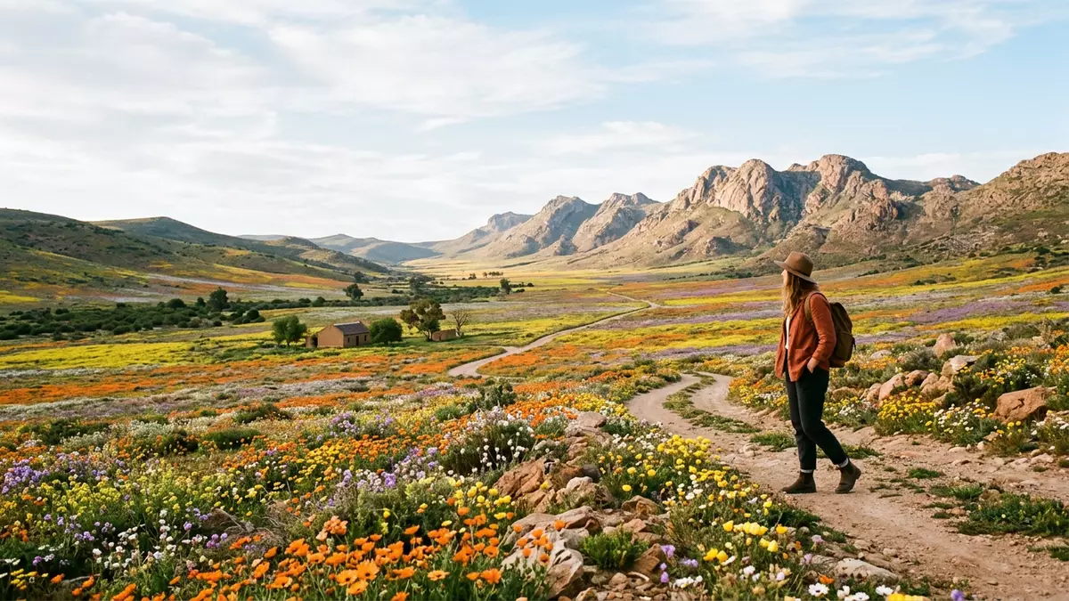
Namaqualand around Springbok in South Africa is an arid region where hard hills, sandy plains and scrubland gain a second life in spring through seasonal wildflower colour. The South African portion of Namaqualand lies in Northern Cape province, with Springbok as its chief town and practical base for exploring the surrounding hills and reserves.
Namaqualand’s arid landscape and the town of Springbok
Namaqualand is a broad geographic region in south-western Africa that stretches along the west coast from Namibia into South Africa, crossing the lower Orange River and reaching inland between the Namib and Kalahari deserts.A geographic region in south-western Africa The South African side lies in Northern Cape province and belongs to the dry western flank of the country, a belt defined by low rainfall and wide horizons.The region sits in Northern Cape province
Springbok is the chief town of Namaqualand on the South African side and anchors the region’s road and administrative life.Springbok is the chief town Hard granite hills rise around the town, and the landscape shifts from rocky slopes to open plains that form part of the Succulent Karoo biome, known for drought-tolerant plants and sparse scrub.Granite hills and open plains
Wildflower displays and plant diversity
Namaqualand is associated with spring wildflower displays that follow winter rainfall, turning sections of the semi-desert into carpets of colour that contrast with the usual browns and greys of the terrain.Wildflower route through Northern Cape The wider Namaqualand region is home to over 3,500 plant species, including succulents and annuals that respond to seasonal moisture.Over 3,500 plant species
Among these species are the Namaqualand daisy Dimorphotheca sinuata, bokbaai vygie Dorotheanthus bellidiformis, gousblom Arctotis hirsuta and beetle daisy Gorteria diffusa, plants that contribute strong orange, yellow and other colours during flowering.Namaqualand daisy and other species The flowering season runs in the transition between winter and spring in this part of South Africa, when Namaqualand daisies and thousands of other species emerge along roadsides, in town gardens and across reserves, including areas near Springbok.
Reserves and routes around Springbok
Springbok falls along the Northern Cape wild flower route, a corridor that links towns and protected areas where seasonal displays occur, including the Goegap Nature Reserve east of the town and the Namaqua National Park to the south.Wild flower route through Northern Cape Goegap covers several thousand hectares of terrain combining mountain backdrops with valleys and plains, while Namaqua National Park includes plateau sections such as Skilpad that are repeatedly highlighted as reliable sites for dense flower displays.Goegap Nature Reserve and Namaqua National Park
Roads link Springbok with these reserves and with other towns on the route, forming circuits that pass through varied terrain, from granite rises to coastal plains and dune fields in the broader region.An arid region along the west coast The area around Springbok therefore acts as both an administrative centre and a practical base for exploring Namaqualand’s rock formations, vegetation and spring flowering landscapes.
Visiting Namaqualand: what travellers from Western Europe should know
- Namaqualand around Springbok lies in Northern Cape in the dry west of South Africa, with roads linking the town to Cape Town and to reserves such as Goegap and Namaqua National Park.
- The terrain near Springbok includes granite hills, gravel tracks and open plains; some reserve routes follow unpaved roads and walking trails across rocky ground.
- Springbok sits near named reserves including the Goegap Nature Reserve to the east and the Namaqua National Park to the south, which form part of the wider wild flower route.
- The official language is Afrikaans and English is also used locally; the national currency is the South African rand.
- Entry requirements depend on your nationality; UK travellers can check the FCDO travel advice at gov.uk/foreign-travel-advice, Irish travellers the Department of Foreign Affairs at ireland.ie.
Searching for Namaqualand on social platforms
These links open searches for Namaqualand on each platform.
Frequently asked questions about Namaqualand
Where is Namaqualand around Springbok located?
Namaqualand around Springbok lies in Northern Cape province in the west of South Africa, forming part of a broader arid region that reaches into Namibia.
What can travellers expect on a visit to Namaqualand near Springbok?
Travellers encounter an arid landscape of granite hills, plains and scrub that, in spring, includes seasonal wildflower displays along roads, in town gardens and within nearby reserves.
What makes Namaqualand around Springbok distinctive?
The combination of Succulent Karoo vegetation, spring wildflower diversity and named reserves such as Goegap and Namaqua National Park gives the region a strong seasonal contrast against its usual dry terrain.