
Namaqualand’s arid hills and seasonal blooms around Springbok
Published on 09/04/2026 at 10:37 | Editorial responsibility: Rafael Müller, Editor-in-Chief AD HOC NEWS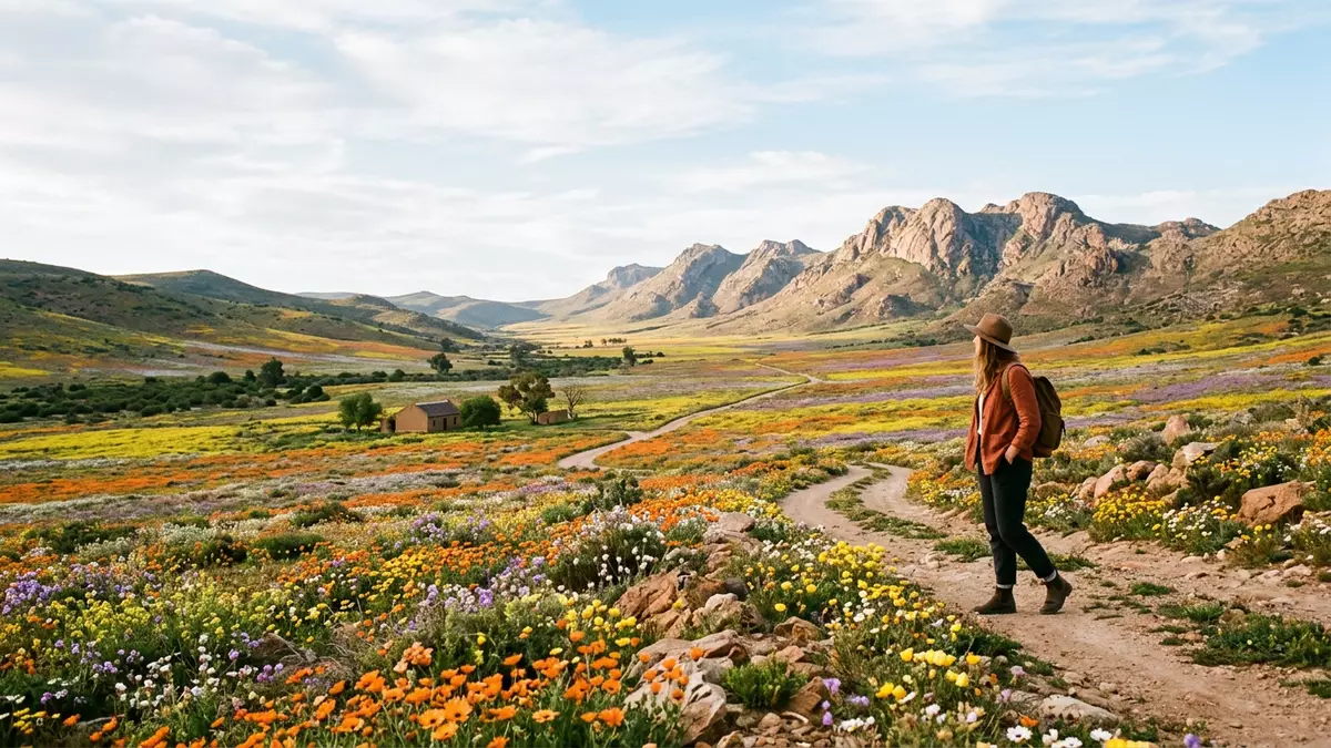
Namaqualand around Springbok is an arid South African region where hard granite hills, sandy plains and sparse scrub are transformed by seasonal wildflower colour. Stretching across the dry western side of the Northern Cape, it forms part of a wider geographic band that reaches north into Namibia and east toward the Kalahari, with Springbok recognised as the chief town on the South African side in this landscape.
Namaqualand as a geographic region of contrast
Namaqualand is described as a geographic region of south-western Africa, extending from near Windhoek in Namibia southward into South Africa’s Northern Cape and from the Namib Desert toward the Kalahari basin, a belt that runs for hundreds of kilometres along the Atlantic side of the subcontinent.Geographic region of south-western Africa Within this expanse, the South African portion lies squarely in the Northern Cape province, and its chief town is Springbok, which anchors administrative life and road connections through the wider Namakwa District.
The physical character of Namaqualand is defined by aridity and open space. Granite hills rise from the plains, breaking into rocky outcrops and low ridges, while stretches of sandy and gravelly ground run between them, supporting hardy shrubs and low vegetation adapted to limited rainfall.Granite hills and wide open country Farther west, the landscape flattens toward the coastal plain, and inland it rises gently in the direction of the Kalahari, but the visual impression across the region remains one of distance, bare rock and open horizons broken by occasional ridges and dunes.
Springbok: chief town in the South African part of Namaqualand
Springbok stands as the largest town in the Namaqualand area and functions as the main settlement and administrative centre for the region.Largest town in the Namaqualand area It lies within the Nama Khoi Local Municipality, itself part of the Namakwa District Municipality on the north-western side of the Northern Cape, and serves as the principal town in this district, drawing in surrounding communities such as Okiep and Nababeep that share its mining and service history.Principal town in the Namaqualand district
The town developed as a centre linked to copper mining activities in the nineteenth century and surrounding settlements such as Okiep, and it later took on the role of commercial and administrative hub for the region.Copper mining history around Springbok Springbok stands on the N7 route, the main northbound road from Cape Town toward Namibia, and is widely described as the last major town in South Africa on this highway before the border, making it a natural stop for supplies and accommodation for travellers heading into or out of the Northern Cape and the wider Namaqualand landscape.Last major town on the northbound road
Seasonal wildflowers and protected areas around Springbok
Namaqualand is closely associated with seasonal wildflower displays that transform parts of its arid terrain into fields of colour in particular months of the year. In the broader Northern Cape flower route, wild Namaqualand daisies and thousands of other floral species emerge in spring, creating extensive displays in reserves and national parks connected by the road network that passes through Namaqualand towns.Wild flower route through the Northern Cape In this context, Springbok appears along the route as a named town linked to nearby reserves such as the Goegap Nature Reserve east of the town and the Namaqua National Park to the south, which are highlighted as floral hotspots in season.Standard Namaqualand flower route corridor
The Goegap Nature Reserve near Springbok combines mountain backdrops with biodiverse vegetation that responds to seasonal rainfall, while the Namaqua National Park and areas such as the Skilpad plateau south of Springbok are indicated as reliable sites for dense flower displays in years when conditions support blooming.Wildflowers near Springbok Even outside peak flower periods, roads such as the N7 and turn-offs like the R355 lead through a landscape where reserves, ridges and plains reflect the underlying geology of Namaqualand, and where towns including Springbok, Kamieskroon and Garies mark points of access to both protected areas and wider open country.
Visiting Namaqualand: what travellers from Western Europe should know
- Namaqualand around Springbok lies in South Africa’s Northern Cape, with Springbok situated on the N7 road that runs north from Cape Town toward the Namibian border.
- The terrain across the region includes granite hills, rocky outcrops and sandy plains, and approaches to nature reserves near Springbok involve travel on roads and tracks across open, sometimes uneven ground.
- In South Africa the official language most widely used in administration is English alongside other national languages, and the currency is the South African rand.
- Entry requirements depend on your nationality; UK travellers can check the FCDO travel advice at gov.uk/foreign-travel-advice, Irish travellers the Department of Foreign Affairs at ireland.ie.
Searching for Namaqualand on social platforms
These links open searches for Namaqualand on each platform.
Frequently asked questions about Namaqualand
Where is Namaqualand around Springbok located?
Namaqualand around Springbok lies in South Africa’s Northern Cape province, forming part of a wider geographic region that extends north into Namibia and east toward the Kalahari, with Springbok as the chief town on the South African side.
What should travellers expect when visiting Namaqualand near Springbok?
Travellers encounter an arid landscape of granite hills, rocky outcrops and sandy plains around Springbok, with nature reserves and open country reached by road, and in certain months some areas show extensive wildflower displays that contrast with the otherwise sparse vegetation.
What makes this part of Namaqualand distinctive?
The combination of Springbok’s role as the largest town and administrative centre in the South African part of Namaqualand and the surrounding arid terrain, which can carry striking seasonal wildflower colour in nearby reserves such as Goegap Nature Reserve and Namaqua National Park, gives this area a distinct character within the Northern Cape.


