
Monument Valley’s sandstone towers above Oljato
Published on 09/12/2026 at 13:57 | Editorial responsibility: Rafael Müller, Editor-in-Chief AD HOC NEWS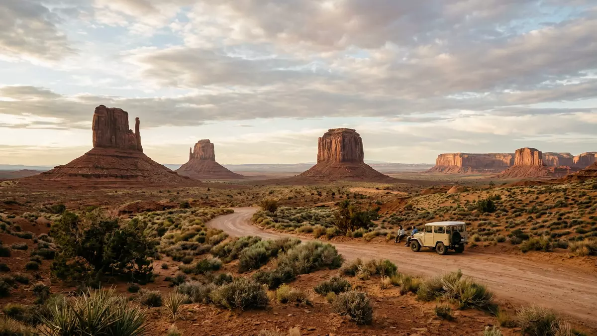
Monument Valley above Oljato in the USA is a desert basin on the Colorado Plateau where isolated sandstone towers break the plateau’s surface in striking red cliffs and broad mesas. Rising from Navajo Nation land along the Utah–Arizona border, these monuments form a landscape in which geology, Indigenous territory and film history meet in one wide, open valley.
Sandstone giants on the Colorado Plateau
Monument Valley lies on the Colorado Plateau in the Four Corners region, close to the state line between Utah and Arizona, with the valley shared between the sister areas of Oljato in Utah and Arizona.
The floor of the valley forms a high desert plain with an elevation of around 1,500 m (4,900 ft), framed by sandstone mesas and buttes that rise hundreds of metres above it in freestanding towers and plateaux.The valley floor elevation The broader region belongs to Navajo Nation land and a large part of the basin is organised as Monument Valley Navajo Tribal Park, where the cliffs and monoliths stand inside a protected landscape.Monument Valley Navajo Tribal Park
Layered rock: Organ Rock, de Chelly and Moenkopi
The sandstone towers in Monument Valley reveal a clear vertical sequence of rock units, with broad lower slopes, sheer middle cliffs and thinner caps at the top. Many mesas and buttes show three principal layers: a lower step of Organ Rock Shale, a middle band of de Chelly Sandstone and an upper unit of Moenkopi Formation, in places capped again by Shinarump Conglomerate.
Organ Rock Shale forms dark red benches and sloping lower faces, built of mudstone and siltstone laid down on ancient floodplains in the Permian period.Organ Rock Shale floodplain deposits Above these, massive de Chelly Sandstone stands in near-vertical cliffs, a resistant desert sandstone formed as wind-blown dunes and now cut into faces and corners that define some of the valley’s best-known buttes.de Chelly Sandstone cliffs The thinner Moenkopi and Shinarump layers at the top protect some mesas from rapid erosion, preserving flat crowns that contrast with the cliffs below.
Navajo land and the Western film landscape
Monument Valley lies within Navajo Nation territory, and in 1958 a substantial part of the basin was designated Monument Valley Navajo Tribal Park by the Navajo Nation Council.Designation as a tribal park The Navajo name Tsé Bii? Ndzisgaii, meaning “valley of the rocks”, reflects the way the tall towers rise from a broad sandy floor.Tsé Bii? Ndzisgaii
The valley’s cliffs and buttes became a central setting for twentieth-century Western films, particularly through the work of director John Ford. Starting with “Stagecoach” in 1939 and continuing with films such as “Fort Apache” (1948), “She Wore a Yellow Ribbon” (1949) and “The Searchers” (1956), Ford and actors including John Wayne used the valley floor and surrounding mesas as a recurring backdrop, helping fix its silhouette of buttes and mesas in global cinema.John Ford’s Westerns in Monument Valley
Visiting Monument Valley: what travellers from Western Europe should know
- Monument Valley lies on Navajo Nation land around Oljato in Utah and Arizona, reached by road from US Highway routes that cross the desert at the Utah–Arizona border.
- The terrain inside the valley consists of a sandy basin with unpaved routes and viewpoints looking towards mesas and buttes, with little shade away from the cliffs.
- The region is an arid high desert, and the elevation of the valley floor around 1,500 m (4,900 ft) means that temperatures and weather can vary markedly between day and night.
- The nearest larger settlements include Kayenta in Arizona and communities in San Juan County in Utah, which serve as bases for visiting the valley and the surrounding canyon country.
- The official language is English and the currency is the United States dollar.
Searching for Monument Valley on social platforms
These links open searches for Monument Valley on each platform.
Frequently asked questions about Monument Valley
Where is Monument Valley in relation to Oljato?
Monument Valley lies on the Colorado Plateau around the Oljato communities in Utah and Arizona, close to the border between those two states within Navajo Nation land.
What should visitors expect on a first visit?
Visitors encounter a high desert basin with a sandy floor and views of mesas and sandstone buttes rising in towers and plateaux, with long sightlines across the valley.
What makes Monument Valley distinctive among desert landscapes?
The clear sequence of Organ Rock, de Chelly and Moenkopi rock layers in the sandstone towers, combined with its status as Navajo Tribal Park and its long association with Western films, gives the valley a distinctive character.


