Lineas de Nazca, the vast geoglyph landscape of southern Peru
Published on 09/14/2026 at 13:48 | Editorial responsibility: Rafael Müller, Editor-in-Chief AD HOC NEWS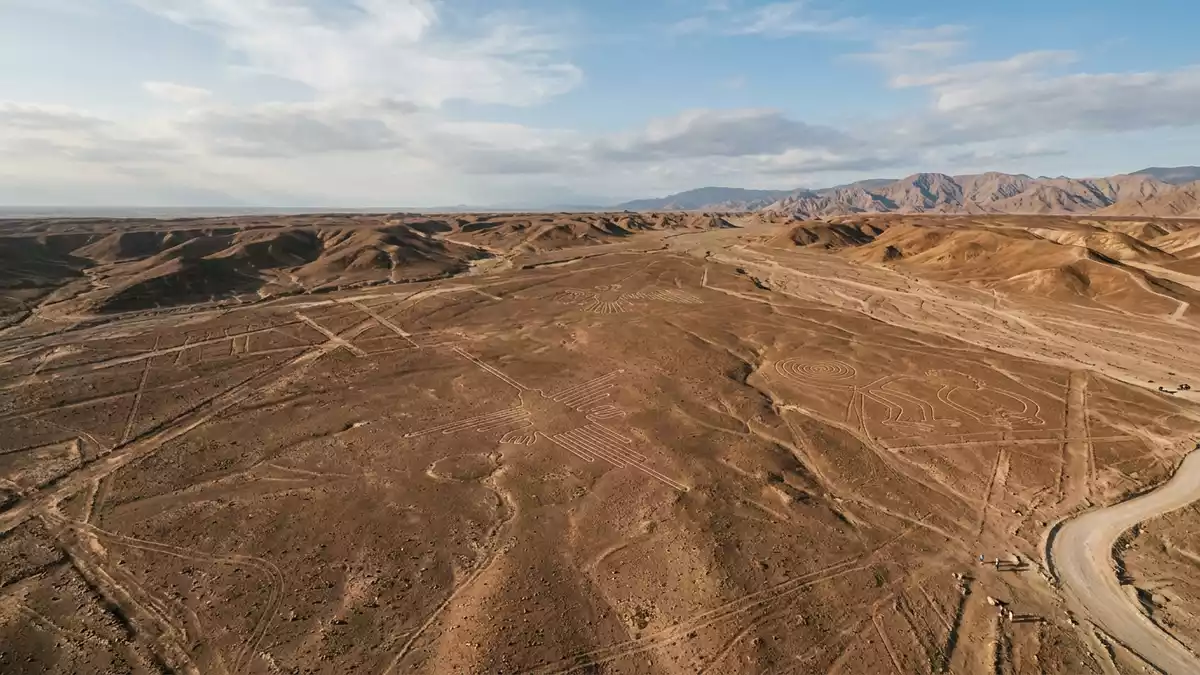
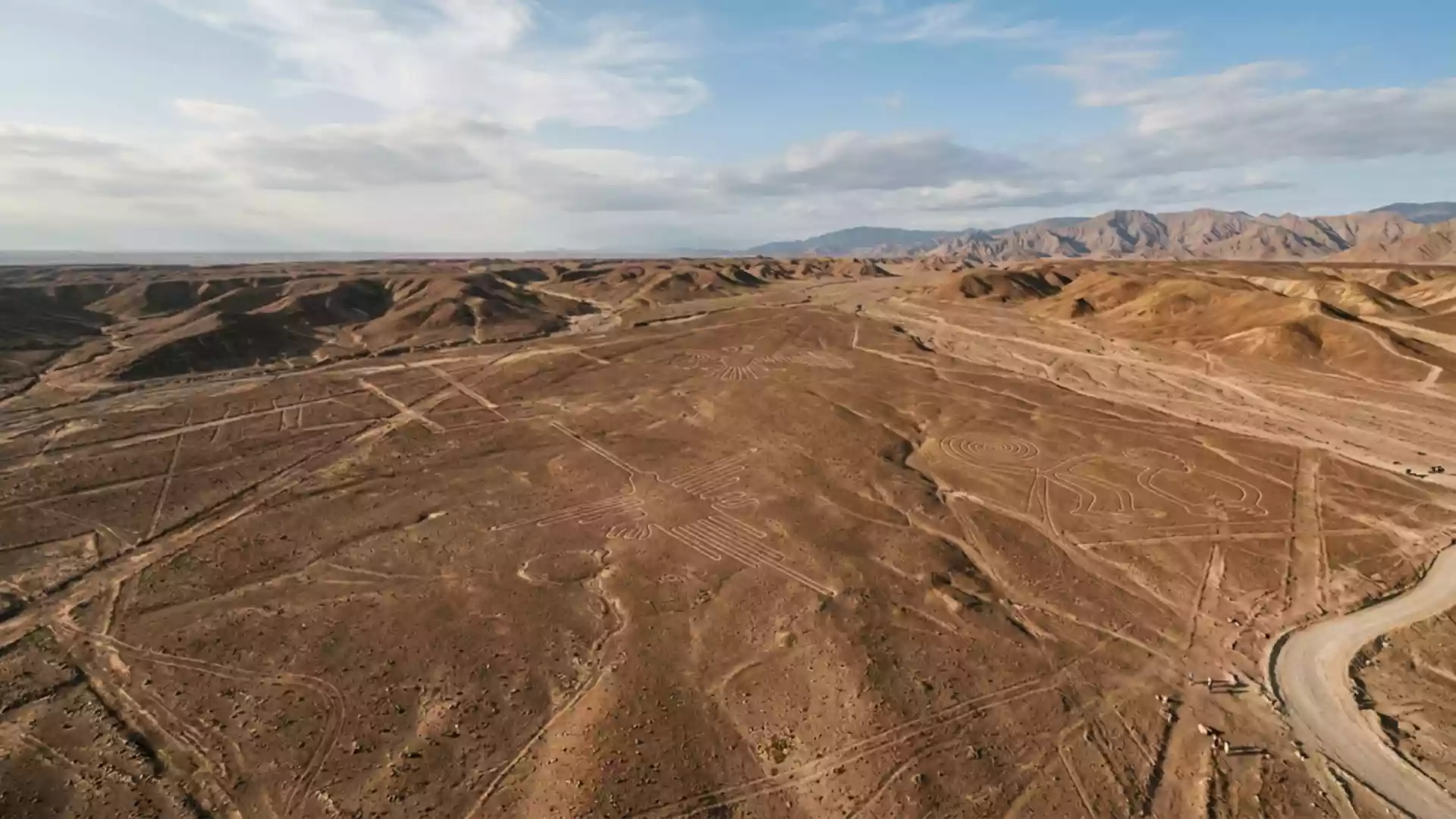
Lineas de Nazca, better known internationally as the Nazca Lines, stretch across the desert plateau near Nazca in southern Peru as an immense field of ancient geoglyphs carved into pale earth beneath darker stones. Created by pre-Hispanic societies over many centuries, these figures and lines turn an otherwise austere plain into a vast patterned landscape recognised as a UNESCO World Heritage Site since 1994.
The desert canvas between Nazca and Palpa
The Nazca Desert forms a high, arid plateau between the towns of Nazca and Palpa on the Pampas de Jumana in the Ica Region of southern Peru. The main concentration of Lineas de Nazca occupies rectangular zones of plateau south of the hamlet of San Miguel de la Pascana, with geoglyphs spread across plains such as the Pampa Colorada and adjacent pampas.high, arid plateau The wider World Heritage property known as the Lines and Geoglyphs of Nasca and Palpa covers tens of thousands of hectares of desert plain in the basin of the Río Grande de Nasca, forming one of the most extensive archaeological landscapes in South America.Lines and Geoglyphs of Nasca and Palpa
Here the desert surface is naturally covered by reddish-brown pebbles coated with iron oxide. Ancient inhabitants produced the lines and figures by removing this darker layer and exposing the paler substratum, so that every line appears as a light trace against darker surroundings.removing the reddish-brown pebbles The plateau’s dryness and lack of dense vegetation have helped preserve these contrasts, so that many geoglyphs remain clearly visible on clean ground and even appear in satellite imagery.view from the Ikonos satellite
Shapes, figures and the making of the lines
Archaeological surveys describe hundreds of straight lines and geometric shapes together with dozens of animal, plant and human figures distributed across the plateau. Many sources distinguish between simple linear geoglyphs and curvilinear designs that depict creatures such as a spider, a hummingbird and other stylised forms, some stretching for hundreds of metres.groups of geoglyphs The combined length of all traced lines runs to more than 1,300 km (800 mi), and the main concentration of designs sits within a rectangle roughly 10 km by 4 km in extent.combined length of all the lines
Radiocarbon dating and ceramic finds associate the geoglyphs with cultures active between about 500 BC and AD 500 in the Nasca region.between 500 B.C. and A.D. 500 Archaeologists distinguish phases linked to the Paracas culture and later Nazca culture, but the essential technique remained the same: simple tools and surveying methods laid out straight alignments or carefully curved figures on open ground. Wooden stakes discovered at the ends of certain lines support the idea that the makers used basic sighting points to keep alignments true over long distances.wooden stakes in the ground
World Heritage recognition and an enigmatic landscape
Lineas de Nazca form part of the World Heritage property formally inscribed as the Lines and Geoglyphs of Nasca and Pampas de Jumana. UNESCO added the site to the World Heritage List in 1994 under cultural criteria that recognise its outstanding universal value as an archaeological and cultural landscape.inscribed on the World Heritage List in 1994 The protected area encompasses desert plains and low Andean foothills where geoglyphs appear both on level ground and on gentle slopes, turning the region into a patterned terrain visible from elevated viewpoints, aircraft and increasingly from remote sensing imagery.protected desert plains in the Nasca and Palpa provinces
Scholars describe Lineas de Nazca as an archaeological enigma because of the quantity, scale and continuity of the markings across centuries.most outstanding group of geoglyphs anywhere in the world Interpretations of their meanings vary, but many researchers link them to ritual practices, astronomical observations or symbolic expressions of the traditional and magical-religious world of pre-Hispanic societies on Peru’s south coast.Nazca civilization flourished in southern Peru Whatever their precise functions, the lines and figures together form a landscape-scale work whose geometry and cultural context give Lineas de Nazca a distinct place among ancient sites in the Andes and coastal desert.
Visiting Lineas de Nazca: what travellers from Western Europe should know
- Lineas de Nazca lie on desert plains in the Ica Region of southern Peru, between Nazca and Palpa roughly south of Lima along the coastal plateau.
- The plateau where the geoglyphs sit is exposed and largely without shade, and approaches to viewpoints involve walking across dry, stony ground.
- The official language is Spanish and the currency is the Peruvian sol.
- Entry requirements depend on your nationality; UK travellers can check the FCDO travel advice at gov.uk/foreign-travel-advice, Irish travellers the Department of Foreign Affairs at ireland.ie.
Searching for Lineas de Nazca on social platforms
These links open searches for Lineas de Nazca on each platform.
Frequently asked questions about Lineas de Nazca
Where are Lineas de Nazca located?
Lineas de Nazca are located on desert plains between Nazca and Palpa in the Ica Region of southern Peru, some distance south of Lima on the coastal plateau.
What can visitors expect when seeing the Nazca Lines?
Visitors encounter long straight lines, geometric shapes and stylised figures traced into pale desert ground, many of which are most clearly seen from elevated viewpoints.
What makes Lineas de Nazca distinctive among ancient sites?
The site stands out for its immense number of geoglyphs, their large scale across an arid plateau and their recognition as a UNESCO World Heritage landscape.