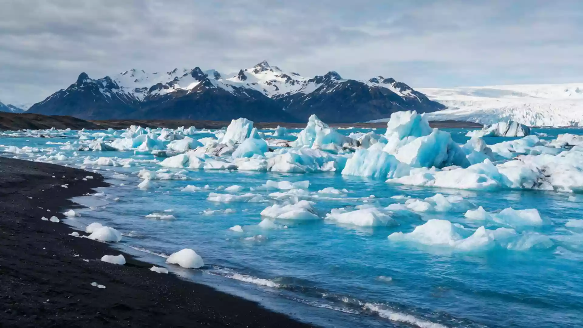
Jokulsarlon: ice, ocean and black sand near Hofn
Published on 09/07/2026 at 17:56 | Editorial responsibility: Rafael Müller, Editor-in-Chief AD HOC NEWS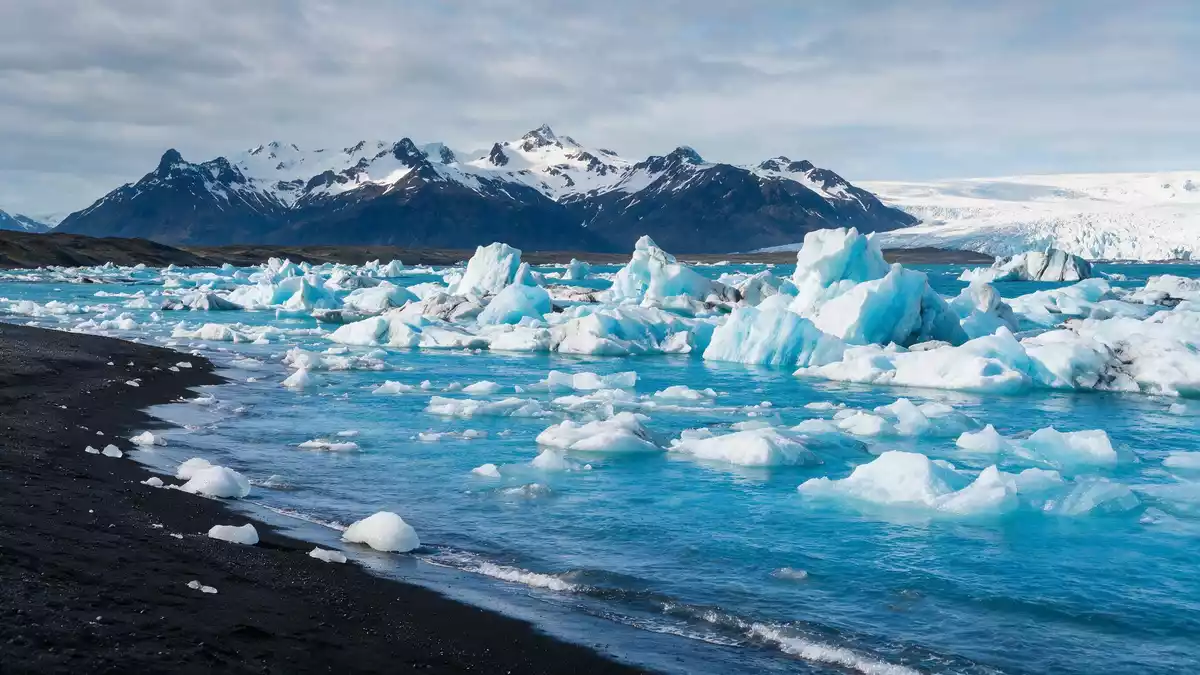
Jokulsarlon in south-east Iceland is a glacier-fed lagoon on the coastal plain of Breidamerkursandur, where broken ice drifts across deep water between Vatnajokull and the Atlantic Ocean. Formed in the twentieth century as the Breidamerkurjokull outlet glacier retreated from the shoreline, it has grown into one of Iceland’s deepest natural lakes and a striking meeting point between glacial ice, seawater and black volcanic sand.
A glacier lagoon at the edge of Vatnajokull
Jokulsarlon lies in the southern part of Vatnajokull National Park, at the foot of the Breidamerkurjokull glacier tongue that descends from Europe’s largest ice cap by volume, Vatnajokull.Vatnajokull ice cap The lagoon occupies a basin carved out by moving ice and filled with meltwater, with fresh water from the glacier mixing with seawater brought in by the tide.
The lake developed during the twentieth century as the glacier front moved inland and left behind a growing expanse of open water dotted with icebergs.twentieth-century formation Jokulsarlon is now recognised as the deepest lake in Iceland, with soundings showing depths of more than 248 m (814 ft) beneath the surface, and surface measurements indicating an area of around 18 to 25 km2 (6.9 to 9.7 sq mi) depending on the source.deepest lake measurements
Icebergs, lagoon and the Atlantic shore
At Jokulsarlon, blocks of ice calve from the front of Breidamerkurjokull and fall into the lagoon, where they break, turn and drift across water that appears dark against their pale surfaces.icebergs adrift on the lagoon Some pieces are streaked with volcanic ash preserved within the glacier, while others appear almost clear. The shapes change as edges melt and fracture, so the lagoon’s surface rarely looks the same from one day to the next.
A short glacial river links Jokulsarlon with the Atlantic Ocean, cutting across the Breidamerkursandur outwash plain on its way towards the sea.connection to the Atlantic Ocean Ice that drifts through this channel reaches the beach, where pieces of varying sizes lie on the dark sand and the surf washes around them. The contrast between clear or blue-tinged ice and black volcanic grains has led visitors to call this Atlantic shoreline Diamond Beach, echoing the way sunlight catches the ice fragments.
Ring Road viewpoints and protected landscape
Jokulsarlon sits beside Iceland’s Ring Road, Route 1, on Breidamerkursandur between Skaftafell and Hofn, with viewpoints and parking areas close to the water on both sides of the road.location on Route 1 Vehicles stop near the lagoon itself, and footpaths run along the water’s edge and across the river bridge, giving changing views of the lake, the glacier tongue and the sea.
The lagoon and the surrounding Breidamerkursandur plains are part of Vatnajokull National Park and have been protected as a landscape of interconnected glacial, fluvial and coastal features.protected Breidamerkursandur area National park information points describe the geology, the role of Vatnajokull as an ice reservoir and the way meltwater streams shape the sandur. Beside the lagoon there is a small cluster of buildings, including a café and service facilities that sit back from the shoreline.
Visiting Jokulsarlon: what travellers from Western Europe should know
- Jokulsarlon lies in south-east Iceland on Breidamerkursandur beside Route 1 between Skaftafell and Hofn, with parking areas and viewpoints directly off the main highway.
- The terrain around the lagoon includes uneven gravel, short slopes and riverbanks, and reaching the Atlantic shore involves walking across loose black sand.
- The nearest town with a wider range of services is Hofn, east of the lagoon along the Ring Road, with accommodation, fuel and harbour views towards the Vatnajokull ice cap.
- The official language is Icelandic and the currency is the Icelandic króna.
- Entry requirements depend on your nationality; UK travellers can check the FCDO travel advice at gov.uk/foreign-travel-advice, Irish travellers the Department of Foreign Affairs at ireland.ie.
Searching for Jokulsarlon on social platforms
These links open searches for Jokulsarlon on each platform.
Frequently asked questions about Jokulsarlon
Where is Jokulsarlon in relation to Hofn?
Jokulsarlon lies on the coastal plain of Breidamerkursandur beside Route 1 between Skaftafell and Hofn in south-east Iceland, with Hofn as the closest town of any size.
What can visitors expect when they reach the lagoon?
Visitors find a deep glacial lake filled with drifting icebergs, views towards the Breidamerkurjokull glacier tongue, footpaths along the shore and a short river leading to an Atlantic beach scattered with ice.
What makes Jokulsarlon distinctive among Iceland’s landscapes?
Jokulsarlon brings together a retreating outlet glacier of Vatnajokull, a very deep glacial lagoon, an outwash plain and a black-sand Atlantic shoreline in one compact, accessible setting beside the Ring Road.