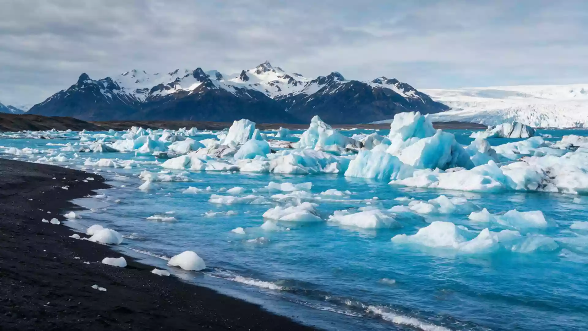
Jokulsarlon: icebergs adrift beneath Vatnajokull
Published on 08/30/2026 at 11:29 | Editorial responsibility: Rafael Müller, Editor-in-Chief AD HOC NEWS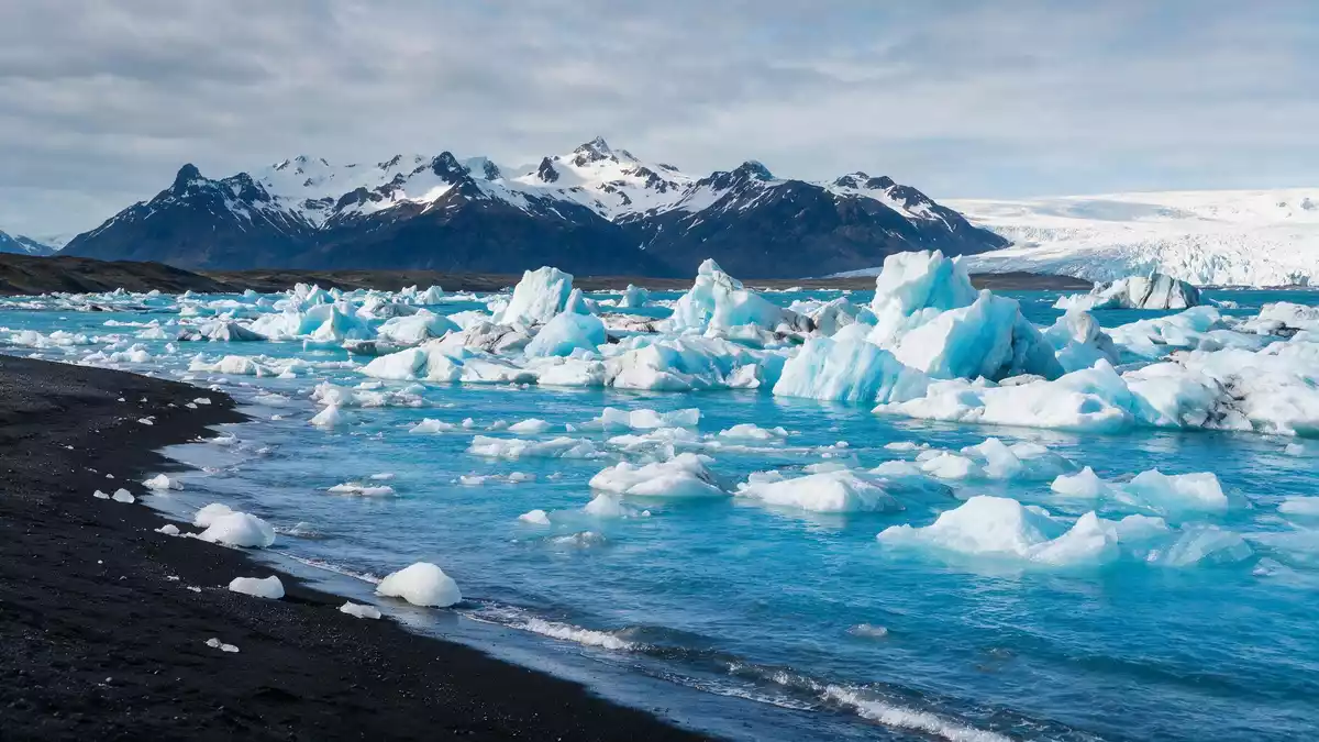
Jokulsarlon is a glacier-fed lagoon in south-east Iceland, on the coastal plain of Breidamerkursandur between Hofn and Skaftafell, where icebergs drift across deep, dark water at the edge of Vatnajokull. Formed in the twentieth century as Breidamerkurjokull retreated from the Atlantic, it has grown into one of Iceland’s deepest lakes and a striking meeting point between ice, sea and black volcanic sand.glacial lake in the southern part of Vatnajokull National Park
Where glacier, lagoon and ocean meet
Jokulsarlon lies at the foot of the Breidamerkurjokull outlet glacier, where the ice front has retreated inland and left a basin now filled with meltwater and broken ice.located at the foot of the Breidamerkurjokull glacier The lagoon connects to the Atlantic Ocean through a short glacial river that cuts across the sandur, so ice that calves from the glacier eventually drifts out to sea. Along the narrow outlet, chunks of ice ground on the black beach at Fellsfjara on Breidamerkursandur, creating the well-known scene of pale blocks scattered across dark volcanic sand.Jokulsarlon and Fellsfjara on Breidamerkursandur
The lagoon sits on the coastal side of Vatnajokull National Park, beside Iceland’s Ring Road, with the main viewpoint close to Route 1 and the glacier rising inland behind it.located right beside the Ring Road between Skaftafell Nature Reserve and Hofn The open water, the glacier tongue and the nearby Atlantic together give Jokulsarlon a layered landscape: icebergs floating on the lagoon, the low bridge and beach at the outlet, and the wide sandur plain stretching along the coast.
A twentieth-century lagoon still changing shape
Jokulsarlon began to form in the 1930s as temperatures rose and Breidamerkurjokull started to retreat rapidly from its earlier position near the ocean, leaving a hollow that filled with meltwater and calving ice.the lagoon started forming around 1935 as the glacier retreated By the mid-1970s the lagoon already covered several square kilometres, and satellite observations and park records show that it has expanded significantly since then as the glacier front has continued to withdraw.the lagoon grew quickly in size in the late twentieth century In the early twenty-first century Jokulsarlon reached a depth of over 200 m (656 ft), making it the deepest lake in Iceland, and its surface area has grown to well over 10 km² (3.9 sq mi).
The lagoon’s development is tied closely to Vatnajokull and its outlet glaciers, which reshape the surrounding land through ice movement, meltwater and sediment. As Breidamerkurjokull has retreated, it has left behind moraines and sandur plains, and the basin that holds Jokulsarlon is part of this wider glacial landscape.Vatnajokull’s outlet glaciers leave moraines and sandur plains behind The lagoon itself continues to evolve as more ice calves into it, the water deepens and the outlet towards the ocean adjusts. Visitors see a lake in motion rather than a fixed form: the pattern of icebergs changes as they melt, rotate and drift, and the glacier front visible inland marks only one stage in a longer retreat.
Icebergs, black sand and wildlife
On Jokulsarlon’s surface, icebergs of varying size and shape break away from the glacier and float across the lagoon, their surfaces showing layers of compacted snow and bands of volcanic ash. Some are bright white, others carry a blue tint where dense ice catches the light. The movement of the ice is slow but visible: blocks turn, split and move towards the outlet, and smaller fragments spread out across the water.
At the mouth of the lagoon, ice carried by the river washes up on the black beach known as Diamond Beach, where low chunks of ice lie on dark sand and polished pebbles. The contrast between pale ice and lava-derived sand is one of the most distinctive sights on this stretch of coast.large chunks of ice on the black sandy beach In colder months, the fish-filled lagoon attracts seals that hunt in the water and haul out on ice floes, adding wildlife to the scene of drifting ice and distant glacier.the fish-filled lagoon hosts numbers of seals in winter
Visiting Jokulsarlon: what travellers from Western Europe should know
- Jokulsarlon lies on Iceland’s Ring Road on Breidamerkursandur between Skaftafell and Hofn, with parking areas and viewpoints close to Route 1 on the coastal plain.
- The terrain around the lagoon includes uneven ground, moraines and black sand, and reaching the water’s edge or the outlet beach involves walking on loose surfaces and short slopes.
- In winter, snow and ice can cover paths and the lagoon’s immediate surroundings, and conditions along the coast and near the glacier may change with weather and season.
- English and Icelandic are widely used in south-east Iceland and the national currency is the Icelandic krona (ISK).
- Entry requirements depend on your nationality; UK travellers can check the FCDO travel advice at gov.uk/foreign-travel-advice, Irish travellers the Department of Foreign Affairs at ireland.ie.
Searching for Jokulsarlon on social platforms
These links open searches for Jokulsarlon on each platform.
Frequently asked questions about Jokulsarlon
Where is Jokulsarlon in relation to Hofn and Vatnajokull?
Jokulsarlon is on Breidamerkursandur in south-east Iceland, beside Route 1 between Skaftafell and Hofn, at the coastal edge of Vatnajokull National Park.the lake can be seen from Route 1 between Hofn and Skaftafell
What should visitors expect when they arrive at Jokulsarlon?
Visitors find a deep glacier lagoon with drifting icebergs, views of Breidamerkurjokull inland, and access to the black sand beach at the lagoon’s outlet towards the Atlantic.
What makes Jokulsarlon distinctive among Iceland’s landscapes?
Jokulsarlon combines a retreating outlet glacier, a deep iceberg-filled lagoon and a short river to the ocean, producing a changing scene of ice on water and black volcanic sand.