
Cabo da Roca where mainland Europe meets the Atlantic
Published on 09/24/2026 at 04:45 | Editorial responsibility: Rafael Müller, Editor-in-Chief AD HOC NEWS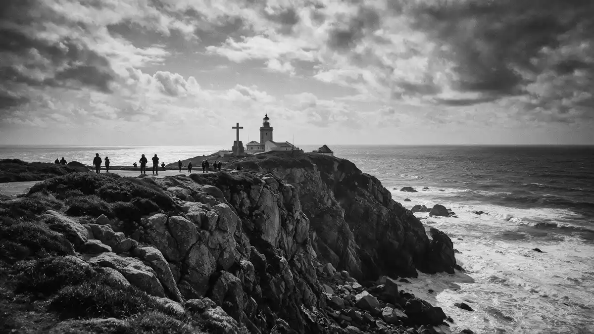
Cabo da Roca is a granite headland on Portugal’s Atlantic coast, west of Sintra. Cliffs rise above the ocean, while a lighthouse and a stone monument mark the westernmost point of mainland Europe.
Granite cliffs at the western edge of mainland Europe
The cape lies in Colares, within the municipality of Sintra and the Sintra-Cascais Natural Park. Its position is recorded near 38°47? north and 9°30? west, where the Sintra Mountains meet the Atlantic.
The headland reaches about 140 m (459 ft) above sea level. Granite boulders and bands of limestone form the rocky coast, with the cliff edge descending towards the breakers below. westernmost point of mainland Europe is the geographic identity attached to the cape.
The lighthouse and the maritime landscape
The Cabo da Roca Lighthouse began operating in 1772, during the government of the Marquis of Pombal. Its white tower rises 22 m (72 ft) above its platform, with the light positioned about 165 m (541 ft) above sea level.
The lighthouse belongs to the visual language of the Atlantic coast: a compact tower, a keeper’s building, pale walls, and open ground around the beacon. the 1722 lighthouse date appears in local tourism material, while other historical records identify 1772 as the beginning of its operation. The operating date is the safer historical anchor for the beacon.
A marker shaped by geography and literature
A stone monument near the cape records its coordinates and geographical status. The inscription includes a line associated with Luís de Camões, Portugal’s sixteenth-century poet, whose writing connected the edge of the land with the beginning of the sea.
The monument, lighthouse, rock and horizon occupy the same exposed coastal setting. Together they present Cabo da Roca as a place read through maps, navigation, national geography and literature. the stone marker and Camões line connect the physical cape with Portugal’s literary tradition.
Visiting Cabo da Roca: what travellers from Western Europe should know
- Cabo da Roca lies in Colares, west of Sintra, on the Atlantic coast. The site is reached by road, with bus links connecting the cape to Sintra and Cascais.
- The terrain is a high coastal promontory with exposed granite, steep cliff edges and uneven ground. The ocean lies below the headland, so viewpoints require care around unfenced coastal areas.
- The Sintra-Cascais Natural Park surrounds the cape with coastal scrub, rocky slopes and protected landscapes extending towards Sintra and Cascais.
- The official language is Portuguese and the currency is the euro.
Searching for Cabo da Roca on social platforms
These links open searches for Cabo da Roca on each platform.Frequently asked questions about Cabo da Roca
Where is Cabo da Roca?
Cabo da Roca is in Colares, within the municipality of Sintra, on Portugal’s Atlantic coast. It lies inside the Sintra-Cascais Natural Park.
What can visitors expect at the cape?
The setting includes granite cliffs, Atlantic views, a lighthouse dating from the eighteenth century and a stone geographical monument. The ground is exposed and uneven near the coastal edge.
What makes Cabo da Roca distinctive?
Its geographical position marks the westernmost point of mainland Europe. The lighthouse operating since 1772 and the Camões reference give the headland maritime and literary significance.


