
Blue Nile Falls, where the Blue Nile drops into a basalt gorge
Published on 09/19/2026 at 14:41 | Editorial responsibility: Rafael Müller, Editor-in-Chief AD HOC NEWS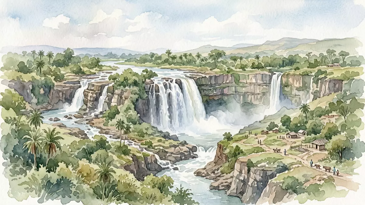
Blue Nile Falls near Bahir Dar in northern Ethiopia is a place where the upper Blue Nile river suddenly drops over a basalt ledge, turning a broad highland river into a dramatic waterfall known locally as Tis Issat, the “smoking water”. The falls sit on the Blue Nile in the Amhara Region, downstream from Lake Tana in a rural landscape of villages and farmland.
Basalt cliffs and a sudden drop on the Blue Nile
Blue Nile Falls forms where the river flowing out of Lake Tana reaches a basalt escarpment and plunges into a gorge below in a sequence of cataracts. The waterfall has a drop of roughly 37–45 m (about 120–148 ft), a figure supported by geographic descriptions of the site and reflected in travel writing that places the falls among Ethiopia’s more substantial river drops.drop of roughly 37–45 m The width of the falling water varies with the season and upstream flow but the underlying basalt ledge and gorge give Blue Nile Falls its recognisable profile.
The waterfall lies on the upper course of the Blue Nile about 30 km downstream from Bahir Dar and Lake Tana in the South Gondar zone of the Amhara Region.about 30 kilometres downstream from Bahir Dar In satellite and map descriptions the site is placed near co-ordinates that mark the point where the river leaves the lake and begins cutting into the highland plateau.water plunges 42 metres The basalt rock faces stand above a gorge that carries the river onwards towards Sudan, and the contrast between the relatively gentle upstream reach and the sudden fall is one of the defining features of the place.
Tis Issat, “smoking water”, in a rural Ethiopian landscape
In Amharic, Blue Nile Falls is known as Tis Issat or Tis Abay, names that translate as “great smoke” or “smoke of the Nile” and refer to the mist that rises from the gorge when the river is in full spate.Tis Issat, Tis Abay That mist drifts over surrounding fields and slopes, giving the falls a presence that reaches beyond the immediate rock face and into the wider landscape. When the river runs high, reports describe multiple streams of water dropping side by side and creating white water formations across a broad section of cliff.cascade can stretch up to 400 metres wide
The area around Blue Nile Falls is described as an agricultural highland with small villages, paths and simple bridges linking the approaches on either side of the gorge.rural landscape of small villages, farms and rolling highlands Guides and practical descriptions mention footpaths that lead to viewpoints, with one route crossing the river on a historic stone bridge built in the seventeenth century.stone bridge from 1626 still standing nearby From these vantage points travellers see the river dropping into the gorge, the spray rising and the surrounding farmland and hills stretching away from the escarpment.
Blue Nile Falls and the wider Blue Nile system
Blue Nile Falls sits on one of the two main tributaries of the Nile, the Blue Nile that originates at Lake Tana and flows north-west towards Sudan. The falls mark a point where the river leaves the lake basin and begins its journey through successive gorges carved into the Ethiopian Highlands.about 30 km downstream from Lake Tana In geographic descriptions of East Africa the site appears both as a scenic landmark and as part of the hydrological story of the Nile, linking the highland lake with the downstream lowlands.
The waterfall itself is described as consisting of several streams, their number and breadth changing with seasonal rainfall and upstream water management.four streams that vary with the season During wetter months the mist plume associated with the name Tis Issat is more pronounced, while in drier periods the basalt ledge and gorge are more exposed and the individual cataracts become more distinct.Blue Nile river cascades down a 42m-high drop These seasonal shifts form part of how the place is experienced, but the underlying elements – basalt cliffs, river gorge and rural highland setting – remain constant.
Visiting Blue Nile Falls: what travellers from Western Europe should know
- Blue Nile Falls lies on the Blue Nile in the Amhara Region of northern Ethiopia, about 30 km southeast of Bahir Dar and downstream from Lake Tana; approaches to the falls begin near the village area commonly referred to as Tis Abay.
- The terrain around the waterfall includes footpaths across fields and slopes and approaches near the edge of a river gorge, with viewpoints reached by walking on uneven ground and crossing simple bridges.
- The official language is Amharic and the currency is the Ethiopian birr.
- Entry requirements depend on your nationality; UK travellers can check the FCDO travel advice at gov.uk/foreign-travel-advice, Irish travellers the Department of Foreign Affairs at ireland.ie.
Searching for Blue Nile Falls on social platforms
These links open searches for Blue Nile Falls on each platform.
Frequently asked questions about Blue Nile Falls
Where is Blue Nile Falls located?
Blue Nile Falls is on the Blue Nile river in the Amhara Region of northern Ethiopia, about 30 km downstream from Bahir Dar and Lake Tana.
What can travellers expect when visiting Blue Nile Falls?
Travellers encounter a river dropping roughly 37–45 m over a basalt ledge into a gorge, with footpaths and viewpoints in a rural highland landscape.
What makes Blue Nile Falls distinctive among Ethiopian landscapes?
The combination of basalt cliffs, the sudden drop on the Blue Nile and the mist associated with the Amharic name Tis Issat creates a landmark tied closely to Ethiopia’s main river system.


