
Blue Nile Falls: basalt cliffs and “smoking water” near Bahir Dar
Published on 09/10/2026 at 21:15 | Editorial responsibility: Rafael Müller, Editor-in-Chief AD HOC NEWS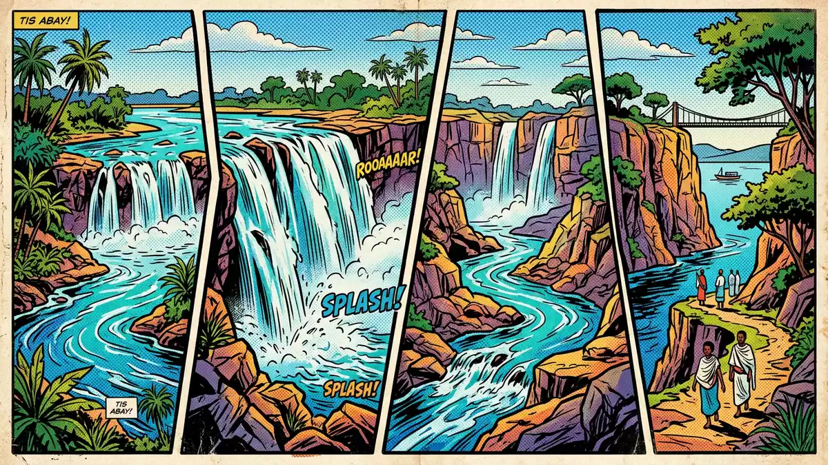
Blue Nile Falls near Bahir Dar in northern Ethiopia is a place where the upper Blue Nile suddenly drops over a basalt ledge, turning a broad highland river into a dramatic curtain of water known locally as “Tis Issat”, the smoking water. Blue Nile Falls sits on the Blue Nile river in the Amhara Region, downstream from Lake Tana and close to small rural villages that overlook the gorge carved by the river. The falls are traditionally dated to the natural course of the river rather than any particular construction, but the modern landscape around them reflects the long history of settlement in this part of Ethiopia.
Basalt cliffs, river drop and the scale of the falls
Blue Nile Falls forms where the Blue Nile, flowing out of Lake Tana, reaches a basalt escarpment and plunges in a sequence of cataracts into a gorge below. The waterfall has a drop of roughly 37–45 m (about 120–148 ft), a figure supported by geographic descriptions of the sitedrop of roughly 37–45 m. In periods of high flow the water spreads across several streams, creating a broad sheet of falling water that can approach hundreds of metres in width, while in drier conditions the flow contracts into narrower channels over the same basalt ledgehundreds of metres in width. Visitors looking across the gorge see dark volcanic rock layered beneath the lip of the plateau, with the river dropping from the upper course into a chasm where spray, mist and rainbows form whenever the sun catches the falling waterdark volcanic rock layered beneath the lip.
The Ethiopian names Tis Issat and Tis Abay highlight what stands out most about Blue Nile Falls: the plume of mist rising from the gorge and the way that mist hangs over the surrounding farmland when the river runs high. The falls lie on the Blue Nile about 30 km (around 19 miles) downstream from Bahir Dar and Lake Tana, in the South Gondar zone of the Amhara Regionabout 30 km downstream from Bahir Dar. On approach, paths and tracks follow the contours of the plateau before dropping towards viewpoints that look across to the main line of the falls, with the river above appearing comparatively calm until it reaches the basalt edgepaths and tracks follow the contours. From many vantage points the contrast between the flat highland fields and the sudden break in terrain where the river plunges is clear, giving a sense of how the waterfall marks a transition between the lake-fed upper course and the deeper gorge further downstream.
Blue Nile Falls in the Ethiopian Highlands
Geographically, Blue Nile Falls sits within the northern Ethiopian Highlands, a plateau landscape of rolling fields, scattered trees and small villages, with the gorge of the Blue Nile cutting through the basalt and sedimentary layers below. Bahir Dar, the nearest city, lies on the southern shore of Lake Tana and functions as the regional hub for visits to both the lake’s monasteries and the fallsregional hub for visits. The Blue Nile leaves Lake Tana near Bahir Dar, flowing southeast before dropping over the escarpment at Blue Nile Falls and continuing into a gorge that eventually carries its waters towards the Sudanese border and the wider Nile basinflowing southeast before dropping. The waterfall thus forms one of the early major drops along the river’s path from the Ethiopian Highlands towards the lowlands.
The surrounding countryside is agricultural, with footpaths crossing fields and small settlements clustered near the access routes to the falls. Approaches from Bahir Dar generally follow roads towards the village of Tis Abay, from where visitors continue on foot along tracks that lead to viewpoints near the gorge and to crossings such as a local bridge and, in some routes, a small suspension structure above the riverroads towards the village of Tis Abay. In the rainy months the landscape around Blue Nile Falls is commonly green and the volume of water ensures that the mist rising from the gorge carries across nearby slopes, whereas in drier periods exposed rock and narrower streams reveal more of the underlying basalt formations.
Pathways, viewpoints and the experience of the gorge
Blue Nile Falls is not just a single viewpoint but a small network of paths, tracks and vantage points that allow different perspectives on the waterfall and the river. One established walking circuit leads from the access area above the falls along a path that descends towards a bridge downstream, crosses the river and then returns on the opposite bank via routes that climb back towards the plateauwalking circuit leads from the access area. Another route uses a motorboat crossing of the upper river to reach a shorter path towards viewpoints near the top of the falls, allowing visitors to see the river as it gathers and drops over the basalt ledgemotorboat crossing of the upper river. These routes share a common character: they traverse uneven ground, cross simple bridges and pass through hamlets and farmland before reaching clear viewpoints of the gorge.
The terrain demands sure footing and a readiness for gradients, particularly on the sections where paths drop towards the bridge or climb back up from the river. The total walking distance on a full circuit is around several kilometres, with stretches that can be rocky or muddy depending on recent rainfall, and with simple steps, slopes and occasional narrow sections that require attentionseveral kilometres with rocky or muddy sections. In some places the paths run close to irrigation channels or small streams feeding the main river, while in others they cross dry ground with views back towards the plateau and out across the gorge carved by the Blue Nile.
Visiting Blue Nile Falls: what travellers from Western Europe should know
- Blue Nile Falls is reached from Bahir Dar, a city on the southern shore of Lake Tana in northern Ethiopia; road routes run southeast towards the Tis Abay area near the falls.
- The terrain around the gorge includes uneven footpaths, slopes and simple bridges; a full circuit on foot covers several kilometres and involves gradients and sections of rocky or muddy ground.
- The area sits within the Amhara Region of Ethiopia, where the official language is Amharic and the currency is the Ethiopian birr.
- Entry requirements depend on your nationality; UK travellers can check the FCDO travel advice at gov.uk/foreign-travel-advice, Irish travellers the Department of Foreign Affairs at ireland.ie.
Searching for Blue Nile Falls on social platforms
These links open searches for Blue Nile Falls on each platform.
Frequently asked questions about Blue Nile Falls
Where is Blue Nile Falls located in relation to Bahir Dar?
Blue Nile Falls lies on the Blue Nile river in the Amhara Region of northern Ethiopia, about 30 km downstream from Bahir Dar and Lake Tana.
What should visitors expect when walking around Blue Nile Falls?
Visitors follow rural tracks and footpaths that cross farmland and descend towards the gorge, with uneven ground, slopes, simple bridges and several kilometres of walking.
What makes Blue Nile Falls distinctive among Ethiopian Highland landscapes?
Blue Nile Falls stands out for its basalt escarpment and its drop of roughly 37–45 m combined with a broad curtain of water, mist and rainbows above a carved gorge.


