
Ayeyarwady River curving past the temple plain of Bagan
Published on 09/01/2026 at 12:12 | Editorial responsibility: Rafael Müller, Editor-in-Chief AD HOC NEWS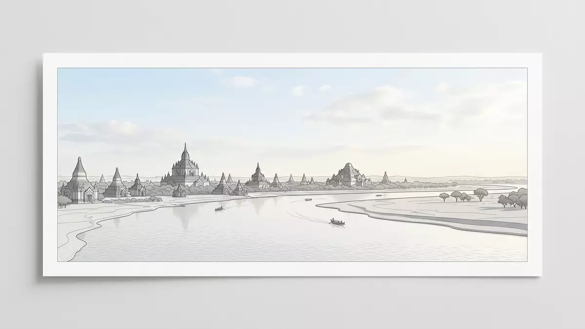
Ayeyarwady River, known in older English texts as the Irrawaddy River, flows through central Myanmar and sweeps past Bagan in a broad bend that defines the city’s temple plain. Along this reach, water, sand and brick sit in one wide landscape, with the Buddhist monuments of the Pagan period rising from the slightly higher ground on the eastern bank.
Where river and temple plain share one horizon
Bagan stands on the eastern bank of Ayeyarwady River in Myanmar’s central dry zone, a region of scrub, low vegetation and reddish soils rather than dense jungle.The plain sits at a modest elevation and is bordered to the west by the river, so that the waterway forms a clear edge to the temple landscape.Across this margin the land steps down in terraces and low bluffs, giving visitors standing among the pagodas frequent glimpses of the pale river surface.
The Bagan Archaeological Zone covers a broad area of flat ground along this bend in Ayeyarwady River, with Old Bagan close to the bank and settlements such as Nyaung U and New Bagan spreading inland.UNESCO’s inscription of Bagan describes a serial property of eight components on a curve of the river in the central dry zone of Myanmar, reflecting how closely the historic city and the waterway are tied.The contrast between the wide channel and the open expanse of brick monuments on slightly raised ground is a characteristic scene of this part of the country.
A river running the length of Myanmar
Ayeyarwady River is the principal river of Myanmar and flows entirely within the country, acting as a north–south spine between the highlands and the sea.It begins at the confluence of the N’mai and Mali rivers in the far north and then runs through central Myanmar towards the Andaman Sea, linking upland valleys, agricultural plains and the coastal delta.Major cities and towns along its course include Myitkyina, Bhamo, Mandalay and Bagan, so journeys on the river connect a sequence of important cultural centres.
By the time Ayeyarwady River reaches Bagan it has gathered a large catchment and spreads into a broad, slow-moving channel bordered by sandbanks and low shores.Boat landings line parts of the eastern bank below Old Bagan and nearby villages, where wooden vessels and other river craft rest against gently sloping sand, while the western side of the river remains more sparsely built.
Bagan’s brick monuments facing the water
Bagan developed as a major Buddhist city between the ninth and thirteenth centuries, when rulers of the Pagan Kingdom sponsored thousands of temples, pagodas and monasteries across the plain.Travel accounts describe more than 10,000 religious structures constructed during this period, with a fraction of them surviving as standing buildings, so the density of brick monuments along the river reach remains striking.Bagan is frequently described as having one of the largest concentrations of Buddhist temples and ruins in the world, many dating from the eleventh and twelfth centuries.
From the river, the skyline of Bagan is punctuated by stupas, tiered roofs and the occasional larger temple mass rising above fields and patches of scrubland.Scholarly descriptions refer to almost 3,000 recorded brick monuments across the site, forming a vast archaeological landscape linked to Buddhism, and several of the most prominent temples stand within easy reach of the river embankment.UNESCO’s documentation notes that seven of the inscribed components lie on one side of Ayeyarwady River and one component on the opposite bank, so the sacred landscape extends across both shores at this bend.
Visiting Ayeyarwady River: what travellers from Western Europe should know
- Ayeyarwady River passes Bagan in central Myanmar, with the Bagan Archaeological Zone spread along the eastern bank and the main visitor services concentrated around Nyaung U and New Bagan.
- Boat landings on the eastern bank sit below Old Bagan and nearby villages, where access between the higher plain and the river typically involves sloping sandy paths or simple embankments.
- Bagan lies in Myanmar’s central dry zone, where the surrounding terrain is largely flat with low vegetation and dusty ground, so walking between riverbank and temples generally follows unshaded tracks.
- The official language is Burmese and the currency is the Myanmar kyat.
- Entry requirements depend on your nationality; UK travellers can check the FCDO travel advice at gov.uk/foreign-travel-advice, Irish travellers the Department of Foreign Affairs at ireland.ie.
Searching for Ayeyarwady River on social platforms
These links open searches for Ayeyarwady River on each platform.Frequently asked questions about Ayeyarwady River
Where is Ayeyarwady River at Bagan?
At Bagan, Ayeyarwady River forms a broad bend in central Myanmar, with the main temple plain and Old Bagan standing on its eastern bank.
What can visitors expect along the river here?
Visitors encounter a wide waterway edged by sandy shores, simple boat landings and a horizon filled with brick stupas and temples rising from the dry plain.
What makes this stretch of Ayeyarwady River distinctive?
This reach is distinctive because a major Buddhist archaeological landscape lies directly beside the river, so historic monuments and the country’s principal waterway share the same open panorama.


