
DJI Phantom 4 RTK Mapping Drone - 1-Inch 20 MP Sensor And 30-Minute Flight Time
Published on 09/10/2026 at 12:29 | Editorial responsibility: Rafael Müller, Editor-in-Chief AD HOC NEWS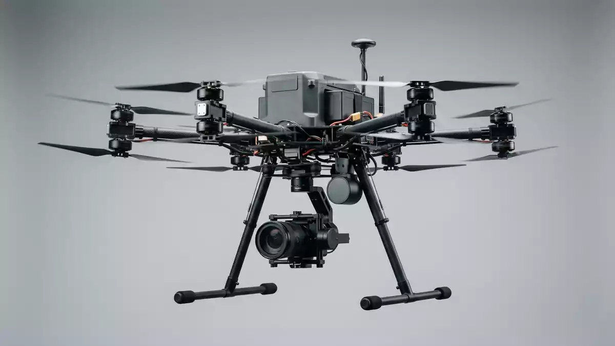
DJI Phantom 4 RTK is a purpose-built mapping drone that combines a 1-inch 20-megapixel camera with an integrated RTK module to capture centimeter-level survey data from the air. Its quadcopter airframe, familiar Phantom design and up to 30-minute flight time make it a workhorse for construction sites, agriculture fields and infrastructure inspections where accurate terrain models and orthophotos are critical.
Design, Camera And RTK Positioning
At the heart of the Phantom 4 RTK is a fixed camera with a 1-inch CMOS sensor delivering 20-megapixel still images for photogrammetry and mapping workflows. According to DJI, the camera captures high-resolution imagery and can achieve a ground sample distance of about 2.74 cm at 100 meters altitude in mapping missions when paired with the RTK positioning system.DJI specifications
The integrated RTK module sits on top of the aircraft and connects to GPS, GLONASS, BeiDou and Galileo satellites to deliver positioning accuracy down to 1 cm horizontally and 1.5 cm vertically plus 1 ppm under ideal conditions.DJI Agriculture overview With RTK enabled and functioning properly, DJI lists hover accuracy of approximately ±0.1 m vertically and horizontally, which is a major step up from standard GNSS-only positioning and helps surveyors minimize ground control points in appropriate workflows.RTK hover accuracy specs
The RTK antenna is aligned with the aircraft body and DJI documents an image position offset of (36, 0, 192 mm) between the camera center and the antenna phase center already applied to Exif coordinates, simplifying post-processing in photogrammetry software.Image offset details For teams needing even tighter control, the Phantom 4 RTK can work with the D-RTK 2 Mobile Station as a base station, delivering real-time differential data as part of a complete surveying solution.RTK system and base station
Flight Performance And Airframe Hardware
Phantom 4 RTK keeps the classic Phantom airframe while tuning it for survey missions. DJI lists a takeoff weight of 1,391 g including the battery and propellers and a diagonal size of 350 mm, which keeps the aircraft compact enough to transport easily yet stable in flight for data capture.Weight and size specifications
Maximum ascent speed reaches 6 m/s in automatic flight and 5 m/s under manual control, while descent speed is specified at 3 m/s.Climb and descent speeds In P-mode, DJI states a maximum horizontal speed of about 31 mph (50 kph), rising to 36 mph (58 kph) in A-mode for repositioning flights.Speed specifications The max service ceiling above sea level is given as 19,685 ft (6,000 m), which covers typical mapping altitudes for civil projects.Service ceiling figures
Flight time is specified at approximately 30 minutes under ideal conditions thanks to the Intelligent Flight Battery with 15.2 V nominal voltage and 89.2 Wh of energy capacity.Battery capacity and energy The battery itself has a net weight of about 468 g and uses a LiPo 4S chemistry, matching the high-power demands of continuous mapping flights.Battery type and net weight In terms of environmental limits, DJI specifies an operating temperature range from 32° to 104°F (0° to 40°C), which covers typical daytime surveying conditions but may require planning around extreme cold or heat.Operating temperature specs
The Phantom 4 RTK airframe integrates forward, rear and downward vision systems for obstacle sensing during missions. Third-party spec summaries mention omnidirectional obstacle sensing in five directions along with wind resistance around level 5, corresponding to roughly 24 mph winds, which helps maintain flight stability in moderate conditions.Obstacle sensing and wind resistance
Controls, Transmission And Software Workflow
Phantom 4 RTK ships with a dedicated remote controller featuring an integrated display and runs the GS RTK app for mission planning and control. DJI highlights OcuSync-based video transmission with stable 720p downlink from the aircraft to the controller, enabling pilots to monitor framing and flight path while capturing survey data.Video transmission and GS RTK app
The transmission system operates in both 2.4 GHz and 5.8 GHz bands depending on region regulations, and FCC-range specifications cite a maximum transmission distance of up to about 7 km under ideal conditions.Transmission range figures For mapping operations, pilots can design grid missions, set flight altitude and overlap, and rely on RTK positioning plus camera calibration to generate accurate point clouds and orthomosaic maps in photogrammetry software after the flight.Mapping workflow description
DJI notes that each camera undergoes a calibration process to measure lens distortions, and those parameters are written into the metadata for more accurate reconstruction of 3D models.Camera calibration information As part of the ecosystem, Phantom 4 RTK can integrate with base station hardware and PPK workflows where teams prefer to correct trajectories after the flight for highest possible accuracy.
Full DJI Phantom 4 RTK Technical Details
DJI publishes complete specifications, feature descriptions and documentation for Phantom 4 RTK, including RTK accuracy figures and camera data.
Pricing, Kits And How It Compares
Phantom 4 RTK targets professional users, and pricing reflects its specialized hardware and positioning system. A US dealer listing the Phantom 4 RTK with D-RTK 2 Mobile Station combo cites regular prices in the multi-thousand-dollar range, with one configuration shown at $5,999.00 and other bundles above $4,900.00 depending on included accessories and stations.US dealer Phantom 4 RTK prices That places Phantom 4 RTK clearly above consumer camera drones and into the territory of specialized surveying systems, where the RTK module and workflow integration are the main value drivers.
Compared with a Phantom 4 Pro without RTK, Phantom 4 RTK adds centimeter-level positioning, image position offset metadata and full integration with base stations, reducing the number of ground control points required for many jobs when used correctly and under suitable conditions.Phantom 4 series comparison While other mapping platforms such as DJI Mavic 3 Enterprise offer newer airframes and variable zoom cameras, Phantom 4 RTK remains attractive to teams that value its fixed-lens calibration, proven workflows and extensive documentation across the surveying community.
For users moving up from consumer drones, the main differences are the RTK module on the airframe, the GS RTK app environment and the emphasis on repeatable, grid-based flights with consistent camera parameters. The combination of a 20 MP 1-inch sensor, approximate 30-minute flight time and 1 cm+1 ppm horizontal positioning accuracy makes Phantom 4 RTK particularly suitable for construction progress mapping, volume measurements and corridor surveys where the terrain and structures must be modeled with tight tolerances.Use cases and accuracy overview
Use Cases, Limits And Who It Suits
In the US market, Phantom 4 RTK is positioned firmly in the professional mapping segment rather than recreational flying. Surveying firms, civil engineering companies, utilities and agricultural consultants use it to generate orthomosaic maps, digital elevation models and precise measurements for earthworks and structures, especially when projects demand clear documentation of site progress or terrain changes.
The drone’s strengths are most apparent on open sites where RTK signals are reliable and projects require consistent data over time. Its approximate 30-minute flight time per battery, 31 mph cruising speed in P-mode and stable hover accuracy with RTK enabled together support efficient coverage of wide areas within a single mission.Flight time and hover performance On dense urban sites with high GNSS interference or confined indoor spaces, crews may turn to alternative solutions or use Phantom 4 RTK with extra care and additional control points, since even centimeter-level RTK depends on satellite geometry and signal quality.
For many teams, Phantom 4 RTK strikes a balance between capability and familiarity: it keeps the Phantom layout that pilots already know while weaving in RTK and GS RTK mission control. Those who need interchangeable payloads, thermal sensors or multi-spectral cameras will look at other DJI enterprise platforms, but for pure RGB mapping with tight georeferencing, Phantom 4 RTK remains a solid reference point in the survey drone space.
Key Facts At A Glance
- Product: DJI Phantom 4 RTK
- Manufacturer: DJI Technology Inc., Cerritos, CA
- Category: Mapping drone (RTK-enabled quadcopter)
- Takeoff weight: 1,391 g including battery and propellers
- Flight time: Approx. 30 minutes per battery under ideal conditions
- Camera sensor: 1-inch CMOS, 20-megapixel resolution
- Positioning accuracy: RTK horizontal 1 cm + 1 ppm, vertical 1.5 cm + 1 ppm
- Max speed: 31 mph (50 kph) in P-mode, 36 mph (58 kph) in A-mode
- Price: Around $5,999.00 for RTK combo bundles (as of 09/10/2026)
- Target audience: Professional surveyors, construction and mapping teams needing centimeter-level aerial data


