
Zugspitze, Germany’s high limestone frontier
Published on 09/09/2026 at 18:01 | Editorial responsibility: Rafael Müller, Editor-in-Chief AD HOC NEWS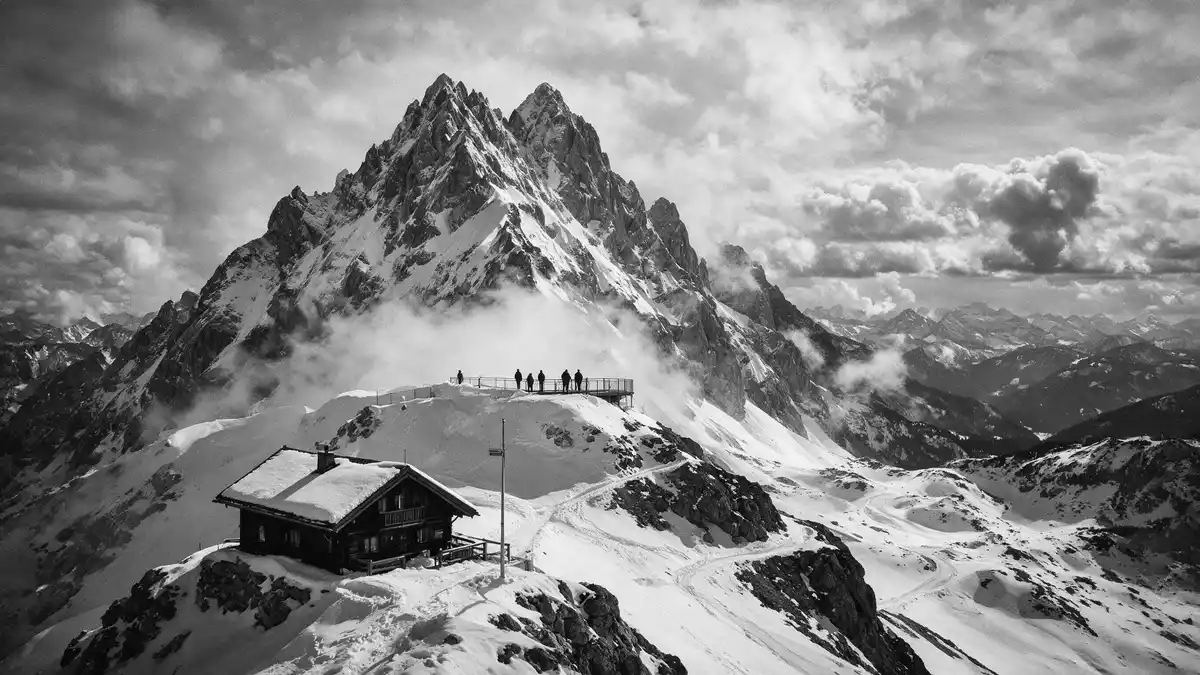
Zugspitze, above the Bavarian town of Garmisch-Partenkirchen, is Germany’s highest mountain and a broad limestone summit shared with Austria. At 2,962 m (9,718 ft), it crowns the Wetterstein range and forms a natural frontier with Tyrol, combining bare rock, remnant glaciers and an accessible viewing platform on the ridge.
Limestone summit on the Germany–Austria border
Zugspitze stands on the border between Bavaria in Germany and Tyrol in Austria, forming the highest point of the Wetterstein Mountains in the Bavarian Alps. Its main summit lies within Germany, but the ridge carries the frontier, so structures on the plateau occupy both sides of the line.highest mountain in Germany The prevailing rock is compact limestone known as Wetterstein limestone, a hard, pale stone that gives the cliffs and gullies their clean, vertical character.Wetterstein limestone
The mountain forms a bulky massif rather than a single spike, with steep faces dropping towards the Höllental valley and gentler bare slopes descending to the glacier plateau on the German side. From the summit structures the view runs out across ranges of the Northern Limestone Alps, with serrated ridges in Austria and forested lower hills in Germany visible on clear days.
Glaciers, plateau and the golden summit cross
Below the summit ridge, on the German flank, lie the last glaciers of Germany, including the Northern Schneeferner and the Höllentalferner, tucked into hollows in the limestone. Their ice fields sit between grey rock and scree, giving the plateau a bright, mottled appearance in colder seasons.Northern Schneeferner and Höllentalferner The glacier plateau carries ski runs and service buildings, connected to the summit ridge by a short cable car and by paths across the stone and snow.glacier plateau and ski area
A distinctive feature at the highest point is the gilded summit cross, a tall metal cross fixed on exposed rock above the main viewing terraces. The first summit cross was brought to the mountain in August 1851 under the guidance of Pastor Christoph Ott, after Lieutenant Josef Naus and his companions made the first recorded ascent in 1820.summit cross history The original cross, later damaged by lightning and wartime gunfire, now stands in the Werdenfels Museum, while a true-to-original replica remains on the eastern summit rock.
Mountain railways and the shared summit station
Zugspitze’s plateau functions as a high station for several mountain railways, bringing visitors from both Germany and Austria directly into the thin air of the ridge. On the Bavarian side, the Bavarian Zugspitze Railway, a cogwheel line that dates from the early twentieth century, climbs from Garmisch-Partenkirchen through tunnels and past Lake Eibsee to the glacier plateau.aerial tramway from Eibsee and railway from Garmisch-Partenkirchen From there, a short cable car continues up to the summit ridge, where terraces, meteorological instruments and restaurant buildings line the crest.cable cars and summit structures
On the Tyrolean side, a separate cable car rises from the Austrian valley to its own station on the ridge, tying into the same cluster of walkways, platforms and signal masts. The shared summit area includes meteorological and research facilities such as the Schneefernerhaus, using the mountain’s elevation and exposure for atmospheric observations.Schneefernerhaus research station Railings, steps and decked paths connect the different buildings, and metal bridges cross the drop between German and Austrian structures, with border markers visible along the ridge.
Visiting Zugspitze: what travellers from Western Europe should know
- Zugspitze rises south of Garmisch-Partenkirchen in Bavaria, with access from the German side via the Bavarian Zugspitze Railway and cable cars, and from Tyrol via the Tyrolean cable car.
- The upper mountain is a high-alpine environment on compact limestone, with steep drops from the summit terraces and stairways, metal walkways and exposed sections on the ridge.
- Snow lies on the glacier plateau and upper slopes in colder months, while the lower approaches cross forest and rock; sturdy footwear is useful for moving between terraces and viewpoints.
- The official language on the mountain is German and the currency is the euro, reflecting its position in Germany and Austria within the European Union.
Searching for Zugspitze on social platforms
These links open searches for Zugspitze on each platform.
Frequently asked questions about Zugspitze
Where is Zugspitze and how high is it?
Zugspitze stands on the border between Bavaria in Germany and Tyrol in Austria, south of Garmisch-Partenkirchen, and reaches 2,962 m (9,718 ft) above sea level.
What can visitors expect on the summit?
The summit ridge offers terraces, restaurant buildings, a meteorological station and the gilded summit cross, with steep limestone faces and panoramic views over the Bavarian and Tyrolean Alps.
What makes Zugspitze distinctive among German mountains?
Zugspitze is Germany’s highest mountain, combining compact Wetterstein limestone, remnant glaciers such as the Northern Schneeferner and a shared summit area spanning the Germany–Austria border.


