
Zion National Park’s towering sandstone canyons
Published on 09/17/2026 at 07:43 | Editorial responsibility: Rafael Müller, Editor-in-Chief AD HOC NEWS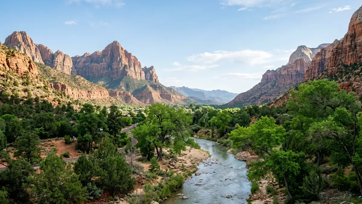
Zion National Park in Utah surrounds Springdale with a deep sandstone canyon carved by the North Fork of the Virgin River, where sheer cliffs rise above the river’s bends and desert plateaus stretch away to the horizon.
Sandstone walls shaped by the Virgin River
The most immediate impression of Zion National Park is the height and colour of its canyon walls, which are largely formed from massive sandstone cliffs that flank the narrow valley floor. These cliffs belong mainly to the Navajo Sandstone, an orange to white rock that forms vertical faces reaching hundreds of metres above the river and is exposed over a thickness of about 2,000 feet in Zion Canyon.Navajo Sandstone exposure The canyon itself is cut by the North Fork of the Virgin River, which flows through the park and has gradually eroded the sandstone, leaving a winding gorge with high, reddish and tan walls.
The Virgin River descends with a relatively steep gradient as it crosses the park, and over geological time this has given the river enough cutting power to incise deeply into the uplifted rock layers and form the present canyon.North Fork of the Virgin River Within the canyon, the contrast between the narrow, sometimes vegetated river corridor and the bare rock faces above it gives Zion National Park much of its character, with terraces, benches and shelves cut into the sandstone and occasional hanging valleys feeding side streams into the main gorge.terraces and canyon walls
Layers of the Colorado Plateau revealed
Zion National Park stands along the edge of the Colorado Plateau, a high region of plateaus and uplands where rock layers have been uplifted, tilted and eroded to form features such as the Grand Staircase, a sequence of colourful cliffs between Bryce Canyon and the Grand Canyon.Colorado Plateau margin Within Zion, the exposed rocks record roughly 275 million years of changing environments, from warm shallow seas to river flood plains, lakes and vast deserts, preserved in a series of sedimentary formations stacked one above another.rock units from Permian to Cretaceous
Most of the rocks visible in the park are sedimentary, made of particles weathered and eroded from older rocks, then transported and laid down in layers that later hardened into sandstone, limestone, mudstone and shale.sedimentary rock layers Zion’s named formations include the Kaibab and Moenkopi limestones and mudstones, the colourful Chinle Formation, the Moenave and Kayenta sandstones and siltstones, the thick Navajo Sandstone, and younger units such as the Temple Cap and Carmel Formations. Together these layers form the cliffs, sloping shelves and plateaus that visitors see from the canyon floor and from the higher viewpoints.
From Mukuntuweap monument to national park
Long before national park status, the canyon that is now Zion National Park was set aside as Mukuntuweap National Monument, a designation created in 1909 by President William Howard Taft to protect its landscape.Mukuntuweap National Monument 1909 In 1918 the area was renamed Zion National Monument, reflecting a change in official terminology and preparing the way for a further shift in status.
On 19 November 1919 the United States Congress passed an act establishing Zion National Park in the state of Utah, and the legislation was signed by President Woodrow Wilson.act establishing Zion National Park Subsequent legal measures adjusted the boundaries and created additional monuments in the wider region, but the core sandstone canyon near Springdale has remained at the heart of Zion’s identity as a protected landscape.
Visiting Zion National Park: what travellers from Western Europe should know
- Zion National Park lies in south-western Utah in the United States, with the main canyon entrance near the town of Springdale and road access from regional highways.
- The central part of the park is a canyon with steep sandstone walls; approaches to viewpoints and trails often involve significant gradients and sections of rocky, uneven ground.
- The Virgin River runs along the canyon floor, and some walking routes follow or cross its channel, so waterproof footwear and awareness of changing water levels are important on those paths.
- Springdale provides the immediate gateway to the park, with accommodation and other services clustered along the road leading to the main entrance.
- The official language is English and the currency is the United States dollar.
Searching for Zion National Park on social platforms
These links open searches for Zion National Park on each platform.
Frequently asked questions about Zion National Park
Where is Zion National Park located?
Zion National Park is in south-western Utah in the United States, with its main entrance near Springdale and its central canyon carved by the North Fork of the Virgin River.
What should visitors expect on a first visit?
Visitors encounter a deep sandstone canyon with high cliffs, a river along the valley floor, desert plateaus above and a landscape shaped by millions of years of sedimentation and erosion.
What makes Zion National Park distinctive among US parks?
Zion National Park combines towering Navajo Sandstone cliffs, a narrow river gorge, clearly exposed rock layers of the Colorado Plateau and a protected landscape whose status as a national park dates from 1919.


