
Zion National Park’s sandstone canyon world in Springdale
Published on 09/05/2026 at 18:49 | Editorial responsibility: Rafael Müller, Editor-in-Chief AD HOC NEWS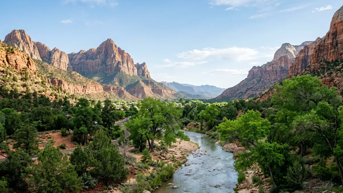
Zion National Park in southern Utah is a desert canyon landscape where towering sandstone walls, carved by the North Fork of the Virgin River, frame a winding valley near the town of Springdale. The protected area was established as a national park on 19 November 1919, building on earlier monument status under the name Mukuntuweap, and it stands along the western edge of the Colorado Plateau in the United States.
A sandstone canyon shaped by the Virgin River
The heart of Zion National Park is Zion Canyon, a deep gorge cut into reddish and tan Navajo Sandstone by the North Fork of the Virgin River, creating sheer cliffs above a relatively narrow valley floor.Navajo Sandstone cliffs This sandstone unit forms some of the park’s most dramatic walls, part of a sequence of sedimentary rocks that record desert dunes and ancient environments from the Mesozoic era. The canyon’s walls rise far above the river, giving visitors a sense of being enclosed by vertical rock faces while the water continues to erode the valley.
Zion lies along the margin of the Colorado Plateau, where rock layers have been uplifted, tilted and eroded into the feature known as the Grand Staircase, a series of colourful cliffs stepping from Bryce Canyon towards Grand Canyon.edge of the Colorado Plateau Within the park nine exposed formations appear in its cliffs and slopes, representing around 150 million years of mostly Mesozoic-aged sedimentation in this part of North America.nine exposed formations Together they create a layered landscape where different colours and textures stack one above another, from pale Navajo Sandstone to deeper red and brown units lower down the canyon.
Layers of rock and a long geological story
The geology of Zion National Park preserves a long record of changing environments, from shallow tropical seas to coastal plains, rivers, lakes and windswept deserts.Zion’s rock layers In the park the exposed formations include, among others, the Kaibab and Moenkopi units associated with marine and coastal settings, the Chinle and Moenave formations related to river floodplains and lakes, the Kayenta formation linked to streams in an arid basin, and the massive Navajo Sandstone formed from ancient desert dunes. These layers dip gently and can be traced across cliffs and mesas, giving structure to the wider plateau above the canyon.
Above Springdale, formations such as the Springdale Member of the Moenave Formation contribute to steep cliff bands and gorges at the mouth of the canyon.Springdale sandstone cliffs Further into the park, the Navajo Sandstone forms monolithic walls that can reach more than 600 m (1,970 ft) in height, giving the canyon its characteristic vertical scale.towering canyon cliffs The combination of resistant sandstone and ongoing river erosion has produced narrow slots in some tributary canyons, wider amphitheatres elsewhere and a variety of cliff profiles that are visible from the valley floor and higher viewpoints.
From Mukuntuweap monument to national park
The protected status of the Zion landscape dates back to the early twentieth century, when the area was proclaimed Mukuntuweap National Monument on 31 July 1909 by President William Howard Taft.Mukuntuweap proclamation in 1909 In March 1918 the monument was enlarged and renamed Zion National Monument, reflecting interest in safeguarding a larger portion of the canyon and plateau landscape under a single designation.renamed Zion National Monument in 1918 The name “Zion” was adopted from an earlier usage associated with the area’s canyon, carrying religious connotations for some early settlers in the region.
On 19 November 1919 the United States Congress passed an act granting national park status to the area, and the legislation was signed by President Woodrow Wilson, creating Zion National Park as a unit of the national park system.national park status in 1919 Later, in 1937, a separate Zion National Monument was established for the Kolob Canyons area and this was combined with the park in 1956, expanding the protected landscape beyond the main canyon. Zion is therefore both a scenic sandstone gorge and a broader high plateau region, with history tied to national conservation efforts in the United States.
Visiting Zion National Park: what travellers from Western Europe should know
- Zion National Park lies in south-western Utah in the United States, with the main entrance near the town of Springdale on Utah State Route 9.
- The terrain in the main canyon includes steep sandstone slopes above the valley floor and maintained paths where approaches can involve sustained gradients and sections with many steps.
- The official language of the region is English and the national currency is the United States dollar (USD).
- Entry requirements depend on your nationality; UK travellers can check the FCDO travel advice at gov.uk/foreign-travel-advice, Irish travellers the Department of Foreign Affairs at ireland.ie.
Searching for Zion National Park on social platforms
These links open searches for Zion National Park on each platform.
Frequently asked questions about Zion National Park
Where is Zion National Park located?
Zion National Park is in south-western Utah in the United States, with its main canyon entrance close to Springdale along Utah State Route 9.
What should visitors expect on a first visit?
Visitors encounter a sandstone canyon landscape with high cliffs, a river along the valley floor, maintained paths and viewpoints that reveal layered rock formations.
What makes Zion National Park distinctive among desert parks?
Zion combines towering Navajo Sandstone walls, a river-carved canyon and a stack of exposed rock formations that record around 150 million years of geological history in one compact area.


