
Zion National Park and the sandstone canyon carved by the Virgin River
Published on 09/08/2026 at 14:21 | Editorial responsibility: Rafael Müller, Editor-in-Chief AD HOC NEWS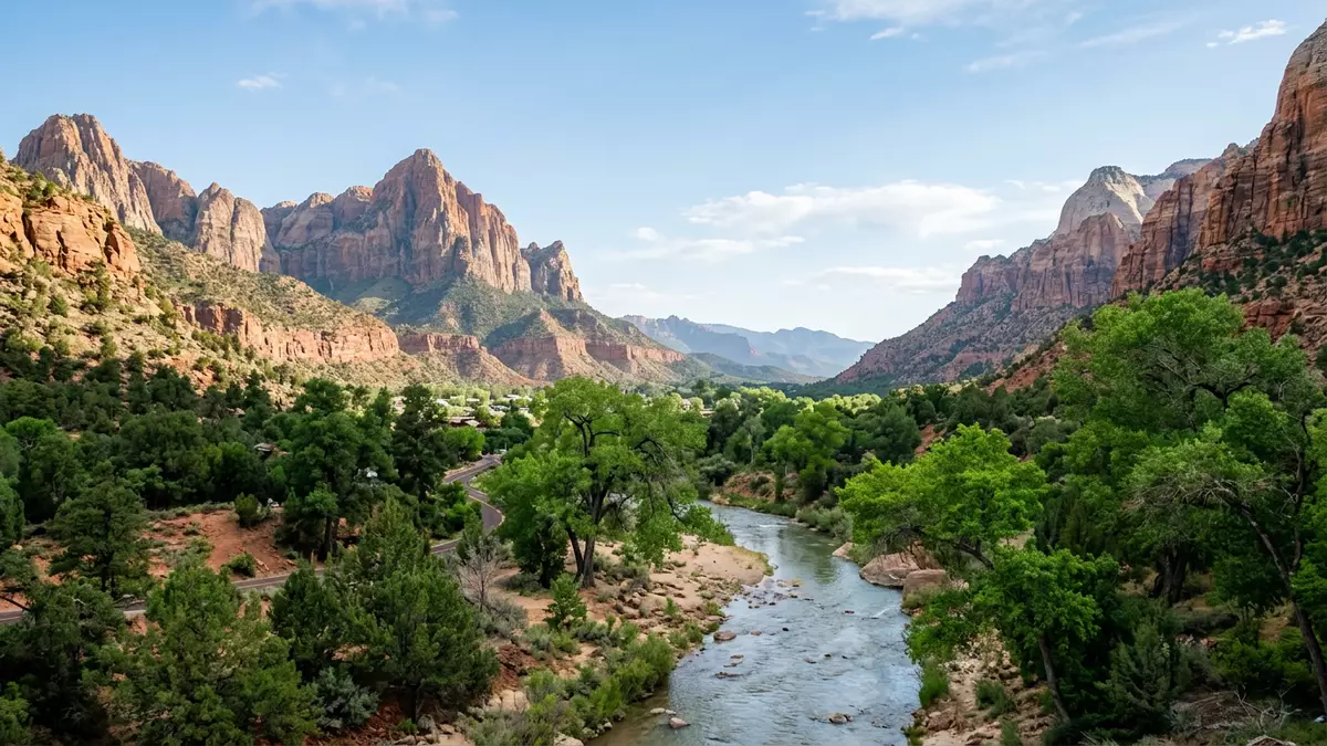
Zion National Park in southwestern Utah centres on a sandstone gorge where the Virgin River has cut into an uplifted plateau, creating steep cliffs above a narrow valley floor. Established as a national park on 19 November 1919, it lies near Springdale and forms part of the wider Colorado Plateau landscape that stretches across the American Southwest.
Sandstone walls and the work of the Virgin River
The heart of Zion National Park is Zion Canyon, a deep incision where the Virgin River and its tributaries run through thick sandstone strata and expose bands of red, pink and white rock. The river has carved through sedimentary formations over millions of years, acting as the primary agent of erosion that still shapes the canyon and its side gorges.The Virgin River and its tributaries drop from high ground north of the park to lower elevations towards Nevada, giving the water enough gradient to cut into the plateau.
Much of the canyon’s vertical architecture is formed from Navajo Sandstone, a Jurassic-age unit that dominates the sheer walls and monoliths lining the river corridor.Navajo Sandstone and other formations of the Colorado Plateau record around 150 to 275 million years of changing environments, from desert dunes to shallow seas.Geologic exposures in Zion give the canyon its layered appearance, with lighter benches and darker cliffs rising hundreds of metres above the river.
From Mukuntuweap Monument to national park
Before becoming Zion National Park, the protected area was first designated Mukuntuweap National Monument in 1909 by President William Howard Taft, recognising the scenic canyon and its geological value.Mukuntuweap National Monument The name was changed and the monument enlarged in 1918, ahead of the Act of 19 November 1919 that granted full national park status under the name Zion National Park. This federal recognition placed the canyon among the early group of national parks in the United States and ensured long-term protection for its cliffs, river corridors and plateaus.
Zion’s setting straddles a transition zone where the High Plateau region of the Colorado Plateau meets the Basin and Range province, a broader pattern of alternating ridges and valleys running across parts of Nevada and Utah.Zion lies in a transition zone With elevations ranging from relatively low river corridors to higher plateaus, the park’s geology records approximately 275 million years of sedimentary history in a single compact area, a timespan that can be read in the exposed cliffs and terraces.
Canyons, plateaus and classic Zion viewpoints
Zion National Park encompasses both the main canyon and outlying sections such as the Kolob Canyons, where younger strata crop out and the terrain opens into a series of high-walled side gorges. In the central canyon, narrow sections such as the Narrows show the Virgin River cutting directly through thick sandstone, creating a corridor where water and rock meet at close quarters.Upstream from the Temple of Sinawava the river has cut into Navajo Sandstone, while downstream it encounters softer formations such as the Kayenta Formation, which erode more easily and contribute to the widening of the canyon.
Across the park, cliffs and benches rise above the valley floor, with some canyon walls reaching about 610 m (2,000 ft) above the river.Zion Canyon contains narrow, sheer cliffs Trails and viewpoints follow the landforms, leading onto ledges and slopes where travellers can see the contrast between pale sandstone faces and darker, vegetated slopes. The combination of a narrow river channel, vertical walls and a high plateau skyline makes Zion a characteristic example of a Colorado Plateau canyon.
Visiting Zion National Park: what travellers from Western Europe should know
- Zion National Park lies in southwestern Utah, near the town of Springdale, and is reached by road routes that connect with regional highways across the state.
- The central canyon floor sits at a relatively high elevation, with steep paths, uneven rock surfaces and some narrow sections on routes that climb from the valley to viewpoints.
- The park forms part of the Colorado Plateau, so conditions can vary between the shaded canyon and more exposed plateaus, and longer walks often involve noticeable changes in altitude.
- Zion lies in the United States; the official language is English and the currency is the US dollar.
- Entry requirements depend on your nationality; UK travellers can check the FCDO travel advice at gov.uk/foreign-travel-advice, Irish travellers the Department of Foreign Affairs at ireland.ie.
Searching for Zion National Park on social platforms
These links open searches for Zion National Park on each platform.
Frequently asked questions about Zion National Park
Where is Zion National Park?
Zion National Park is in southwestern Utah in the United States, close to the town of Springdale and set within the broader Colorado Plateau region.
What should travellers expect on a visit to Zion?
A visit centres on sandstone canyons carved by the Virgin River, with steep cliffs, high plateaus and trails that follow the valley floor and climb onto ledges and benches.
What makes Zion National Park distinctive among canyon landscapes?
The combination of Navajo Sandstone cliffs, a narrow river gorge and a long geological record exposed in colourful strata gives Zion a characteristic Southwest canyon profile.


