

Xiangbishan and the elephant-shaped hill on the Li River
Published on 08/27/2026 at 22:43 | Editorial responsibility: Rafael Müller, Editor-in-Chief AD HOC NEWS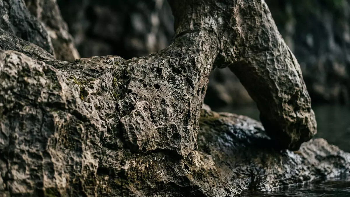
Xiangbishan, known in English as Elephant Trunk Hill, is a limestone hill in Guilin in southern China whose outline resembles an elephant dipping its trunk into the Li River. The hill rises within Xiangshan Park at the confluence of the Li River and the Taohua River and forms part of the karst landscape that has shaped Guilin’s identity for centuries.
The elephant shape above the rivers
The defining feature of Xiangbishan is the way the hill’s rock mass suggests the body and head of an elephant standing in the shallows of the Li River. A large natural opening between the base of the hill and a separate pillar of rock forms the space that visitors recognise as the “trunk” reaching towards the water, and this outline is visible from many points along the riverbank.The hill stands at the junction of the Li River and the Taohua River in the urban area of Guilin, so the elephant shape appears against a backdrop of the city as well as the river.
Xiangbishan is part of a landscape of karst hills created from limestone, whose slopes and cliffs show weathered rock faces and patches of vegetation clinging to ledges and crevices.The hill stands on the western bank of the Li River near the point where the Taohua River meets it, and the surrounding park opens views across the water to other limestone peaks. The combination of the elephant-like outline, exposed rock and river surface gives Xiangbishan a silhouette that differs from the more conical hills upriver, and many images show the curve of the “trunk” reflected in the water.
A hill shaped by limestone and legend
Xiangbishan’s rock is part of the same limestone formations that underpin much of Guilin’s scenery, and the hill reaches a summit around 200 m (656 ft) above sea level.Descriptions of the site emphasise that it has attracted visitors since the Tang Dynasty, between 618 and 907, which gives the hill a recorded place in Chinese travel culture that stretches back more than a millennium. From the foot of the hill the rock rises in layers and outcrops, and passages have been cut or worn into the slopes to reach higher points.
Carved into the hill is a space known as Water-Moon Cave, a natural opening whose name refers to the way the river surface and the rocky arch interact in reflections.The cave and the hill share the same setting at the confluence of the Taohua River and the Li River, and the interior walls carry inscriptions and calligraphy created over different periods. Around the slopes stand further structures, including a small pagoda on the upper part of the hill and temples and pavilions linked with religious practice and modern exhibitions within the wider park.
Xiangshan Park and the urban riverside setting
Xiangbishan forms the centrepiece of Xiangshan Park, a riverside park that brings together the hill, riverbanks, planted areas and paths into a single accessible landscape within Guilin.The park’s address on Binjiang Road in the Xiangshan District underlines its location within the city rather than in open countryside, and paved paths connect the waterfront with viewing platforms and landscaped spaces among the trees. From within the park, the Li River widens into a stretch of open water, and boats on the river pass in front of the elephant outline.
Within the scenic area around Xiangbishan stand several named attractions that connect the natural hill to different strands of local history.Descriptions mention features such as Puxian Pagoda, a Sanhua wine cellar set into the rock and a temple building used as an exhibition hall on the Taiping Heavenly Kingdom, so a visit brings together views of the elephant-shaped hill and a sequence of smaller sites. Lawns, tree-lined paths and open plazas frame the water’s edge, and the park’s setting within Guilin means that streets and urban districts lie just outside the boundary.
Visiting Xiangbishan: what travellers from Western Europe should know
- Xiangbishan lies within Xiangshan Park on the western bank of the Li River in Guilin, in the Guangxi region of southern China, and the park entrance faces Binjiang Road in the urban area.
- The terrain around the base of Xiangbishan includes riverside promenades, park paths and steps up the slopes of the hill, and visitors who climb towards the summit encounter stone stairways and uneven rock surfaces.
- Guilin Railway Station lies to the south of Xiangshan Park and city buses, including services numbered 2 and 16, run to stops named for Xiangshan Park near the entrance.
- The official language is Chinese and the currency is the Chinese yuan.
- Entry requirements depend on your nationality; UK travellers can check the FCDO travel advice at gov.uk/foreign-travel-advice, Irish travellers the Department of Foreign Affairs at ireland.ie.
Searching for Xiangbishan on social platforms
These links open searches for Xiangbishan on each platform.Frequently asked questions about Xiangbishan
Where is Xiangbishan located?
Xiangbishan stands within Xiangshan Park on the western bank of the Li River in the city of Guilin, in the Guangxi region of southern China.
What can visitors expect when exploring Xiangbishan?
Visitors encounter a limestone hill whose outline recalls an elephant standing in the river, with riverside paths, stone steps up the slopes and views across the Li River.
What makes Xiangbishan distinctive among Guilin’s hills?
The combination of its elephant-like profile, the natural opening known as Water-Moon Cave and its position at the confluence of the Li River and the Taohua River gives Xiangbishan its distinctive character within Guilin’s karst landscape.


