
Wadi-e Hunza: terraces, river and high Karakoram peaks
Published on 09/12/2026 at 09:33 | Editorial responsibility: Rafael Müller, Editor-in-Chief AD HOC NEWS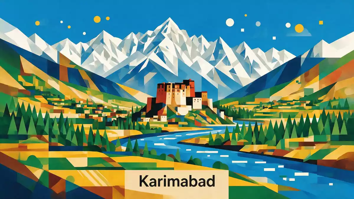
Wadi-e Hunza, known in German as Hunza-Tal, is the high mountain valley around Karimabad in northern Pakistan where terraced orchards, stone villages and steep Karakoram walls share the same narrow space. The valley lies in Gilgit-Baltistan, in the Hunza District, and follows the course of the Hunza River between lower settlements near Gilgit and the high land towards the Khunjerab Pass on the border with China.
Hunza River, stepped fields and the Karakoram walls
Hunza Valley is a mountainous river valley in Gilgit-Baltistan, Pakistan, traversed by the Hunza River as it cuts through the Karakoram range.Hunza River valley South-facing slopes around Karimabad carry terraced fields where fruit trees, especially apricot and other orchard crops, grow on narrow ledges of soil supported by stone walls.terraced apricot orchards Beneath the settlements the river runs in a deep trench, and above them rise peaks of the Karakoram with elevations reaching well over 7,000 m (22,966 ft).
The valley floor in central Hunza is at roughly 2,400 to 2,500 m (7,874 to 8,202 ft), placing everyday life here within high-altitude surroundings while still allowing cultivation on the gentler slopes.elevation of Hunza Valley Karimabad itself sits on a broad terrace above the Hunza River, with views towards Rakaposhi to the south and Ultar Sar behind the town.Karimabad terrace above the river The valley is commonly divided into lower, central and upper sections along the river, with Karimabad forming the heart of central Hunza and acting as a focus for routes, markets and accommodation.
Karimabad, Baltit Fort and the former princely state of Hunza
Karimabad, formerly known as Baltit, is the main town of Hunza Valley and sits on the western side of the Hunza River.Karimabad formerly Baltit It served as the capital of the historical princely state of Hunza, whose rulers governed the surrounding valley and high passes from here before integration into Pakistan.capital of Hunza Above the town stands Baltit Fort, built in traditional stone and timber, which dominated the settlement and overlooks the terraces and river corridor.
The town’s layout follows the slope, with tightly clustered houses stepping up towards Baltit Fort and narrow alleys linking older neighbourhoods. Karimabad’s elevation, around 2,400 m (7,874 ft), gives clear views of high summits such as Rakaposhi at 7,788 m (25,551 ft) and Ultar Sar at 7,388 m (24,239 ft), part of a wider skyline that also includes peaks like Ladyfinger (Bublimating) and Diran mentioned in regional descriptions.Rakaposhi and Ultar Sar The terraces around Karimabad and nearby villages form continuous belts of fields and orchards, with irrigation channels drawing water from glacial streams and the Hunza River.
Languages, routes and the wider valley landscape
Hunza District, of which Wadi-e Hunza is a part, covers a substantial mountain area in Gilgit-Baltistan and includes several physiographic zones from lower river sections to high passes.Hunza District extent The population is spread across multiple villages, with Karimabad, Aliabad, Altit and Ganish among the central settlements described in regional guides.central Hunza settlements Languages in the valley vary by section: Burushaski in central Hunza, Wakhi in the upper Gojal area and Shina in the lower stretches, while Urdu and English are widely used for administration and tourism.
The Karakoram Highway, one of the main trans-mountain roads of Pakistan, follows the Hunza River through the valley and links it with Gilgit further south and the Khunjerab Pass towards China.Karakoram Highway through Hunza Approaching Wadi-e Hunza along this road, travellers see the river alternating between broader sections and tight gorges, with lateral valleys leading towards glaciers and side villages. Terraced farming, scattered memorials of the former princely state and views to high ice-covered peaks give the valley its character as a lived-in landscape rather than a purely remote mountain corridor.
Visiting Wadi-e Hunza: what travellers from Western Europe should know
- Wadi-e Hunza lies in Hunza District in Gilgit-Baltistan, northern Pakistan, with Karimabad on a terrace above the Hunza River and road access via the Karakoram Highway from Gilgit.
- The terrain around Karimabad is steep, with paths and stairways climbing between terraces and up to Baltit Fort, and high-altitude conditions due to elevations around 2,400 m.
- Hunza Valley is flanked by major Karakoram peaks, so many viewpoints around Karimabad look directly onto glaciated summits such as Rakaposhi and Ultar Sar rising above the river corridor.
- The official language of Pakistan is Urdu and the currency is the Pakistani rupee.
- Entry requirements depend on your nationality; UK travellers can check the FCDO travel advice at gov.uk/foreign-travel-advice, Irish travellers the Department of Foreign Affairs at ireland.ie.
Searching for Wadi-e Hunza on social platforms
These links open searches for Wadi-e Hunza on each platform.
Frequently asked questions about Wadi-e Hunza
Where is Wadi-e Hunza?
Wadi-e Hunza is the Hunza Valley around Karimabad in Hunza District, Gilgit-Baltistan in northern Pakistan, following the Hunza River between Gilgit and the high Karakoram.
What can travellers expect during a visit?
Travellers encounter stone-built villages on steep terraces, orchards overlooking a deep river trench, high-altitude paths between fields and near-constant views of snow-covered Karakoram summits.
What makes Wadi-e Hunza distinctive among mountain valleys?
Its combination of a lived-in agricultural landscape, the historical centre at Karimabad with Baltit Fort and close views of high peaks like Rakaposhi and Ultar Sar gives Wadi-e Hunza a specific character.


