
Wadi-e Hunza, a high Karakoram valley around Karimabad
Published on 08/26/2026 at 09:53 | Editorial responsibility: Rafael Müller, Editor-in-Chief AD HOC NEWS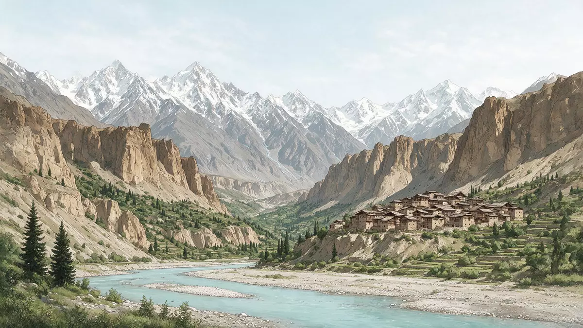
Wadi-e Hunza, the mountain valley of the Hunza River in northern Pakistan, unfolds around the terraced town of Karimabad in a corridor of rock, orchards and high Karakoram peaks. Set within Gilgit-Baltistan, Wadi-e Hunza is both a landscape and a lived-in valley, where stone houses, hilltop forts and irrigated fields share the same steep slopes.
A terraced valley framed by Karakoram peaks
Wadi-e Hunza lies in Gilgit-Baltistan, a northern region of Pakistan administered as part of the wider Kashmir area, where the Karakoram range forms a maze of high ridges and narrow river corridors.Wadi-e Hunza is a mountainous river valley The valley follows the course of the Hunza River, which cuts through pale rock and carries snowmelt from upland glaciers through a chain of villages towards the regional hub of Gilgit.The Hunza Valley widens around Karimabad
Much of Wadi-e Hunza sits at elevations of around 2,400 m (7,874 ft), with mountains rising sharply above the valley floor and retaining snow on their upper slopes.Much of the valley lies around 2,400 m Peaks such as Rakaposhi and Ultar Sar form a backdrop of steep, glaciated faces and ridges, giving Wadi-e Hunza a skyline of jagged summits above cultivated terraces.Rakaposhi and Ultar Sar rise above Karimabad Across the valley, the slopes of Nagar face the inhabited terraces of Wadi-e Hunza, creating a cross-valley view of rock, fields and scattered hamlets.
Karimabad and the old forts of Hunza
Karimabad, formerly known as Baltit, is the main town of Hunza District and the central settlement of Wadi-e Hunza, built on the western side of the valley above the Hunza River.Karimabad, formerly Baltit, is the capital of Hunza District The town stands at around 2,438 m (7,999 ft) and has grown along a slope of terraces, where stone and rendered houses line narrow lanes and small courtyards.Karimabad is a terraced town on the hillside Above the houses, orchards of apricot and other fruit trees occupy irrigated plots, while paths and steps connect the neighbourhoods to the terraces below.
For centuries Wadi-e Hunza formed the territory of the princely state of Hunza, with Baltit as its historic capital. On a spur above Karimabad stands Baltit Fort, a multi-storey structure rebuilt and extended in different periods, where timber and stone walls follow the contours of the hill.Baltit Fort stands above Karimabad Further along the valley lies Altit Fort, another fortified complex on a promontory, anchoring the link between Wadi-e Hunza’s settlements and their strategic positions above the river.Karimabad is framed by old fort complexes
Terraces, orchards and village life along the Hunza River
The inhabited band of Wadi-e Hunza stretches along the Hunza River between clusters of fields and orchards, forming a patchwork of green within a rocky landscape.Hunza Valley is a mountainous valley near Gilgit Irrigation channels carry water from the river and from side valleys to the terraces, where plots of grain, vegetables and fruit trees define the edges of each village. Settlements such as Aliabad, Altit and further communities in Central Hunza link to Karimabad through roads and paths that follow the contours of the slopes.The valley gathers around Karimabad in its central section
The broader Hunza Valley is sometimes divided into lower, central and upper areas, with Karimabad associated with Central Hunza and the Gojal region extending further north towards Khunjerab Pass.Settlements in Hunza are grouped into upper, central and lower sections Local languages include Burushaski in the central part of the valley and Wakhi in the upper reaches, with Urdu and English used as contact languages in administration and tourism.Burushaski, Wakhi and Shina are primary local languages Across Wadi-e Hunza, mosques, small community buildings and terraces used for gatherings mark the centres of villages, set against cliffs and sharp ridges that rise well above the highest fields.
Visiting Wadi-e Hunza: what travellers from Western Europe should know
- Wadi-e Hunza lies in Gilgit-Baltistan in northern Pakistan, with Karimabad as the main town; overland routes link the valley with Gilgit along the Karakoram Highway.
- The valley floor and settlements stand at over 2,000 m, with Karimabad around 2,438 m (7,999 ft), so approaches and village streets involve gradients and stepped paths.
- Karimabad and neighbouring settlements spread across terraces on the western side of the Hunza River, facing the Nagar slopes across the valley, with narrow lanes between closely built houses.
- The official languages of Pakistan include Urdu and English at national level, while local languages in Wadi-e Hunza include Burushaski and Wakhi alongside Shina in parts of the wider valley.
- Entry requirements depend on your nationality; UK travellers can check the FCDO travel advice at gov.uk/foreign-travel-advice, Irish travellers the Department of Foreign Affairs at ireland.ie.
Searching for Wadi-e Hunza on social platforms
These links open searches for Wadi-e Hunza on each platform.
Frequently asked questions about Wadi-e Hunza
Where is Wadi-e Hunza located?
Wadi-e Hunza is the valley of the Hunza River in Gilgit-Baltistan in northern Pakistan, with the main town of Karimabad on the western side of the valley.
What can visitors expect when exploring Wadi-e Hunza?
Visitors encounter a high mountain valley where terraced villages, orchards and historic forts such as Baltit and Altit stand beneath peaks like Rakaposhi and Ultar Sar.
What makes Wadi-e Hunza distinctive among mountain valleys?
The combination of steep Karakoram ridges, a string of hilltop forts and terraced settlements around Karimabad gives Wadi-e Hunza a clear blend of landscape and built heritage.


