

Volcan Baru, Panama’s stratovolcano above Boquete
Published on 08/31/2026 at 07:59 | Editorial responsibility: Rafael Müller, Editor-in-Chief AD HOC NEWS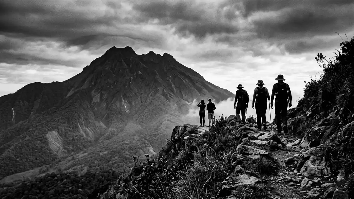
Volcan Baru rises above the highland town of Boquete in western Panama, a stratovolcano whose summit forms the highest point in the country at around 3,475 m (11,401 ft) above sea level. It is Panama’s only volcano and the centrepiece of Volcan Baru National Park, a protected area in Chiriquí Province where cloud forest, old lava flows and steep valleys cluster around a single massif.
The highest peak in Panama’s western highlands
Volcan Baru stands in the western part of Panama, close to the border with Costa Rica, within the Talamanca Range that runs along this section of Central America. Its summit reaches approximately 3,475 m (11,401 ft), making it the tallest mountain in Panama and a dominant feature in views from the surrounding valleys and ridges.the tallest mountain in Panama The volcano is also known locally as Volcán de Chiriquí and gives its name to Volcan Baru National Park, which protects both the peak and extensive highland terrain around it.Volcan Baru National Park
The town of Boquete lies on the eastern flank of the volcano and serves as the main gateway for travellers who wish to explore the surrounding national park.Boquete as the gateway On the western side, the agricultural towns of Volcán and Cerro Punta sit in fertile valleys carved into older volcanic deposits. From the upper slopes, the ridge of Volcan Baru forms a long, irregular summit area with several craters and rocky outcrops, and on clear mornings the horizon can include both the Pacific Ocean and the Caribbean Sea.
A stratovolcano shaped by eruptions and craters
Geologically, Volcan Baru is a complex stratovolcano built up by overlapping lava flows, pyroclastic deposits and volcanic debris spread over a broad cone. It is considered an active volcano in scientific classifications, with documented eruptive episodes extending back several millennia and a historically recorded explosive eruption around the middle of the sixteenth century.a historically recorded eruption around the sixteenth century Radiocarbon dating of volcanic layers indicates that Volcan Baru has produced eruptions at various points over the past 9,000 years, marking it as geologically young in the landscape of Panama.
The volcano’s upper structure includes multiple craters that give the summit area a broken, undulating profile rather than a single sharp peak.the volcano has seven craters Historic eruptions have sent flows and ash into surrounding valleys, and archaeological and geological evidence records damage to earlier settlements northwest of the mountain after a major event around 700 AD.damage to settlements northwest of the volcano Today, geothermal activity beneath the massif continues to attract scientific interest, and the volcano is monitored as part of Central America’s wider belt of active and dormant peaks.
Cloud forest, highland trails and national park landscapes
Volcan Baru sits at the centre of a protected landscape where elevation changes rapidly, and this creates a sequence of habitats ranging from agricultural valleys to high, misty ridges. Volcan Baru National Park extends across roughly 140 square kilometres (about 54 square miles), providing a biological corridor of international importance and safeguarding Panama’s only volcano as well as extensive cloud forest and montane ecosystems.around 140 square kilometres Within this area, steep slopes are draped in forest, while older lava flows and volcanic deposits shape cliffs, ravines and flat highland plateaus.
Several marked routes lead through the park towards the summit, including an approach from the Boquete side and another from Los Llanos on the western flank.marked routes lead through the park Trails pass ranger stations, cut through stands of dense vegetation and eventually reach more open, rocky sections where the tree line gives way to grass and exposed volcanic rock. Along the way, views open onto neighbouring ridges and cultivated valleys, and at the highest points the path crosses loose stones and hardened ash laid down by earlier eruptions.
Visiting Volcan Baru: what travellers from Western Europe should know
- Volcan Baru rises near Boquete in Chiriquí Province in western Panama, close to the country’s border with Costa Rica; Boquete is the usual base for visits.
- The ascent routes involve sustained uphill walking on uneven volcanic terrain, with long sections on dirt tracks, forest paths and rocky ground that demand sure footing.
- Higher parts of the mountain reach elevations above 3,000 m (9,843 ft), and summit routes cross exposed ridges where weather conditions can change quickly with altitude.
- The official language is Spanish and the currency is the Panamanian balboa, which circulates alongside the United States dollar.
- Entry requirements depend on your nationality; UK travellers can check the FCDO travel advice at gov.uk/foreign-travel-advice, Irish travellers the Department of Foreign Affairs at ireland.ie.
Searching for Volcan Baru on social platforms
These links open searches for Volcan Baru on each platform.
Frequently asked questions about Volcan Baru
Where is Volcan Baru located?
Volcan Baru is in Chiriquí Province in western Panama, near the border with Costa Rica and just outside the highland town of Boquete.
What can visitors expect on a visit to Volcan Baru?
Visitors encounter steep highland terrain, cloud forest, volcanic rock and long trails that climb from valley farmland towards a broad summit area with multiple craters.
What makes Volcan Baru distinctive among Panama’s mountains?
Volcan Baru is both the country’s highest peak and its only volcano, rising within a national park that protects a large belt of cloud forest and volcanic landscapes.


