
Vinh Ha Long: limestone towers in the Gulf of Tonkin
Published on 09/12/2026 at 21:22 | Editorial responsibility: Rafael Müller, Editor-in-Chief AD HOC NEWS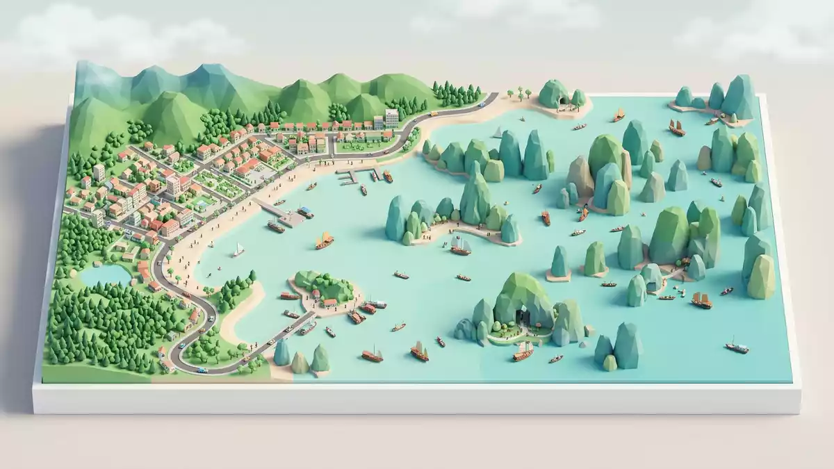
Vinh Ha Long, better known internationally as Ha Long Bay, is a broad bay off the coast of Quang Ninh province where limestone towers rise directly from the waters of the Gulf of Tonkin. The bay’s Vietnamese name, Vinh Ha Long, is usually translated as “Bay of the Descending Dragon”, tying a dramatic landscape to an old legend that has travelled far beyond Vietnam.
Limestone towers and a flooded karst landscape
Vinh Ha Long occupies part of the north-western edge of the Gulf of Tonkin, off the city of Ha Long in north-eastern Vietnam.The bay lies near Ha Long in Quang Ninh province and forms a maze of rocky islands and channels. The broader Ha Long Bay area covers around 1,500 km2 (580 sq mi), with the World Heritage core zone identified as about 434 km2 (168 sq mi).The UNESCO core zone occupies roughly 434 square kilometres
Within this wider bay, hundreds of islands and islets rise steeply or vertically from shallow waters, forming a classic marine karst landscape.The islands are cut in thick sequences of limestone more than 1,000 m deep and many are shaped into isolated towers and clusters. In descriptions of the region, figures between about 1,600 and 2,000 islands and islets recur, and the number of named islands is recorded in the hundreds.Surveys list 1,969 islands with 989 officially named Even without counting, the impression from any vantage point in the bay is of a dense field of pale-grey limestone masses rising out of green water.
Geology, age and the making of the landscape
The towers and ridges of Vinh Ha Long are carved from strong, fine-grained limestones laid down in ancient tropical seas. Geological work on the area describes thick Carboniferous and Permian limestone sequences that reach more than 1,000 m in total depth beneath the bay.Studies characterise Ha Long Bay as fengcong and fenglin karst Accounts of the bay’s formation place the average geological age of the islands between roughly 250 and 280 million years, highlighting how long the rocks have been subjected to tropical weathering and changes in sea level.The islands’ geological age is recorded as between 250 and 280 million years
Karst geomorphologists describe Vinh Ha Long as a drowned or marine-invaded tower karst landscape, where limestone hills have been dissected, dissolved and partly submerged to leave only their stronger cores as towers and ridges.UNESCO documents refer to some 1,600 islands and islets forming a seascape of limestone pillars Many islands contain enclosed marine lakes and complex cave systems, revealing further stages of karst development within the larger masses.Descriptions highlight lakes within larger islands and extensive caves The combination of vertical cliffs, overhangs, arches and inner basins gives the bay its layered character: even short passages by boat move between open reaches of sea and enclosed pockets of water surrounded entirely by rock.
World Heritage status and Vietnamese context
Vinh Ha Long lies in north-eastern Vietnam, within Quang Ninh province, and is part of a wider coastal zone that includes Bai Tu Long Bay and the Cat Ba Archipelago.The bay forms part of the Bac Bo Gulf and the coastal area of Ha Long City and Cam Pha The site’s position at the edge of the Gulf of Tonkin places it east of the Red River delta and roughly east of Hanoi, with shipping routes and fishing grounds extending between the islands and towards the open gulf.Ha Long Bay occupies the north-eastern corner of the Gulf of Tonkin
Ha Long Bay was recognised as a World Natural Heritage site by UNESCO for its scenic value in 1994 and for its geology and geomorphology in 2000.UNESCO records the 1994 inscription under criterion vii and a 2000 extension under criterion viii A later inscription brought together Ha Long Bay and the neighbouring Cat Ba Archipelago as a single World Heritage property spanning both Quang Ninh province and Hai Phong city.The combined Ha Long Bay - Cat Ba Archipelago property is documented as covering 65,650 ha with 1,133 islands and islets These formal recognitions sit alongside the bay’s role in Vietnamese culture, where the image of the “descending dragon” and the sight of limestone towers in green water have become strongly associated with the north of the country.
Visiting Vinh Ha Long: what travellers from Western Europe should know
- Vinh Ha Long lies off the coast of Quang Ninh province in northern Vietnam, near the city of Ha Long, and is reached by road and sea from inland centres such as Hanoi.
- The bay consists of sea channels and rocky limestone islands, so movement within it generally involves boats navigating between cliffs, narrow passages and sheltered basins.
- The official language is Vietnamese and the currency is the Vietnamese dong.
- Entry requirements depend on your nationality; UK travellers can check the FCDO travel advice at gov.uk/foreign-travel-advice, Irish travellers the Department of Foreign Affairs at ireland.ie.
Searching for Vinh Ha Long on social platforms
These links open searches for Vinh Ha Long on each platform.
Frequently asked questions about Vinh Ha Long
Where is Vinh Ha Long located?
Vinh Ha Long is on the north-eastern coast of Vietnam, off Quang Ninh province near the city of Ha Long, within the northern Gulf of Tonkin.
What can visitors expect on a visit to Vinh Ha Long?
Visitors encounter a bay dotted with limestone islands and cliffs, with boat routes threading through narrow channels, open reaches of sea and enclosed basins surrounded by rock.
What makes Vinh Ha Long distinctive among coastal landscapes?
Vinh Ha Long is distinguished by its concentration of steep limestone towers rising from shallow waters and by its recognition as a World Natural Heritage site for both scenery and karst geology.


