
Vinh Ha Long and its limestone islands of Ha Long
Published on 09/08/2026 at 20:56 | Editorial responsibility: Rafael Müller, Editor-in-Chief AD HOC NEWS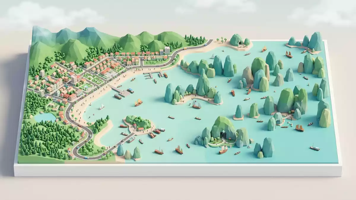
Vinh Ha Long, known internationally as Ha Long Bay, is a broad, island?studded inlet off the coast of Ha Long in northern Vietnam, where forested limestone towers rise directly from the Gulf of Tonkin. Its scattered islands and rocky pillars create a dense seascape that has been recognised as a World Natural Heritage Site by UNESCO and has become one of the most closely associated landscapes with Vietnam’s northeastern shore.
Limestone pillars in the Gulf of Tonkin
Ha Long Bay occupies part of the north?western edge of the Gulf of Tonkin, close to the city of Ha Long in Quang Ninh province. It extends across a shallow marine basin where seawater reaches between the coastal mainland and a wide field of islands and islets. Encyclopaedia entries describe an area on this coast measuring around 1,500 square kilometres, containing thousands of rocky and earthen islands that stand as jagged limestone pillars in the bay.1,500-square-kilometre bay These islands rise steeply from the sea, some reaching several hundred metres above the water, and together they form one of the world’s most visible examples of a coastal karst landscape.karst features in Ha Long Bay
The bay’s islands are predominantly made of limestone, shaped over long periods by tropical weathering, dissolution and the movement of water. Descriptions from conservation datasheets and tourism guides note that the wider region includes more than 1,600 islands and islets, many sparsely covered by trees on steep slopes and cliffs.limestone pinnacles and forested islands Within the area inscribed by UNESCO, hundreds of these islands fall inside a defined core zone that protects rocky outcrops, caves and marine approaches as part of the World Heritage property.Ha Long Bay – Cat Ba Archipelago inscription
The name Vinh Ha Long and UNESCO recognition
The Vietnamese name Vinh Ha Long translates broadly as “Where the Dragon Descends to the Sea”, an expression introduced in reference works that has become part of the bay’s identity.Vietnamese name Vinh Ha Long In English usage the same place is commonly referred to as Ha Long Bay or Halong Bay, and it is administered within Quang Ninh province in northeastern Vietnam.bay in northeastern Vietnam The bay forms part of a larger coastal system that also includes Bai Tu Long Bay to one side and the island of Cat Ba further to the south?west, together framing much of the region’s island coastline.
Ha Long Bay’s limestone landscape and island scenery led to recognition on the World Heritage List in the late twentieth century. UNESCO first inscribed the bay in 1994 for its outstanding scenic qualities and then extended the recognition in 2000 to acknowledge its geological and geomorphological value.two UNESCO inscriptions in 1994 and 2000 More recently, UNESCO has classified Ha Long Bay together with the Cat Ba archipelago as a joint World Natural Heritage Site, covering tens of thousands of hectares and more than a thousand islands and islets within Quang Ninh province and neighbouring Hai Phong City.Ha Long Bay – Cat Ba Archipelago World Heritage site
Karst seascapes, caves and islands
Descriptions of Vinh Ha Long emphasise its mature karst geomorphology, developed over geological time under a warm, wet tropical climate. In the World Heritage datasheet the bay is described as a large inlet near the mouth of the Bach Dang river, filled with rocky pillars, steep forested islets and a series of caves and grottoes carved into the limestone.mature karst landscape in Ha Long Many of the islands have sheer cliffs that drop straight into the water, while others include sheltered coves and small sandy beaches tucked between headlands.
Tourism and geography resources set out more detailed numbers for the bay’s islands and protected zones. Guides from Vietnam’s tourism authorities describe a broader region with nearly 2,000 islands of varying size, of which hundreds carry formal names.1,969 islands in the wider bay Within the area recognised by UNESCO, the core protected zone is reported as about 434 square kilometres with 775 islands, combining limestone pinnacles, rocky outcrops and small beaches in a compact triangle of sea and rock inside the larger bay.434 km² UNESCO core with 775 islands
Visiting Vinh Ha Long: what travellers from Western Europe should know
- Vinh Ha Long lies off the north?east coast of Vietnam, in the Gulf of Tonkin near Ha Long City in Quang Ninh province, and is reached from the mainland by boat through the island?studded bay.
- The terrain combines open sea with steep limestone islands, so approaches often involve walking on uneven rock or sand at small landing spots and climbing stairways cut into slopes or built along the shoreline.
- The bay forms part of a wider coastal region that includes Bai Tu Long Bay to one side and the Cat Ba archipelago to the south?west, with some islands and viewpoints offering clear sights across these neighbouring areas.
- The official language is Vietnamese and the currency is the Vietnamese dong.
- Entry requirements depend on your nationality; UK travellers can check the FCDO travel advice at gov.uk/foreign-travel-advice, Irish travellers the Department of Foreign Affairs at ireland.ie.
Searching for Vinh Ha Long on social platforms
These links open searches for Vinh Ha Long on each platform.
Frequently asked questions about Vinh Ha Long
Where is Vinh Ha Long?
Vinh Ha Long is an inlet on the north?eastern coast of Vietnam, forming Ha Long Bay in Quang Ninh province near the city of Ha Long.
What can visitors expect on a visit to Vinh Ha Long?
Visitors encounter a wide bay dotted with limestone islands, steep cliffs, caves and small beaches, with journeys typically made by boat among the pillars and islets.
What makes Vinh Ha Long distinctive?
The combination of a mature limestone karst seascape, hundreds of forested islands and its status as a UNESCO World Natural Heritage Site gives Vinh Ha Long a distinctive coastal character.


