
Vieux-Port de Marseille, the historic harbour basin of Marseille
Published on 08/28/2026 at 18:11 | Editorial responsibility: Rafael Müller, Editor-in-Chief AD HOC NEWS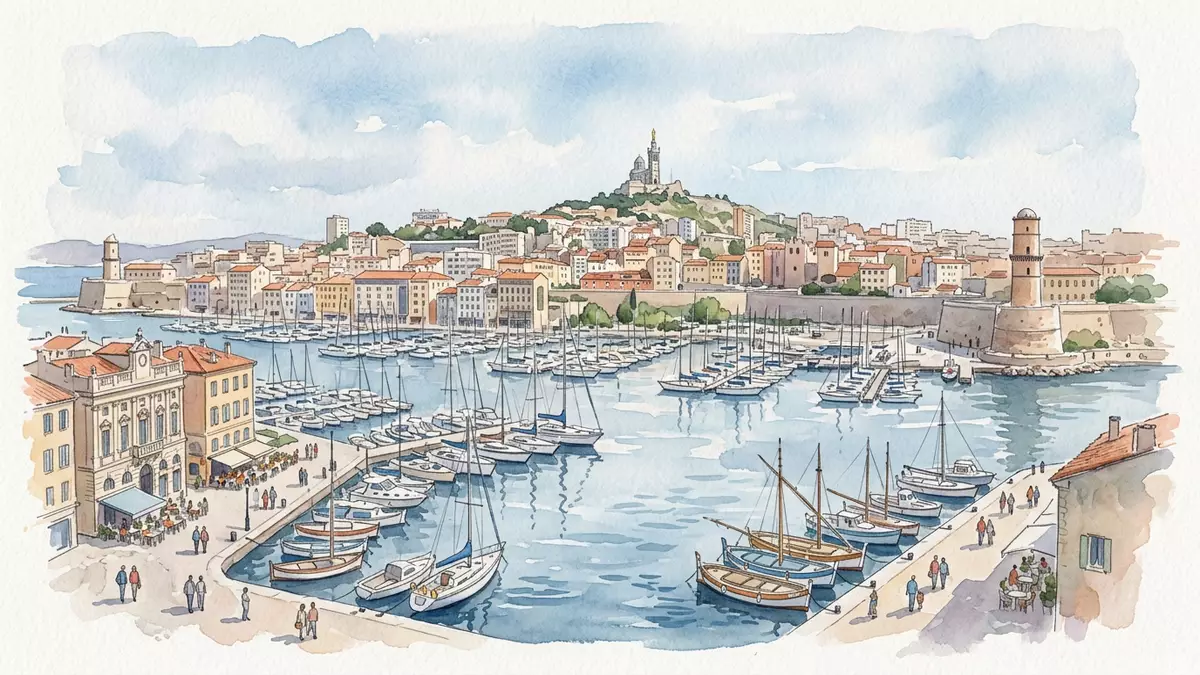
Vieux-Port de Marseille is the sheltered harbour basin that shaped Marseille, a Mediterranean cove where Greek sailors founded Massalia around 600 BC and the city has grown around the water ever since. The inlet, historically known as Lacydon, has served as Marseille’s main harbour from antiquity through the nineteenth century, tying the urban fabric to the sea and making the port the historic centre of the city.
A harbour where Marseille began
The story of Vieux-Port de Marseille starts with the arrival of sailors from Phocaea, who established the Greek settlement of Massalia on the northern shore of the rocky inlet in the sixth century BC.Greek settlers from Phocaea The basin offered protected water opening onto the Mediterranean, and trade routes fanned out from this anchorage towards other coastal towns and islands. In Roman times Massalia became Massilia, yet the same inner harbour remained the focus of maritime life, with wharves, storage buildings and defensive structures concentrating around the edge of the water.centre historique et culturel
Through the Middle Ages the end of the basin furthest from the entrance was used for cultivating hemp, supporting local rope?making for ships and giving the Canebière, Marseille’s main thoroughfare, its name.hemp for rope?making As Marseille expanded into a wider hinterland after its annexation to the French crown in 1481, maritime activity continued to concentrate in Vieux-Port. Quays were progressively built between the fifteenth and seventeenth centuries, establishing stone edges along the basin where galleons could be built and moored.quays from the fifteenth to seventeenth centuries
Fortified entrance and limestone backdrop
The entrance to Vieux-Port de Marseille is framed by two prominent forts, Fort Saint?Jean to the north and Fort Saint?Nicolas to the south, guarding the narrow mouth where the basin opens towards the Mediterranean.Fort Saint?Jean and Fort Saint?Nicolas These fortifications date from the seventeenth century and stand on rocky promontories, giving the harbour entrance a distinctive stone frame that contrasts with the water and the boats passing between them. From the quays inside the basin the forts are visible as landmarks, linking maritime space to the defensive architecture of the early modern city.
The wider setting of the port is shaped by limestone hills that rise behind the city, forming a natural backdrop beyond the built waterfront.surrounded by limestone hills The basin itself cuts into the coastline like a deep notch, with quays lining the inner edges and streets running parallel to the water. Historically the harbour entrance was also marked by a steel transporter bridge, inaugurated in 1905 between the two forts, whose structure became one of the symbols of the port before its destruction in the twentieth century.transporter bridge inaugurated in 1905
From working harbour to civic waterfront
Until the nineteenth century Vieux-Port de Marseille functioned as Marseille’s main harbour for maritime commerce, with shipbuilding yards, cargo handling and fishing boats concentrated within the basin.economic centre for sea trade Galleons were built along the quays between the fifteenth and seventeenth centuries, and merchant ships arriving from across the Mediterranean and beyond crowded the water, making the port not only the city’s economic heart but also a scene of constant maritime activity.shipyard making galleons
As ship sizes increased in the nineteenth century, heavy commercial operations shifted towards larger docks to the north, in districts such as La Joliette and the area that developed into Grand Port Maritime de Marseille, leaving the historic basin to evolve towards lighter maritime uses and civic waterfront space.shift towards La Joliette and Grand Port Maritime In the twentieth century the quaysides were progressively reclaimed as public space, with technical harbour installations relocated to platforms over the water, and urban projects focused on reconnecting the historic harbour with the surrounding city streets as a place for promenades, gatherings and views of the basin.reclaiming the quaysides as civic space
Visiting Vieux-Port de Marseille: what travellers from Western Europe should know
- Vieux-Port de Marseille lies at the western edge of central Marseille, where the harbour basin indents the coastline; tram and metro services link nearby squares and streets with other districts of the city.
- The waterfront consists of long quays and paved promenades, with level surfaces alongside the water and connecting streets rising slightly towards the limestone hills behind the harbour.
- Fort Saint?Jean and Fort Saint?Nicolas stand beside the harbour entrance, and paths and streets around their bases connect to viewpoints over the basin and the wider coastline.
- The official language is French and the currency is the euro.
Searching for Vieux-Port de Marseille on social platforms
These links open searches for Vieux-Port de Marseille on each platform.
Frequently asked questions about Vieux-Port de Marseille
Where is Vieux-Port de Marseille within Marseille?
Vieux-Port de Marseille occupies the western side of central Marseille, at a deep harbour basin opening onto the Mediterranean and framed by the forts at its entrance.
What can visitors expect when walking along the harbour?
Visitors encounter long stone quays, paved promenades beside the water, views towards Fort Saint?Jean and Fort Saint?Nicolas, and streets that lead back into the historic city centre.
What makes Vieux-Port de Marseille distinctive among harbour basins?
Vieux-Port de Marseille stands out through its role as the historic cradle of Marseille, its sixth?century BC foundation as Massalia, and the combination of fortified entrance and limestone hills around the basin.


