
Victoria Peak where Hongkong rises above its harbour
Published on 09/23/2026 at 23:39 | Editorial responsibility: Rafael Müller, Editor-in-Chief AD HOC NEWS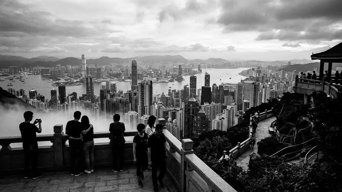
Victoria Peak is the high ridge above Hongkong’s Central and Western District, with woodland, roads, residences and viewing terraces gathered around its upper slopes. The summit reaches 552 m (1,811 ft), while Victoria Harbour and Kowloon spread below the ridge.
Victoria Peak and the shape of Hongkong
Known locally as The Peak and also as Mount Austin, Victoria Peak forms a steep green backdrop to Hongkong Island’s western urban districts. Its summit area lies around Mount Austin Road, while Victoria Gap sits below the summit between Victoria Peak and Mount Gough.
The mountain is not a single enclosed attraction. It is a landscape of roads, paths, houses, gardens and public viewpoints. Lugard Road follows the hillside above the city, and the Hong Kong Trail begins at Victoria Peak before crossing Hongkong Island towards Big Wave Bay.
From nineteenth-century retreat to urban landmark
Victoria Peak entered Hongkong’s colonial history during the nineteenth century. Sir Richard MacDonnell, the sixth Governor of Hong Kong, had a summer residence built on the Peak around 1868. European residents and merchants occupied hillside homes, while the high ground became associated with seasonal residences and the administration of the colony.
The 552-metre summit belongs to the mountain’s physical identity, but the lower ridge contains much of the public life connected with the name. Victoria Peak Garden occupies the site of the Former Mountain Lodge, a summer residence built between 1900 and 1902.
The Peak Tram, Lugard Road and the upper ridge
The Peak Tram links Central with the upper Peak area. Alexander Findlay Smith proposed the railway project in 1881, and the line opened in May 1888 under Governor Sir George William des Vœux. It began as a steam-powered funicular railway.
The Peak Tram’s 1888 opening fixed the mountain into Hongkong’s transport history. Electric power replaced the original steam system in 1926, and the railway remains associated with the steep ascent from the city to the Peak Tower area.
Lugard Road carries the name of Sir Frederick Lugard, Governor of Hong Kong from 1907 to 1912. Construction began in 1913, and the road was completed in 1921. Its hillside route passes viewpoints above Victoria Harbour, with the city’s towers, Kowloon and the harbour forming the visible panorama.
Visiting Victoria Peak: what travellers from Western Europe should know
- Victoria Peak rises above Central and the Central and Western District on Hongkong Island. The Peak Tram climbs from Garden Road, while roads reach the upper ridge through Victoria Gap and Mount Austin Road.
- The summit reaches 552 m (1,811 ft), and Victoria Gap lies at about 396 m (1,299 ft). The upper area includes steep slopes, winding roads and hillside paths.
- Lugard Road forms part of the Hong Kong Trail. Stage 1 follows Lugard Road and the western end of Harlech Road before continuing towards Pok Fu Lam Reservoir Road.
- The official language is Chinese and English, and the currency is the Hong Kong dollar.
Searching for Victoria Peak on social platforms
These links open searches for Victoria Peak on each platform.
Frequently asked questions about Victoria Peak
Where is Victoria Peak?
Victoria Peak is on the western side of Hongkong Island, above Central and the Central and Western District. Victoria Harbour lies below its northern and eastern slopes.
What can travellers expect on Victoria Peak?
The upper ridge combines woodland, roads, residences, gardens and viewpoints. The Peak Tram, Lugard Road, Mount Austin Road and Victoria Peak Garden are key named places.
What makes Victoria Peak distinctive?
Its 552 m (1,811 ft) summit rises directly above a dense harbour city. The mountain also combines a nineteenth-century colonial history with a major urban transport landmark dating from 1888.


