
Victoria Falls and the world’s largest curtain of water
Published on 09/07/2026 at 07:39 | Editorial responsibility: Rafael Müller, Editor-in-Chief AD HOC NEWS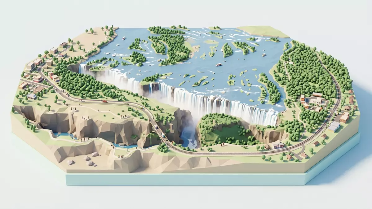
Victoria Falls on the Zambezi River between Zimbabwe and Zambia is a waterfall where a broad river drops abruptly into a line of deep basalt gorges, creating an immense curtain of water and spray. Recognised as “Mosi-oa-Tunya”, the “Smoke that Thunders”, it forms one of the largest single sheets of falling water in the world and has been inscribed as a UNESCO World Heritage Site for its natural beauty and geological significance.
The Zambezi River plunging into basalt gorges
Victoria Falls lies at a point where the Zambezi River, which is generally more than 2 km wide in this stretch, runs across a basalt plateau marked by fractures and fault lines before dropping into a narrow chasm.basalt plateau marked by fractures Along the lip of the waterfall the river’s full width is carried over the edge, producing a continuous line of water that descends into the First Gorge below.a length of around 1,700 m at full flood
The fall line reaches heights of up to about 108 m (354 ft), and the World Heritage listing describes Victoria Falls as the largest curtain of falling water, with a span of roughly 1,708 m (5,604 ft).largest curtain of falling water The deep gorge below the lip has been carved by the river as it exploited weaknesses in the basalt over long periods, leaving a series of steep-sided channels that extend downstream from the present-day fall line.deep basalt gorges created by erosion
Mosi-oa-Tunya / Victoria Falls as a World Heritage landscape
The name Mosi-oa-Tunya, used in local languages such as Lozi, translates as “Smoke that Thunders” and captures the way spray rises above the gorge when the river flows over the full width of the lip.Mosi-oa-Tunya, “Smoke that Thunders” The designation “Mosi-oa-Tunya / Victoria Falls” was inscribed on the UNESCO World Heritage List in 1989, recognising both the dramatic display of water and the geological processes that produced the basalt plateau and gorges.inscribed on the World Heritage List in 1989
The protected area covers sections of riverbank and plateau on both sides of the Zambezi, linking Zambia’s Mosi-oa-Tunya National Park with Zimbabwe’s Victoria Falls National Park.Victoria Falls National Park Within this landscape the abrupt break between the broad upstream channel and the succession of gorges downstream is striking: the river flows calmly across the plateau, then drops into a chasm more than 100 m deep, raising mist that can be visible at considerable distances when the river is at high flow.mist plume that may rise hundreds of metres
Victoria Falls town and viewpoints along the gorge
On the southern bank of the Zambezi, the Zimbabwean town of Victoria Falls lies adjacent to the waterfall and serves as a gateway for visitors approaching from the country’s interior.township on the south bank of the Zambezi The town faces Livingstone in Zambia across the river, and the border crossing connects the built-up area directly with the vicinity of the waterfall and its national parks.located along the border with Zambia
Trails and viewpoints on both sides of the gorge give changing perspectives on the fall line and the eroded channels below. From the rim near the Devil’s Cataract through Main Falls and Rainbow Falls to the Eastern Cataract, the lip is broken into sections that together form the continuous curtain described in the World Heritage listing.named sections of the fall line When the river is high, spray from the descent can obscure parts of the view along the gorge; when levels drop, more of the basalt walls and individual channels become visible, underlining how the river has cut back into the plateau.
Visiting Victoria Falls: what travellers from Western Europe should know
- Victoria Falls lies on the Zambezi River at the border between Zimbabwe and Zambia, reached via the town of Victoria Falls on the Zimbabwean side and Livingstone in Zambia.
- Paths and viewpoints run close to the gorge and riverbank, with sections involving steps, uneven surfaces and exposure to spray from the descending water.
- The official languages are English in both Zimbabwe and Zambia, and the currencies are the Zimbabwean dollar and the Zambian kwacha.
- Entry requirements depend on your nationality; UK travellers can check the FCDO travel advice at gov.uk/foreign-travel-advice, Irish travellers the Department of Foreign Affairs at ireland.ie.
Searching for Victoria Falls on social platforms
These links open searches for Victoria Falls on each platform.
Frequently asked questions about Victoria Falls
Where are Victoria Falls located?
Victoria Falls are situated on the Zambezi River at the border between Zimbabwe and Zambia in southern Africa, adjacent to the town of Victoria Falls on the Zimbabwean side.
What can visitors expect when viewing Victoria Falls?
Visitors encounter a broad river dropping into deep basalt gorges, with viewpoints along the rim where dense spray, mist and rainbows can accompany the sight of the descending water.
What makes Victoria Falls distinctive among waterfalls?
Victoria Falls combine a fall height of around 108 m (354 ft) with a width of about 1,708 m (5,604 ft), forming what is described as the world’s largest single curtain of falling water.


