
Victoria Falls and the Smoke that Thunders
Published on 09/10/2026 at 19:59 | Editorial responsibility: Rafael Müller, Editor-in-Chief AD HOC NEWS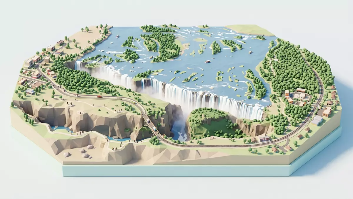
Victoria Falls is the point where the Zambezi River throws itself off a basalt plateau in an almost continuous wall of water, splitting the border between Zimbabwe and Zambia in a roar of spray. Stretching for around 1,7 km and dropping about 108 m (354 ft) into a narrow chasm, this is one of the places where scale, geology and atmosphere come together so completely that the landscape feels shaped around the falls themselves.
Zambezi River on the edge of a plateau
The setting of Victoria Falls is simple to state and complex to grasp: a wide African river, a flat upstream plateau and a fracture where water and rock meet. The Zambezi River flows across southern Africa and reaches a breadth of more than 2 km as it approaches the lip of the falls, then plunges 108 m into the gorge below.The Zambezi River forms the boundary between Zimbabwe and Zambia here, and Victoria Falls sits directly on that frontier, with viewpoints in both countries.Victoria Falls is a waterfall on the Zambezi River
The cliffs and platforms around the falls are carved from basalt, a dark volcanic rock that resists erosion differently from the softer layers beneath it.Basalt and dolerite form the foundation of the falls Over time, the river has cut a sequence of gorges into this plateau, and the present line of the falls is only the latest in a chain of former lips further downstream. The result is a landscape where the main drop is almost two kilometres wide, yet the channel it falls into feels sharply enclosed, with the river confined to a deep, zigzagging trench immediately after the plunge.
Mosi-oa-Tunya: the smoke that thunders
Long before Victoria Falls carried the name given by the Scottish explorer David Livingstone in the nineteenth century, the falls were known locally as Mosi-oa-Tunya, “the smoke that thunders”. The name captures two straightforward facts: the immense spray plume rising above the gorge and the sound produced as water hits the chasm below.The Lozi name Mosi-oa-Tunya means “Smoke that Thunders” On days of high flow the spray can form a cloud visible many kilometres away, and the forested paths on the Zimbabwean side pass through air that is frequently saturated by fine droplets.
The scale of the curtain and the continuous line of the drop together make Victoria Falls the world’s largest sheet of falling water when the river runs high.The waterfall is about 1,708 m wide with a maximum vertical drop of 108 m This property is recognised in the UNESCO World Heritage inscription “Mosi-oa-Tunya / Victoria Falls”, which covers both banks of the river and the adjoining protected areas in Zimbabwe and Zambia.The site was inscribed on the World Heritage List in 1989 The designation emphasises not only the visual spectacle but also the way the falls express geological processes in action, with ongoing erosion steadily reshaping the lip and the gorges downstream.
Town, viewpoints and national parks
On the Zimbabwean bank, Victoria Falls town lies close to the edge of the gorge, with streets, accommodation and services clustered within walking distance of the rainforest paths leading to the viewpoints.Victoria Falls town stands in the north-western corner of Zimbabwe on the Zambezi River The main public viewpoints here sit inside Victoria Falls National Park, a protected area of riverine forest and cliff top trails. Across the river in Zambia, Mosi-oa-Tunya National Park occupies the opposite side of the gorge, with paths and platforms looking back towards the Zimbabwean bank.The World Heritage property includes both Victoria Falls National Park and Mosi-oa-Tunya National Park
The falls themselves are divided into named sections along the lip, including the Devil’s Cataract, the Main Falls, the Rainbow Falls and the Eastern Cataract, each corresponding to a slightly different height and angle of descent.Heights along the lip range from around 61 m to 99 m Walkways on the Zimbabwean side run opposite much of this line, giving views into the chasm and along the face of the curtain, while on the Zambian side paths approach the edge from different angles, including routes near the Eastern Cataract and the bridge downstream. Between them, these vantage points illustrate how the Zambezi narrows abruptly after the drop, funnelling into the series of basalt gorges that carry its water away.
Visiting Victoria Falls: what travellers from Western Europe should know
- Victoria Falls lies on the Zambezi River at the frontier between Zimbabwe and Zambia in southern Africa, with the Zimbabwean town of Victoria Falls and the Zambian town of Livingstone nearby.
- The main viewpoints involve walking on formed paths along the gorge edge, with sections that include steps, wet surfaces from spray and short approaches on foot through forest.
- The falls are surrounded by protected areas: Victoria Falls National Park in Zimbabwe and Mosi-oa-Tunya National Park in Zambia, both reached by local roads from their respective towns.
- The official languages are English in Zimbabwe and English in Zambia, and the currencies are the Zimbabwean dollar and the Zambian kwacha.
- Entry requirements depend on your nationality; UK travellers can check the FCDO travel advice at gov.uk/foreign-travel-advice, Irish travellers the Department of Foreign Affairs at ireland.ie.
Searching for Victoria Falls on social platforms
These links open searches for Victoria Falls on each platform.
Frequently asked questions about Victoria Falls
Where is Victoria Falls?
Victoria Falls is on the Zambezi River in southern Africa, directly on the border between Zimbabwe and Zambia, beside the towns of Victoria Falls and Livingstone.
What should travellers expect on a visit?
Travellers encounter formed paths and viewpoints along the edge of a deep basalt gorge, with extensive spray during periods of high river flow and views across a wide waterfall curtain.
What makes Victoria Falls distinctive among waterfalls?
Victoria Falls combines a breadth of about 1,7 km with a drop of roughly 108 m into a narrow chasm, creating one of the world’s largest continuous sheets of falling water.


