
Victoria Falls and the basalt gorge beyond
Published on 09/09/2026 at 10:36 | Editorial responsibility: Rafael Müller, Editor-in-Chief AD HOC NEWS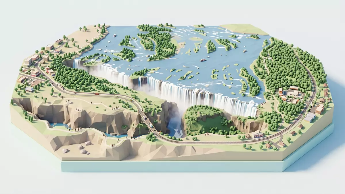
Victoria Falls spans the Zambezi as a broad curtain of falling water on the border between Zambia and Zimbabwe. It was inscribed with the name Mosi-oa-Tunya / Victoria Falls in 1989, and the water meets a chain of basalt gorges below the lip.World Heritage site
Victoria Falls in a basalt gorge system
The falls drop into a chasm rather than an open basin, and the river then turns through a sequence of steep-sided gorges. The UNESCO description gives the site’s scale as 6,860 ha and records the width of the falls at about 1,708 m (5,604 ft).6,860 ha
David Livingstone recorded the falls for a European audience in 1855, and the English name honours Queen Victoria. The historic naming sits alongside the local name Mosi-oa-Tunya, which is attached to the World Heritage property and remains part of the site’s identity.David LivingstoneMosi-oa-Tunya
The river, spray and viewing line
The Zambezi is more than 2 km wide at this point, and the falls raise a mist that can be seen from far away. That spray and the rock walls of the gorge give the site its immediate visual character, while the river continues into Batoka Gorge below.more than 2 km wideBatoka Gorge
Britannica describes the main drop as 108 m (355 ft), with water entering a narrow gorge cut through the rock wall. That confined channel, the deep pool below the gorge and the bridge nearby give the landscape a layered, vertical form.108 m (355 ft)
Victoria Falls as a shared border landscape
The site is a transboundary natural landscape shared by Zambia and Zimbabwe. Its formal designation covers national park land on both sides of the river, together with the riverine strip in Zimbabwe.transboundary
That shared status gives the place its mixture of river, basalt, gorge and parkland. The falls remain the central feature, but the surrounding terrain is part of the same protected whole.protected whole
Visiting Victoria Falls: what travellers from Western Europe should know
- The falls lie on the border between Zambia and Zimbabwe, with access from the town of Victoria Falls on the Zimbabwean side and Livingstone on the Zambian side. The Victoria Falls Bridge crosses the gorge downstream.Victoria Falls Bridge
- The immediate terrain changes from river lip to steep gorge, with rock walls and broken ground below. Paths near the falls share that vertical setting, and the main viewpoints look into the chasm rather than across flat ground.
- The surrounding protected area includes river islands and riparian vegetation. Birds of prey and other wildlife are part of the broader landscape around the falls.river islands
- English is widely used on both sides of the border, and the local names Mosi-oa-Tunya and Victoria Falls both appear in formal references. The place sits within the protected landscape, not in a separate enclosed monument.formal references
Searching for Victoria Falls on social platforms
These links open searches for Victoria Falls on each platform.
Frequently asked questions about Victoria Falls
Where is Victoria Falls?
Victoria Falls lies on the Zambezi River at the border between Zambia and Zimbabwe. The wider protected landscape is a transboundary World Heritage property.
What does a visit involve?
The place centres on a waterfall, steep basalt gorges and the bridge downstream. Views focus on the drop, the spray and the rock formations cut by the river.
What makes Victoria Falls distinctive?
The falls are very wide, drop into a narrow gorge system and form part of a protected border landscape. The combined setting of water, basalt and mist is the defining feature.


