

Varadero’s long ribbon of sand on Cuba’s Hicacos Peninsula
Published on 08/26/2026 at 06:27 | Editorial responsibility: Rafael Müller, Editor-in-Chief AD HOC NEWS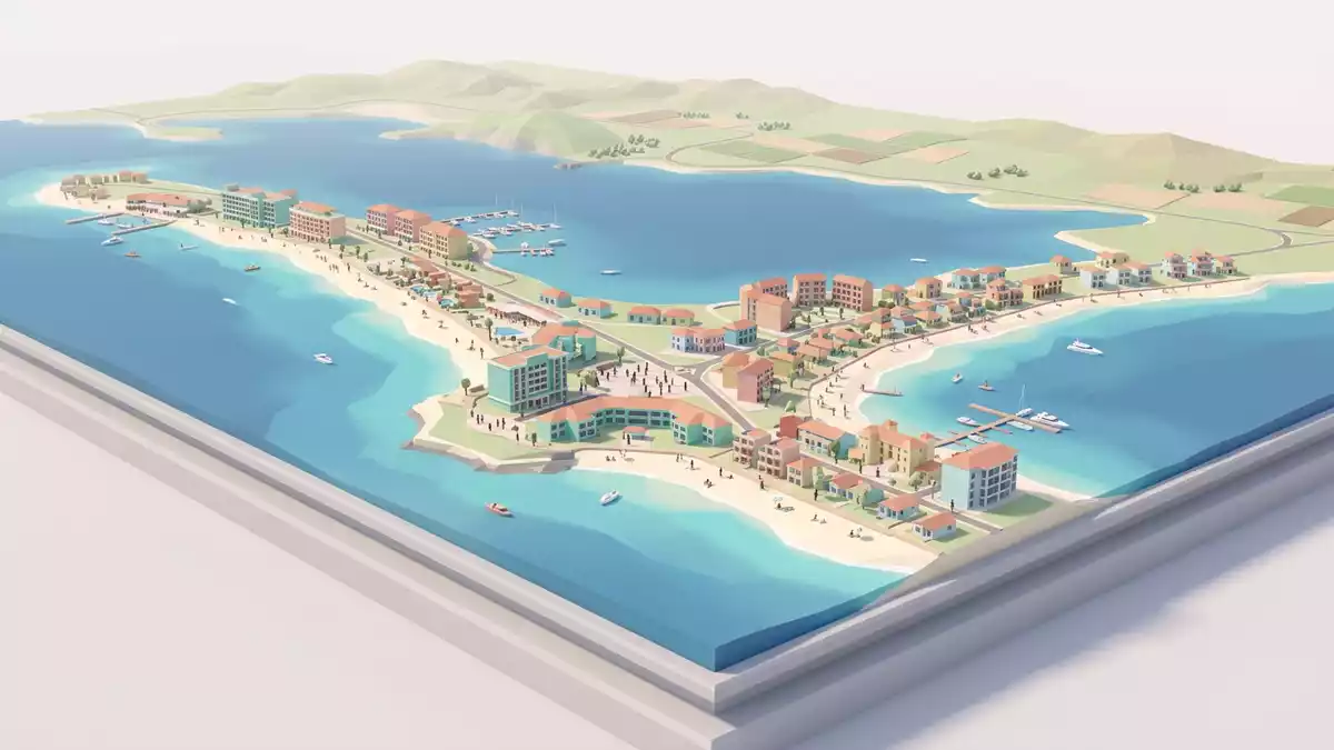
Varadero in northern Cuba is a resort town laid out along the narrow Hicacos Peninsula, where a long belt of pale sand runs between the Straits of Florida and the Bay of Cárdenas. The town in Matanzas province is administered as part of the municipality of Cárdenas and is known for a beach that extends for about 20 km (12.5 mi) along the outer shore of the peninsula.resort town in the province of Matanzas
A town drawn along a peninsula
The setting of Varadero is defined by the Hicacos Peninsula, an elongated tongue of land on the northern coast of Cuba in Matanzas province, stretching roughly north-east from the mainland into the sea.peninsula on Cuba's northern shore The peninsula is generally flat, based on carbonated rocks, with an average elevation of around 10 m (33 ft) above sea level and slightly higher ground facing the open water.average height of 10 m and a maximum of 27 m
On a map, Varadero appears as a linear town following the spine of the peninsula, with streets and hotel plots arranged roughly parallel to the shore. The resort area occupies much of the outer coast, while the inner side faces the quieter waters of the Bay of Cárdenas, giving the place two distinct maritime horizons. At the far end of the peninsula lies Punta Hicacos, recognised as the northernmost point of the island of Cuba.Punta Hicacos, the northernmost point of Cuba
Varadero beach and the Hicacos landscape
The defining physical feature of Varadero is its beach, which runs along the outer edge of the Hicacos Peninsula for about 20 km and forms a near-continuous strip of light-coloured sand and shallow sea.Varadero beach with more than 20 km of extension Behind the sand, low dunes and patches of coastal vegetation mark the transition to the built-up zone, where resort buildings, smaller guesthouses and service structures are aligned in narrow bands.
The geology of the peninsula gives Varadero a characteristic low relief. Much of Hicacos consists of limestone and other carbonated rocks, with low cliffs appearing in places where the beaches are interrupted.formation and evolution of Varadero's relief Towards the southern shore, the land becomes marshier, with mangroves, coastal lagoons and patches of wet ground extending towards the Bay of Cárdenas. Offshore, small islets and coral formations punctuate the shallow waters around the peninsula, hinting at the wider archipelagos along Cuba’s north coast.surrounded by cayos, reefs and underwater caves
From salt works to resort town
The human story of Varadero reaches back to Indigenous communities on Hicacos, whose presence is recorded in cave paintings on the peninsula. Written records mention the area in the sixteenth century, when the long, gently shelving shore was used as a place to beach and service ships. The Spanish name “Varadero” itself comes from the verb “varar”, meaning to run aground or beach a vessel.name comes from the Spanish word varar
For centuries, salt extraction shaped parts of the peninsula, particularly around the “Las Salinas” salt works that supplied the region. The modern town of Varadero dates from the late nineteenth century and is officially founded on 5 December 1887, when the council of nearby Cárdenas approved a town plan by surveyor José López Martínez and granted permission for families from Cárdenas to build summer houses here.founding of Varadero is recognised as December 5, 1887 In the early twentieth century the local economy shifted away from salt towards beach tourism, with small hotels and guest villas making use of the long shoreline.economy reoriented from salt mining to tourism
Visiting Varadero: what travellers from Western Europe should know
- Varadero lies on the Hicacos Peninsula on the northern coast of Cuba, in Matanzas province, and is administratively part of the municipality of Cárdenas.
- The peninsula is a long, narrow strip of low-lying limestone with sandy beaches on the outer coast and marshier, mangrove-lined shores towards the Bay of Cárdenas.
- The resort area stretches for many kilometres along the coast, so moving between different parts of Varadero involves travelling lengthwise along the peninsula rather than across a compact town grid.
- The official language is Spanish and the currency is the Cuban peso.
- Entry requirements depend on your nationality; UK travellers can check the FCDO travel advice at gov.uk/foreign-travel-advice, Irish travellers the Department of Foreign Affairs at ireland.ie.
Searching for Varadero on social platforms
These links open searches for Varadero on each platform.
Frequently asked questions about Varadero
Where is Varadero in Cuba?
Varadero is a resort town on the Hicacos Peninsula on Cuba’s northern coast, in Matanzas province, between the Straits of Florida and the Bay of Cárdenas.
What should visitors expect in Varadero?
Visitors encounter a long, low-lying peninsula dominated by a sandy beach, resort developments, coastal vegetation and marshier, mangrove-backed shores towards the inner bay.
What makes Varadero distinctive among Cuban beach areas?
Varadero combines a beach of around 20 km in length with a narrow limestone peninsula, double seafronts and a town layout that follows the peninsula’s linear form.


