
U Bein Bridge, Amarapura’s long teak walk over Taungthaman Lake
Published on 09/07/2026 at 22:24 | Editorial responsibility: Rafael Müller, Editor-in-Chief AD HOC NEWS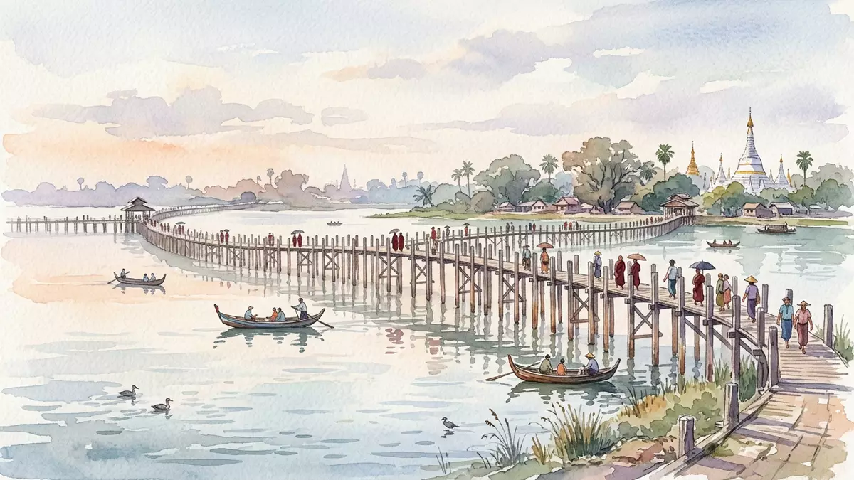
U Bein Bridge is a long teak footbridge that stretches across Taungthaman Lake on the edge of Amarapura in Myanmar, turning a simple crossing into an extended walk over water that has become closely associated with the former royal city. Built in the nineteenth century during the Konbaung period, it ties together dry ground and shallow lake in a way that is as much part of the landscape as the water itself, its timber deck resting on a forest of posts sunk into the lakebed.
A nineteenth-century teak crossing between city and lake
U Bein Bridge spans Taungthaman Lake beside Amarapura in Myanmar’s Mandalay Region, linking the lakeshore near the city with villages and fields on the opposite side of the water.Taungthaman Lake near Amarapura Amarapura itself served twice as a royal capital during the Konbaung period in the late eighteenth and nineteenth centuries, placing the bridge within a landscape of former courtly power.Amarapura during the Konbaung period
The structure dates from around 1850, with construction associated with U Bein, an Amarapura official often described as mayor, whose name the bridge carries.built between 1849 and 1851 by U Bein Much of the timber used is recorded as reclaimed teak from royal buildings that lost their role when Mandalay took over as capital in 1859, a reuse of substantial columns that gave the footway its long rows of heavy posts.constructed from palace remains Nineteenth-century dating and the association with the Konbaung dynasty make the bridge a physical remnant of Myanmar’s pre-colonial court history as well as an everyday route.
Timber, length and structure: how U Bein Bridge is built
U Bein Bridge is built predominantly from teak, a durable hardwood long used in Southeast Asian architecture and shipbuilding, giving the deck and posts their characteristic dark, weathered appearance.oldest and longest teak bridge The bridge runs for about 1.2 km (0.75 mi), a figure repeated across technical descriptions and guide material, making it one of the longest timber footbridges to remain in regular use.total length around 1.2 km For anyone crossing the lake on foot, this length turns the journey into a slow progression over water, with the shoreline receding and returning in a gentle arc.
Beneath the deck, a grid of upright timber posts supports the walkway, with documented counts clustering a little above 1,080 separate supports driven into the lakebed.supported by 1,086 teak pillars The deck itself consists of simple wooden planks laid along the route, forming a single narrow lane used by pedestrians and cyclists. Along the way, small pavilions and rest houses punctuate the line of the bridge, providing covered points where people pause above the water and breaking up the otherwise continuous run of timber. In some sections, ageing teak posts have been reinforced or replaced by concrete supports, marking the ongoing maintenance required to keep such an extensive wooden structure in use.
U Bein Bridge in its Mandalay Region setting
Geographically, U Bein Bridge sits just south of Mandalay city in central Myanmar, close enough that the lakeside counts as part of the wider Mandalay urban area.located in Amarapura near Mandalay Taungthaman Lake is a shallow body of water bordered by farmland, village houses and remnants of earlier royal layouts, so the bridge’s timber line crosses not only water but also a historical landscape of moats, embankments and former palace grounds. From the deck, views extend over low-lying fields and the distant outline of Mandalay’s hills.
The bridge functions as an open public footway rather than a gated monument, so it carries daily pedestrian traffic alongside visitors who come to walk its length. Its long alignment across the lake means that, at many points, the deck rises only modestly above the surface of the water, giving an uninterrupted sense of being out over the lake rather than beside it. The combination of nineteenth-century teak, Konbaung-era associations and an unbroken line across shallow water has made U Bein Bridge one of the most recognisable structures in the Mandalay Region, with images of its timber posts and silhouettes widely used to represent Amarapura and central Myanmar.
Visiting U Bein Bridge: what travellers from Western Europe should know
- U Bein Bridge crosses Taungthaman Lake on the edge of Amarapura in Myanmar’s Mandalay Region, reachable by road from Mandalay city using local transport such as taxis or motorbikes.
- The footbridge is a long, narrow wooden walkway with simple planking underfoot and sections without continuous handrails, so crossing involves walking on timber boards above shallow lake water.
- The surroundings combine lake, village and former royal landscapes, with open views over Taungthaman Lake and the low countryside south of Mandalay.
- The official language is Burmese and the currency is the Myanmar kyat.
- Entry requirements depend on your nationality; UK travellers can check the FCDO travel advice at gov.uk/foreign-travel-advice, Irish travellers the Department of Foreign Affairs at ireland.ie.
Searching for U Bein Bridge on social platforms
These links open searches for U Bein Bridge on each platform.
Frequently asked questions about U Bein Bridge
Where is U Bein Bridge located?
U Bein Bridge crosses Taungthaman Lake beside Amarapura in Myanmar’s Mandalay Region, a short distance south of Mandalay city.
What can visitors expect when walking across the bridge?
Visitors walk along a long, narrow wooden footway over shallow lake water, passing simple pavilions and rest points with open views over Taungthaman Lake and the surrounding countryside.
What makes U Bein Bridge distinctive among bridges in Myanmar?
Its nineteenth-century teak construction, association with U Bein during the Konbaung period and its 1.2 km (0.75 mi) length across Taungthaman Lake together make it a distinctive timber footbridge in central Myanmar.


