
Trolltunga, the horizontal cliff above Ringedalsvatnet
Published on 09/15/2026 at 16:21 | Editorial responsibility: Rafael Müller, Editor-in-Chief AD HOC NEWS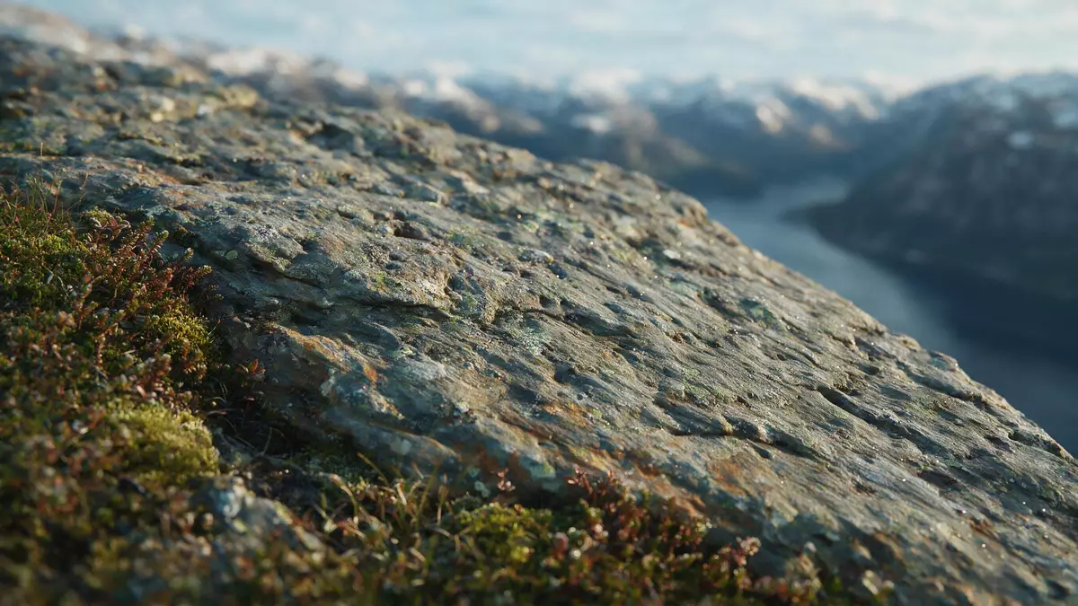
Trolltunga in Ullensvang is a horizontal cliff of ancient bedrock hanging high above Ringedalsvatnet in western Norway’s Hardanger region. The ledge projects from the mountain in Vestland county and forms a distinctive platform above the long, narrow lake.
A rock ledge on the Hardangervidda plateau
Trolltunga is a rock formation in Ullensvang municipality in Vestland, inland from the Hardangerfjord coastline of Norway. The cliff juts out from the mountains on the edge of the Hardangervidda plateau, in terrain shaped by glaciers and water over thousands of years.rock formation in Ullensvang The name “Trolltunga” translates as “Troll’s Tongue” in Norwegian and refers to the way the rock extends horizontally from the cliff face, resembling a tongue reaching out over the valley.translates as Troll’s Tongue
The ledge lies in the mountains above Ringedalsvatnet, a lake enclosed by steep slopes and high ground east of the town of Odda in Ullensvang. The cliff stands at an elevation of around 1,100–1,126 m (roughly 3,600–3,694 ft) above sea level on the plateau, and the rock overhang is about 700 m (around 2,300 ft) above the surface of Ringedalsvatnet.about 700 metres above the lake The formation itself consists largely of hard Precambrian bedrock, including granite and gneiss, which has resisted erosion while the surrounding landscape was carved by ice.granite and gneiss bedrock
The demanding mountain hike to the ledge
Trolltunga is reached on foot via marked mountain trails starting near Skjeggedal and Tyssedal in Ullensvang, inland from the Hardangerfjord. The main approach begins at the P2 parking area in Skjeggedal, above Tyssedal, and follows a long out-and-back route through varied terrain to the cliff ledge.main trailhead in Skjeggedal An alternative trailhead lies higher at Mågelitopp (often referred to as P3), shortening the distance but beginning with a steeper section.
From the P2 Skjeggedal trailhead the round-trip hike is documented as around 27 km (about 16.8 miles), with a total ascent of close to 800 m (approximately 2,625 ft).27 km round trip From Mågelitopp the route is around 20 km (about 12.4 miles) there and back, with an ascent of about 320 m (roughly 1,050 ft).20 kilometres from Mågelitopp The trail crosses high mountain ground, sections of stone steps and exposed rock, and it is described in official guidance as a long and demanding day hike that requires solid mountain equipment and experience.
Trolltunga in the Hardanger landscape
Trolltunga sits within the wider Hardanger region of western Norway, a landscape known for fjords, waterfalls and high plateaux. The lake Ringedalsvatnet beneath the cliff lies in a valley that runs inland from the Hardangerfjord, with steep rock walls rising towards the Hardangervidda plateau where the ledge is found.east of Odda above Ringedalsvatnet The location places Trolltunga among other natural landmarks of the region, including high waterfalls and additional viewpoints on the fjord system.
The rock formation lies roughly north-east of Odda in Ullensvang and is mapped with coordinates close to 60° 7? 59? N, 6° 45? 14? E.mapped coordinates The wider Hardangervidda plateau around Trolltunga forms one of Norway’s large mountain uplands, and the combination of steep drops, long lake and high ground makes the ledge a distinct feature within that landscape.
Visiting Trolltunga: what travellers from Western Europe should know
- Trolltunga lies in Ullensvang municipality in Vestland, inland from the Hardangerfjord in western Norway; approaches start near the villages of Tyssedal, Skjeggedal and Odda.
- The hike from the main P2 Skjeggedal trailhead crosses high mountain terrain with long sections on rock and stone steps, and involves sustained ascent and descent over many kilometres.
- The ledge stands at over 1,100 m (about 3,600 ft) above sea level on the Hardangervidda plateau, and around 700 m (about 2,300 ft) above Ringedalsvatnet, so weather and exposure in the mountains can be pronounced.
- The official language is Norwegian and the currency is the Norwegian krone.
- Entry requirements depend on your nationality; UK travellers can check the FCDO travel advice at gov.uk/foreign-travel-advice, Irish travellers the Department of Foreign Affairs at ireland.ie.
Searching for Trolltunga on social platforms
These links open searches for Trolltunga on each platform.Frequently asked questions about Trolltunga
Where is Trolltunga?
Trolltunga is a rock ledge in Ullensvang municipality in Vestland, western Norway, above the lake Ringedalsvatnet and inland from the Hardangerfjord region.
What should visitors expect on a trip to Trolltunga?
Visitors reach the cliff via a demanding mountain hike from trailheads near Skjeggedal or Mågelitopp, covering a long distance across high, exposed terrain.
What makes Trolltunga distinctive among Norwegian landmarks?
Trolltunga is distinctive for its thin horizontal rock ledge of granite and gneiss that projects far out from a high cliff wall, around 700 m above Ringedalsvatnet.


