

Trolltunga’s horizontal edge above Ringedalsvatnet
Published on 09/02/2026 at 07:23 | Editorial responsibility: Rafael Müller, Editor-in-Chief AD HOC NEWS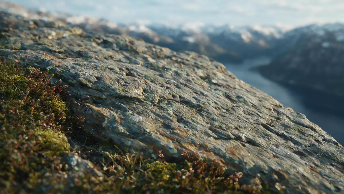
Trolltunga in Ullensvang is a horizontal slab of bedrock that projects from a high mountain plateau above the north side of Ringedalsvatnet in western Norway’s Hardanger region.The rock formation sits more than 1,100 m (about 3,600 ft) above sea level and carries a sheer drop of around 700 m (about 2,300 ft) down to the lake.The name Trolltunga translates as “the troll’s tongue”, a reference to the way the ledge sticks out from the cliff like a tongue of rock over the valley.
A tongue of Precambrian rock above Ringedalsvatnet
The core of Trolltunga is Precambrian gneiss, part of the ancient Scandinavian Shield that underlies much of western Norway.This hard metamorphic rock formed more than a billion years ago and was later lifted to form the high plateau behind the Hardangerfjord.Glacial erosion during the last Ice Age carved the steep walls above Ringedalsvatnet, leaving the narrow ledge projecting from the cliff.
The ledge extends horizontally from the mountainside as a relatively thin projection, with vertical drops on three sides and plateau rock behind.It stands at around 1,180 m above sea level and about 700 m above the surface of Ringedalsvatnet, so the lake appears far below between other cliffs and summits of the wider Hardangervidda area.The surrounding plateau carries bare rock, scattered pools and low ridges shaped by ice and meltwater, giving the approach to the ledge a stark high-mountain character.
Hardangervidda, Ringedalsvatnet and the setting in Ullensvang
Trolltunga lies in Ullensvang municipality in Vestland county, in the inland mountains behind the Hardangerfjord.The cliff stands above Skjeggedal and the northern shore of Ringedalsvatnet, part of the watercourse that drains towards the Sørfjorden branch of the Hardangerfjord.From the ledge there are views along the length of the lake and towards other summits on the mountain plateau.
The plateau around Trolltunga forms part of the western edge of Hardangervidda, a highland region where glaciers and meltwater carved wide valleys and left rounded summits and scoured rock.The bedrock surface is uneven, with shallow hollows, boulders and small tarns between low ridges, and snow can linger on the higher ground well into the warmer months.Beyond Ringedalsvatnet the terrain rises again towards other parts of the Hardanger mountains and the wider Hardangervidda plateau, giving the ledge a setting surrounded by high country rather than a single isolated summit.
A demanding mountain approach from Skjeggedal
The standard approach route to Trolltunga follows a marked mountain trail from Skjeggedal above the village of Tyssedal in Ullensvang.The hike is an out-and-back route that starts near the former Mågelibanen funicular line and climbs to the high plateau before continuing towards the cliff.The first section gains height rapidly on a steep slope above Skjeggedal, after which the trail crosses undulating high ground of bare rock, boggy patches and small lakes.
On the plateau the marked route follows red T symbols on rock and waymarks across open terrain with intermittent views down to Ringedalsvatnet far below.The final section runs towards the cliff edge, where the ground narrows and the ledge itself projects over the drop and there are no fences along the drop towards the lake.The overall route from Skjeggedal covers dozens of kilometres there and back, and the cumulative ascent from the valley floor reaches several hundred metres, so the walk combines high distance with sustained height gain in a mountain environment.
Visiting Trolltunga: what travellers from Western Europe should know
- Trolltunga lies in Ullensvang municipality in Vestland county, in the inland mountains of western Norway, above the northern shore of Ringedalsvatnet and the valley of Skjeggedal near Tyssedal.
- The standard walking route begins in Skjeggedal above Tyssedal and climbs steeply on a mountain trail, then continues across high plateau terrain on rock, mud, boggy sections and occasional snow patches.
- The cliff edge around the ledge has no permanent fencing, and the final approach includes areas close to vertical drops, so travellers encounter exposed ground as they approach the projection.
- The wider landscape lies in the Hardangervidda area, at elevations above 1,000 m (around 3,300 ft), so mountain weather and snow cover can affect the high plateau and the upper parts of the trail.
- The official language is Norwegian and the currency is the Norwegian krone; entry requirements depend on your nationality, UK travellers can check the FCDO travel advice at gov.uk/foreign-travel-advice, Irish travellers the Department of Foreign Affairs at ireland.ie.
Searching for Trolltunga on social platforms
These links open searches for Trolltunga on each platform.
Frequently asked questions about Trolltunga
Where is Trolltunga located?
Trolltunga is in Ullensvang municipality in Vestland county in western Norway, above Skjeggedal near Tyssedal and the lake Ringedalsvatnet, inland from the Hardangerfjord.
What should travellers expect on a visit?
Travellers encounter a demanding mountain hike from Skjeggedal across high plateau terrain, with long distances on rock and boggy sections and exposed ground near the unfenced cliff edge.
What makes Trolltunga distinctive among Norwegian viewpoints?
The ledge is a horizontal slab of Precambrian gneiss that projects from a high cliff about 700 m above Ringedalsvatnet, with vertical drops on three sides and wide views over the surrounding Hardanger mountains.


