
Tonle Sap and the changing shape of Cambodia’s great lake
Published on 09/02/2026 at 06:54 | Editorial responsibility: Rafael Müller, Editor-in-Chief AD HOC NEWS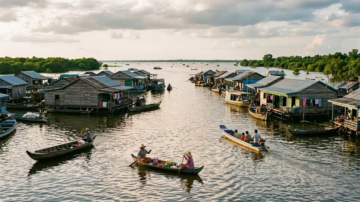
Tonle Sap is Cambodia’s great lake, a broad freshwater system near Siem Reap with a changing shoreline and a long connection to the Mekong. Its seasonal spread, flat waters and wetland margins make the place memorable before any history is added.
Tonle Sap’s basin and lake
Tonle Sap sits in central Cambodia and belongs to the Mekong river system. The Tonle Sap Biosphere Reserve lies in the north-east of the country, with the lake at the centre of a wider basin.
The lake is linked to the Mekong by the Tonle Sap River, and its water level changes markedly across the year. Its maximum area is far larger than its dry-season extent, which gives the lake its shifting outline.
Wetlands, floodplains and the reserve
The biosphere reserve includes floodplains, freshwater swamps, seasonally flooded rice fields and grasslands. The area was nominated in 1997, and the reserve also carries a formal UNESCO designation.
These landscapes sit around the lake rather than beside a single fixed edge. The reserve also reaches into Siem Reap province, placing the lake within a wider cultural and ecological region that travellers already know from Angkor.
Siem Reap’s water landscape
Siem Reap is one of the settlements associated with Tonle Sap, and the lake lies within reach of the province of the same name. The lake’s drainage basin extends across a large part of Cambodia, so it belongs to geography as much as to local sightseeing.
The surrounding land includes low plain country and, farther out, higher ground at the basin’s margins. Central Cambodia’s floodplain reservoir sits in that broad setting, with the lake and river system forming a single hydrological landscape.
Visiting Tonle Sap: what travellers from Western Europe should know
- Tonle Sap is reached through Siem Reap and the settlements around the lake. Boats, roads and rivers all form part of access across the basin.
- The water margin changes across the year, and the lake’s edge is not fixed. Floodplain ground and shallow water are part of the setting.
- The reserve includes wetlands and flooded forests. Those habitats are part of the place rather than separate from it.
- English is not an official language here; the official language is Khmer and the currency is the Cambodian riel.
- Entry requirements depend on your nationality; UK travellers can check the FCDO travel advice at gov.uk/foreign-travel-advice, Irish travellers the Department of Foreign Affairs at ireland.ie.
Searching for Tonle Sap on social platforms
These links open searches for Tonle Sap on each platform.
Frequently asked questions about Tonle Sap
Where is Tonle Sap?
Tonle Sap is in central Cambodia, close to Siem Reap and connected to the Mekong river system. It sits within a basin that spreads across floodplain land and wetland country.
What does a visit involve?
A visit usually means travelling across water and low-lying land rather than to a single monument. The scenery is defined by the lake, the wetlands and the changing shoreline.
What makes Tonle Sap distinctive?
The lake’s size changes across the year, and the basin includes a formal biosphere reserve. UNESCO designated the reserve in 1997, giving the place an internationally recognised conservation status.


