
Tongariro National Park and its volcanic skyline
Published on 09/16/2026 at 16:04 | Editorial responsibility: Rafael Müller, Editor-in-Chief AD HOC NEWS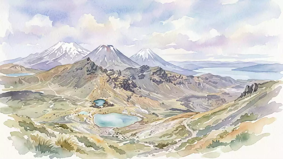
Tongariro National Park rises around three volcanic mountains in the central North Island of New Zealand, south-west of Taupo. Its profile is dominated by Tongariro, Ruapehu and Ngauruhoe, with Ruapehu reaching 2,797 m (9,177 ft).
Three volcanoes in a single park
The park’s best-known form is a broad volcanic landscape rather than a single summit. Tongariro, Ngauruhoe and Ruapehu sit together at the southern edge of the Taup? Volcanic Zone, and each mountain contributes a distinct silhouette.
Ruapehu is the highest point in the park and on the North Island. Tongariro and Ngauruhoe belong to the same volcanic system, with Ngauruhoe rising as a separate cone beside the larger mass of Tongariro.Central North Island volcanoes
Ng?ti T?wharetoa and the park’s origin
The park is also shaped by M?ori history. In 1887, Horonuku Te Heuheu Tukino IV of Ng?ti T?wharetoa transferred the peaks of Tongariro, Ngauruhoe and part of Ruapehu to the Crown, and the park was established by statute in 1894.Horonuku Te Heuheu Tukino IV
That history remains visible in the park’s dual identity as a natural landscape and a place of cultural significance. UNESCO inscribed Tongariro as a World Heritage property in 1993, recognising both its volcanic setting and its cultural landscape status.World Heritage property
A landscape of lava, cones and alpine ground
The park’s terrain is built from andesitic volcanoes, crater forms and high-altitude ground. Ruapehu, Tongariro and Ngauruhoe are all active volcanoes, and the volcanic field has developed over a long geological span that includes activity before the last ice age.andesitic volcanoes
Ruapehu carries crater lakes and glaciers, while the slopes around the peaks shift from steep volcanic sides to open uplands. The result is a park where black rock, snow, tussock and exposed ridges sit close together in a compact mountain setting.
Visiting Tongariro National Park: what travellers from Western Europe should know
- The park lies near Taupo in the central North Island. Whakapapa Village and National Park Village are the main access points for road travellers.
- The terrain includes high volcanic slopes, loose rock and alpine weather at elevation. Ruapehu rises to 2,797 m (9,177 ft), and the high ground is exposed.
- The mountain roads and walking routes connect to Whakapapa, T?roa and the park’s volcanic centres. The names of the main peaks are Tongariro, Ngauruhoe and Ruapehu.
- The park sits within a dual World Heritage landscape. M?ori history remains central to its identity through Ng?ti T?wharetoa and Horonuku Te Heuheu Tukino IV.
Searching for Tongariro National Park on social platforms
These links open searches for Tongariro National Park on each platform.
Frequently asked questions about Tongariro National Park
Where is Tongariro National Park?
It lies in the central North Island of New Zealand, south-west of Taupo. The park surrounds the volcanic mountains Tongariro, Ngauruhoe and Ruapehu.
What does a visit involve?
The landscape is mountainous, exposed and volcanic, with high ground, crater forms and steep slopes. Road access centres on villages such as Whakapapa Village and National Park Village.
What makes Tongariro National Park distinctive?
It combines active volcanoes with a cultural landscape shaped by Ng?ti T?wharetoa. Its UNESCO World Heritage status reflects both natural and cultural values.


