
Tongariro National Park and its volcanic heartlands
Published on 09/18/2026 at 20:58 | Editorial responsibility: Rafael Müller, Editor-in-Chief AD HOC NEWS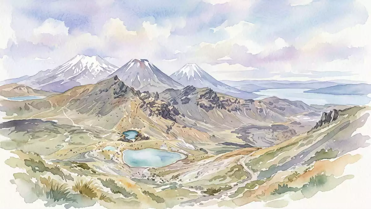
Tongariro National Park, on New Zealand’s central North Island, is a high volcanic plateau where three major mountains rise above a broad landscape of old lava flows, craters and alpine tussock. Created as New Zealand’s oldest national park in the late nineteenth century and later recognised as a dual UNESCO World Heritage Site, it brings together dramatic geology and deep M?ori cultural connections in one protected area.
Volcanic giants of the central plateau
The core of Tongariro National Park is a compact group of volcanoes: Ruapehu, Tongariro and Ngauruhoe. Ruapehu, with an elevation of 2,797 m (9,177 ft), is the highest mountain on the North Island and carries a crater lake near its summit, making it a dominant landmark over the surrounding plateau.Ruapehu, Tongariro and Ngauruhoe Tongariro itself forms a broad volcanic massif with multiple vents and craters, while Ngauruhoe rises as a steep cone on its slopes, regarded by geologists as part of the wider Tongariro system.Ngauruhoe as part of the Tongariro system
These volcanoes sit at the southern end of the Taupo Volcanic Zone, a tectonically active corridor linked to the Pacific “Ring of Fire”, where the Pacific Plate is subducted beneath the Australian Plate.southern end of a volcanic chain The result is a landscape of hard andesitic rock shaped by eruptions over hundreds of thousands of years. Old lava fields, ash slopes and solidified mudflows spread out from the main summits, and the park also includes a northern group of older, inactive volcanic hills such as Pihanga and Kakaramea.
A protected landscape of global significance
Tongariro National Park covers an area in the order of 79,000 ha, encircling the Ruapehu–Ngauruhoe–Tongariro massif at elevations that begin around 500 m (1,640 ft) and rise into alpine terrain.total area of the park It was established as New Zealand’s first national park, placing a large section of the central plateau under protection long before national parks became common elsewhere in the world.oldest national park in New Zealand Alpine herbfields, tussock grasslands and patches of forest occupy different bands of elevation, and geothermal features such as steaming vents and warm springs mark active ground.
In 1990 Tongariro National Park was inscribed on the UNESCO World Heritage List for its natural values, and in 1993 the inscription was extended under revised criteria to recognise it as a cultural landscape.World Heritage inscription and extension The park is one of three World Heritage properties in New Zealand, and its dual status reflects both its outstanding volcanic landforms and its significance to M?ori communities.dual World Heritage status
M?ori heritage and the living mountains
The mountains of Tongariro National Park hold cultural and religious importance for M?ori, with Tongariro in particular described as a sacred mountain in M?ori tradition.sacred mountain of the M?ori The volcanic peaks symbolise spiritual links between people and the land, and this relationship forms a core part of the park’s recognition as an associative cultural landscape by UNESCO.associative cultural landscape Place names, stories and customary relationships with the mountains sit alongside scientific descriptions of eruptions and lava flows.
Geologically, the volcanoes are part of an active system less than 500,000 years old, with Ruapehu showing repeated eruptions and a constantly steaming crater lake over the last century and a half.Ruapehu crater lake and eruptions Tongariro’s complex of cones and craters records earlier activity, while Ngauruhoe has produced numerous historic eruptions, building its steep volcanic cone. Together, these features create an alpine environment where earth processes and cultural associations are closely interwoven.
Visiting Tongariro National Park: what travellers from Western Europe should know
- Tongariro National Park lies on New Zealand’s North Island, inland from the Bay of Plenty and Taupo region. It is reached by road from towns such as Taup? and National Park Village, and long-distance coach services and regional rail links serve the wider area.
- Terrain in the park ranges from gentle valleys to steep volcanic slopes. Many routes cross uneven ground shaped by old lava flows and loose ash, and higher paths can involve prolonged walking at altitude.
- In winter, snow can extend from the summit areas down into the upper valleys, and conditions on exposed ridges and plateaus can change quickly with the weather.
- The official language is English and the currency is the New Zealand dollar.
- Entry requirements depend on your nationality; UK travellers can check the FCDO travel advice at gov.uk/foreign-travel-advice, Irish travellers the Department of Foreign Affairs at ireland.ie.
Searching for Tongariro National Park on social platforms
These links open searches for Tongariro National Park on each platform.
Frequently asked questions about Tongariro National Park
Where is Tongariro National Park?
Tongariro National Park is on the central North Island of New Zealand, surrounding the Ruapehu, Tongariro and Ngauruhoe volcanic massif inland from Taup?.
What can visitors expect on a visit?
Visitors encounter a high plateau with prominent volcanic peaks, old lava fields, alpine vegetation and, in higher areas, terrain that can be snow-covered in winter.
What makes Tongariro National Park distinctive?
The park is distinctive for combining active and dormant volcanoes, alpine ecosystems and recognised M?ori cultural and spiritual associations within one dual UNESCO World Heritage landscape.


