
Thingvellir, where Iceland’s Alþingi met in a tectonic rift
Published on 09/07/2026 at 06:25 | Editorial responsibility: Rafael Müller, Editor-in-Chief AD HOC NEWS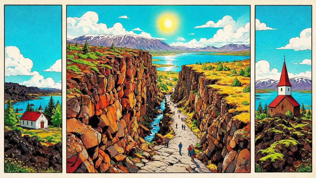
Thingvellir in southwestern Iceland brings together political history and raw geology in a single landscape, where the Alþingi assembly met on a plain shaped by an active tectonic rift. The national park lies within a rift valley beside Lake Thingvallavatn, and the cliffs and fissures around the old meeting ground make the continental divide visible on land.
A parliament on assembly fields beside Lake Thingvallavatn
The name Thingvellir derives from the Icelandic “Þingvellir”, meaning “assembly fields”, a reminder that this open plain once served as the meeting place for Iceland’s national assembly. From 930, chieftains and their followers gathered here for the Alþingi, an open-air parliament that continued to meet on the site until 1798, with laws recited and disputes settled on the grassy floor of the valley.Alþingi was established here in 930 The assembly area occupies the innermost part of the valley, where traces of turf and stone-built booths still mark the lines of temporary shelters used during these sessions.the innermost assembly site
Thingvellir gained formal protection as a national park in the twentieth century, recognising its central role in Iceland’s history and the visibility of the old assembly ground within the wider landscape.Thingvellir National Park The park also carries UNESCO World Heritage status, highlighting both the assembly remains and their setting in a dramatic rift valley backed by lava cliffs and a broad lake.UNESCO World Heritage status
Walking between tectonic plates in the Thingvellir rift valley
Thingvellir sits within a NE–SW rift valley that forms part of the Mid-Atlantic Ridge, the volcanic boundary where the North American and Eurasian tectonic plates drift apart.the rift zone continuation of the Mid-Atlantic Ridge The valley occupies a graben several kilometres wide, with high cliffs marking the edges of subsiding land and long fissures cutting through the lava fields.a seven-kilometre wide graben Walking paths lead through these fissures, bringing the geological structure into view for anyone following the marked routes.
On the western side of the valley, the Almannagjá gorge marks the boundary of the North American plate, its basalt walls rising above a cleared path that threads between rock faces.a rift valley with high cliffs East of the gorge, the land steps down towards Lake Thingvallavatn, where the clear waters of fissures such as Silfra reveal the meeting of groundwater and tectonic fractures within the park.Silfra in Lake Thingvallavatn The combination of cliffs, lava fields, cracks in the ground and the lake gives Thingvellir a layered topography, with visible markers of plate boundaries surrounding the historic assembly plain.
Cliffs, lake and paths: experiencing Thingvellir’s landscape
The core of Thingvellir National Park lies around the northern shore of Lake Thingvallavatn, a large natural lake filling much of the basin below the cliffs.broad basin on the northern shore of Lake Thingvallavatn Lava fields extend across the valley floor, broken by shallow depressions, turf patches and fissures, while the surrounding escarpments frame long views across water and rock.Almannagjá gorge and the rift The contrast between the flat assembly plain and the steep edges of the graben forms a defining feature of the park.
Visitors move through this landscape on established footpaths, including routes that descend through the Almannagjá gorge and others that follow the valley towards the lake. Some paths pass close to Lögberg, the Law Rock associated with the historic Alþingi gatherings, while others focus on viewpoints into the rift and towards the water.walking paths through narrow fissures Together, these routes link the cultural heart of Thingvellir with its geological surroundings, making it possible to see both the assembly traces and the plate boundary during a single visit.
Visiting Thingvellir: what travellers from Western Europe should know
- Thingvellir lies in southwestern Iceland, east of Reykjavík, within a national park that covers tens of thousands of hectares of rift valley and lake basin. Public roads reach the park from the capital’s region.
- The terrain around the historic assembly site includes uneven lava, turf and rock, while the Almannagjá gorge is approached by footpaths and stairways that climb or descend between basalt walls.
- Lake Thingvallavatn occupies much of the basin below the cliffs, and some paths run close to its shoreline, where wind exposure and open ground contrast with the more sheltered routes within fissures.
- The official language is Icelandic and the currency is the Icelandic króna.
- Entry requirements depend on your nationality; UK travellers can check the FCDO travel advice at gov.uk/foreign-travel-advice, Irish travellers the Department of Foreign Affairs at ireland.ie.
Searching for Thingvellir on social platforms
These links open searches for Thingvellir on each platform.
Frequently asked questions about Thingvellir
Where is Thingvellir and what kind of place is it?
Thingvellir is a national park in southwestern Iceland, east of Reykjavík, centred on a rift valley and the northern shore of Lake Thingvallavatn.
What can visitors expect during a visit to Thingvellir?
Visitors encounter lava fields, cliffs, fissures and lakeshore paths, along with the historic assembly plain where the Alþingi parliament once met in the open air.
What makes Thingvellir distinctive compared with other Icelandic landscapes?
Thingvellir combines visible continental plate boundaries, marked by the Almannagjá gorge and other fissures, with the remains of Iceland’s early parliamentary assembly on the same valley floor.


