
Thingvellir’s rift valley where Iceland became a nation
Published on 09/15/2026 at 10:19 | Editorial responsibility: Rafael Müller, Editor-in-Chief AD HOC NEWS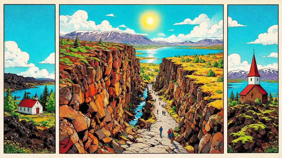
Thingvellir in south-western Iceland is one of those rare places where a country’s history and its geology occupy the same ground. In a rift valley on the northern shore of Lake Thingvallavatn, Iceland’s Althing assembly first met in 930 and continued there until 1798, while the visible boundary between the North American and Eurasian tectonic plates cuts through the park’s cliffs and fissures.Þingvellir National Park Today Thingvellir is a national park and UNESCO World Heritage Site, recognised for both the assembly remains and the surrounding cultural landscape.World Heritage Site in Iceland
A rift valley written into the landscape
The defining experience of Thingvellir is the rift valley itself, a long depression edged by cliffs that mark the crest of the Mid-Atlantic Ridge and the boundary between major tectonic plates.rift valley on the Mid-Atlantic Ridge Almannagjá, one of the largest visible faults, reads as a canyon through the park, where the valley floor has subsided by several metres since the assembly was founded.subsiding valley floor Smaller fissures branch away from it, some dry and some filled with clear groundwater that reveals the broken lava beneath.
The national park lies in an active volcanic area enclosed on three sides by a belt of mountains, with grass-covered lava fields between the slopes and the valley floor.active volcanic area with lava fields At the southern end of the protected area is Lake Thingvallavatn, the largest natural lake in Iceland, whose shoreline and low bays frame the open plains of the assembly site.largest natural lake in Iceland The river Öxará crosses the park and drops over the edge of Almannagjá as Öxarárfoss, bringing flowing water into the volcanic scenery.
The Althing: an open-air parliament on the law rock
Thingvellir’s global significance rests on the Althing, the open-air general assembly that met here each year from 930 until 1798, representing the whole of Iceland.Althing established in 930 Over two weeks the assembly set laws, treated as covenants between free people, and settled disputes under a legal system that became central to Icelandic identity.assembly as legal and judicial centre The focal point of proceedings was the Lögberg, or Law Rock, a natural platform where the lawspeaker recited the law and where announcements concerning the entire country were made.Lögberg law rock and lawspeaker
Physical traces of the assembly survive in low turf and stone remains of around fifty booths that housed chieftains and their followers during the sessions.fragments of around 50 booths Thingvellir Church and its adjacent farm stand near the heart of the historic area, and the wider park preserves an agricultural landscape of abandoned farms, fields and tracks used by those travelling to the assembly over centuries.church, farm and fossilised cultural landscape The national park was formally founded in 1930, marking the thousandth anniversary of the Althing, and was later inscribed on the UNESCO World Heritage List in 2004 as a cultural landscape under criteria (iii) and (vi).national park founded 1930 and UNESCO inscription 2004
Water-filled fissures and Lake Thingvallavatn
Water is as much a part of Thingvellir’s character as rock. Lake Thingvallavatn lies along the southern edge of the park, and its cold, clear waters support a notable population of arctic char within a basin shaped by volcanic activity.arctic char in Lake Þingvallavatn On the northern shore, the Silfra fissure forms one of the largest and deepest water-filled rifts in the valley, connecting to the lake’s freshwater system and reflecting the slow movement between tectonic plates.Silfra fissure in northern lake shore
Silfra lies within the Thingvellir valley, where earthquakes relieve tectonic tension and create new cracks that sometimes flood with groundwater.Silfra in Þingvellir valley Elsewhere in the park, fissures such as Peningagjá carry still water beneath steep rock walls, and the combination of submerged rifts, lava fields and the broad surface of Lake Thingvallavatn gives the national park a distinct mixture of volcanic and aquatic scenery.
Visiting Thingvellir: what travellers from Western Europe should know
- Thingvellir lies north-east of Reykjavík in south-western Iceland, on the northern shore of Lake Thingvallavatn in the municipality of Bláskógabyggð, and is usually reached by road from the capital along Route 36.
- The assembly area and main viewpoints stand within a rift valley bordered by cliffs and lava fields, and the terrain includes uneven ground and paths crossing bedrock and low slopes.
- The national park belongs to Iceland, where the official language is Icelandic and the currency is the Icelandic króna.
- Entry requirements depend on your nationality; UK travellers can check the FCDO travel advice at gov.uk/foreign-travel-advice, Irish travellers the Department of Foreign Affairs at ireland.ie.
Searching for Thingvellir on social platforms
These links open searches for Thingvellir on each platform.Frequently asked questions about Thingvellir
Where is Thingvellir and what kind of place is it?
Thingvellir is a national park in south-western Iceland, north-east of Reykjavík, centred on a rift valley and the northern shore of Lake Thingvallavatn.
What should visitors expect when walking through the park?
Visitors move between cliffs, lava fields and open plains, with signed paths crossing the former assembly area and viewpoints overlooking the rift valley and lake.
What makes Thingvellir distinctive among Icelandic landscapes?
Thingvellir combines visible continental plate boundaries, water-filled fissures and Lake Thingvallavatn with the remains of the historic Althing assembly in a single protected landscape.


