

Thingvellir between law, lava and shifting continents
Published on 08/30/2026 at 14:04 | Editorial responsibility: Rafael Müller, Editor-in-Chief AD HOC NEWS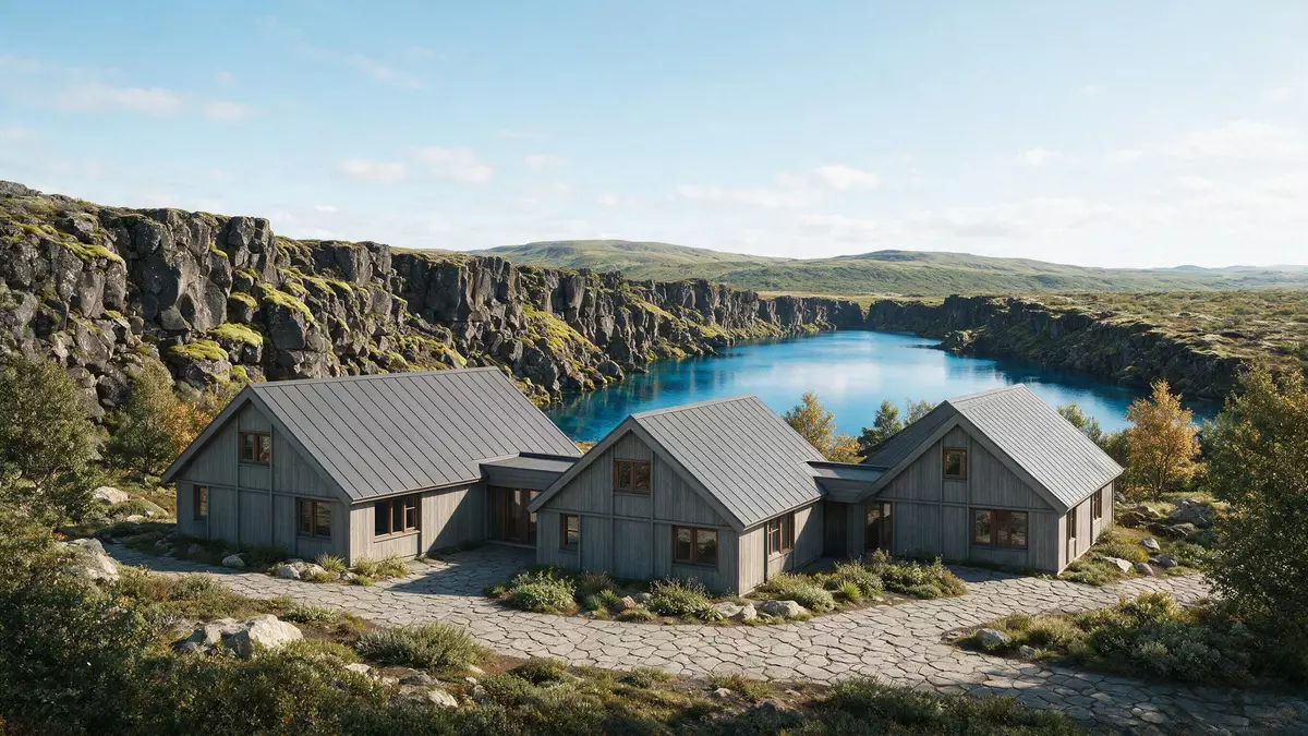
Thingvellir in southwestern Iceland is a rare place where a country’s earliest parliament met in an open valley that also marks the boundary between continental plates. Set beside Lake Thingvallavatn in a basalt rift landscape, it combines political history, geology and scenery in a single, coherent view.
Assembly fields above a basalt rift
Thingvellir lies on the northern shore of Lake Thingvallavatn in southwestern Iceland, in a broad basin backed by dark cliffs and lava fields. The name means “assembly fields” in Icelandic, reflecting its role as a meeting ground for chieftains and delegates from across the island.Thingvellir, historical site The park occupies a rift valley within the western branch of Iceland’s active volcanic zone, where the crust has sunk between higher edges and basaltic rock dominates the slopes and plains.a rift valley with high cliffs
The valley floor carries low remains of turf and stone-built structures that once housed participants in the Alþingi, the national assembly of Iceland. The assembly was established at Thingvellir in 930 and met there for centuries, until its last session at the site in 1798.established in 930 and continued to meet until 1798 Though permanent buildings from that period are scarce, the open setting of grass, rock and water still makes the political history legible in the landscape.
Law under the open sky: the Alþingi at Thingvellir
From 930 the Alþingi, an assembly representing the whole of Iceland, gathered at Thingvellir to recite laws, announce decisions and settle disputes under the open sky.the Althing, an open-air assembly Delegates came to the valley from different regions, using the natural amphitheatre formed by cliffs and slopes as a setting for speeches and judgements. This long continuity of annual meetings gave the site a central place in the country’s legal and political development.
Thingvellir was designated Iceland’s first national park in 1930, marking the millennial anniversary of the Alþingi’s founding.became a national park as a result of legislation passed in 1928 In 2004, the core of the park, including the historical assembly grounds, was inscribed on the UNESCO World Heritage List as a cultural landscape that links early parliamentary practice with its physical setting.inscribed on the World Heritage List in 2004 Protection has gradually extended over a wider area of lava fields, cliffs and lake shore, preserving both the traces of human occupation and the geological forms that frame them.
Tectonic plates, fissures and Lake Thingvallavatn
Thingvellir sits in a graben, a sunken block of crust bounded by higher margins, within the western branch of Iceland’s rift zone. The valley marks part of the crest of the Mid-Atlantic Ridge on land, where the boundary between the North American and Eurasian plates is visible in the landscape.a site of historical, cultural, and geological significance Basaltic lavas from eruptions after the last glaciation, roughly 10,000 years ago, fill much of the basin, while older hyaloclastite and pillow lava formations line the periphery.Holocene lavas are most extensive
Lake Thingvallavatn occupies the lower part of the graben and shapes much of the park’s character, with its irregular shore and clear water set against dark rock. In the northern part of the lake lies Silfra, a water-filled fissure formed in the tension zone between the North American plate and a smaller Hreppar microplate.Silfra is a fissure in northern lake Þingvallavatn Silfra is one of many fissures in a zone roughly 5 km wide, but its depth, clarity and location within the lake make it a distinctive feature of Thingvellir’s geology.Silfra lies in the Þingvellir valley
Visiting Thingvellir: what travellers from Western Europe should know
- Thingvellir lies north of Lake Thingvallavatn in southwestern Iceland, reached by road from Reykjavík and commonly visited as part of the Golden Circle route.
- The main walking areas follow paths over uneven basalt and through gorges, with sections of boardwalk and stairs that climb between the valley floor and cliff tops.
- Weather can change quickly in this exposed rift landscape, and visits on foot involve time outside without much shelter from wind or precipitation.
- The official language is Icelandic and the currency is the Icelandic króna.
- Entry requirements depend on your nationality; UK travellers can check the FCDO travel advice at gov.uk/foreign-travel-advice, Irish travellers the Department of Foreign Affairs at ireland.ie.
Searching for Thingvellir on social platforms
These links open searches for Thingvellir on each platform.
Frequently asked questions about Thingvellir
Where is Thingvellir and what kind of place is it?
Thingvellir is a national park and historical site in southwestern Iceland, on the northern shore of Lake Thingvallavatn, set in a basalt rift valley.
What should visitors expect on a visit to Thingvellir?
Visitors walk among cliffs, fissures and lava fields, with views over the lake and access to the grassy parliament site where the Alþingi met for centuries.
What makes Thingvellir distinctive among Icelandic landscapes?
Thingvellir combines the remains of an early national assembly with clearly visible tectonic plate boundaries and basalt formations, giving it both cultural and geological significance.


