
Sydney Harbour Bridge and the arch over the harbour
Published on 08/31/2026 at 12:02 | Editorial responsibility: Rafael Müller, Editor-in-Chief AD HOC NEWS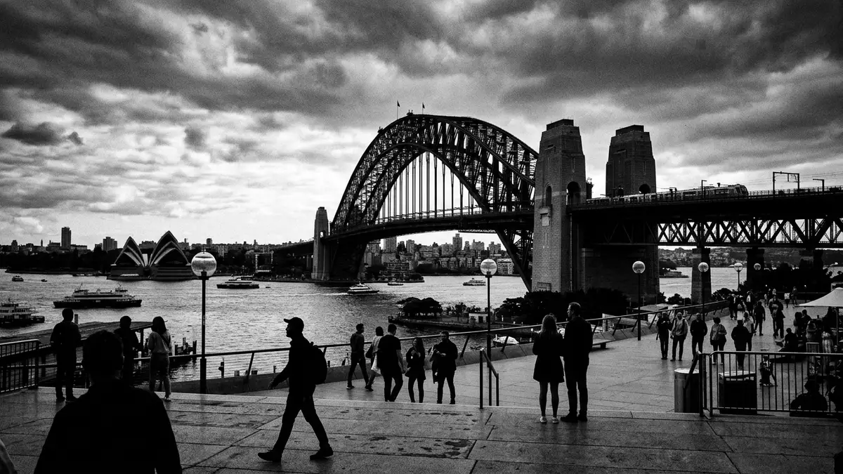
Sydney Harbour Bridge is a steel arch bridge in Sydney, opened in 1932 and carried by granite-faced pylons at each end. Its 503 m (1,650 ft) arch and 134 m (440 ft) summit make its profile legible from across the harbour.
The steel arch across Sydney Harbour
The bridge was designed under John Bradfield, a civil engineer with the New South Wales Department of Public Works, and opened on 19 March 1932. National Heritage links it to Australia’s heritage register, and the bridge remains a major engineering work in Sydney.
The arch spans the harbour in one sweep, with the deck carried above the water and the pylons anchored at either end. 19 March 1932 marks its formal opening, a date that sits at the centre of its history and public identity.
Granite pylons and a river of steel
The bridge combines painted steelwork with four granite-faced pylons, a contrast that is visible even from the city foreshore. 503 metres gives the arch its scale, while the pylons add a heavier, more vertical note at the edges of the span.
John Bradfield’s name is tied to the project, and Dorman Long of Middlesbrough built the bridge. The result is a long steel curve with a clearly readable structure, rather than a thin outline against the skyline.
How the bridge works as a city crossing
The bridge carries road traffic, rail tracks, a cycle path and a pedestrian route. That mixed use makes the deck a layered piece of city infrastructure, not just a picture from the harbour front.
Its position between Dawes Point and Milsons Point places it directly between Sydney’s central districts and the northern shore. The bridge is part of the city’s daily geography as much as its historic landscape.
Visiting Sydney Harbour Bridge: what travellers from Western Europe should know
- Location and getting there: the bridge crosses Sydney Harbour between Dawes Point and Milsons Point. It is reached on foot from the city side, by train to Milsons Point, or along the road network.
- What the terrain demands: the bridge deck is broad, with traffic, rail lines and pedestrian space sharing the span. The harbour frontage around it is open and exposed.
- Nearby places include The Rocks on the southern side and Milsons Point on the northern side. The bridge also sits close to the central business district and the waterfront at Circular Quay.
- The official language is English and the currency is the Australian dollar.
- Entry requirements depend on your nationality; UK travellers can check the FCDO travel advice at gov.uk/foreign-travel-advice, Irish travellers the Department of Foreign Affairs at ireland.ie.
Searching for Sydney Harbour Bridge on social platforms
These links open searches for Sydney Harbour Bridge on each platform.
Frequently asked questions about Sydney Harbour Bridge
Where is Sydney Harbour Bridge?
It spans Sydney Harbour between Dawes Point and Milsons Point. The bridge sits beside the city centre and links the southern and northern sides of the harbour.
What does a visit involve?
The bridge is experienced as a wide crossing with road, rail and pedestrian movement sharing the same structure. The harbour setting, the arch and the pylons are all visible from nearby public spaces.
What makes Sydney Harbour Bridge distinctive?
The combination of a single steel arch, granite-faced pylons and a 1932 opening gives it a clear identity. John Bradfield’s engineering project remains one of Sydney’s defining built forms.


