
Stanley Park in Vancouver, where forest meets seawall
Published on 09/15/2026 at 11:38 | Editorial responsibility: Rafael Müller, Editor-in-Chief AD HOC NEWS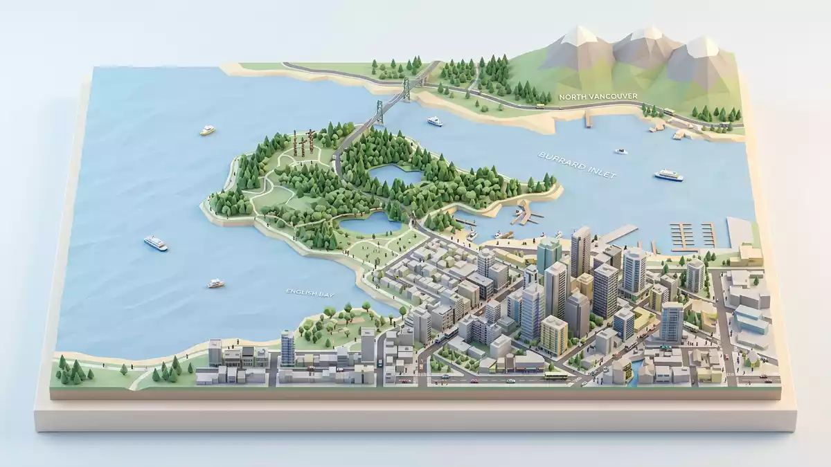
Stanley Park in Vancouver is a 405-hectare public park that occupies the north-western edge of the city’s downtown peninsula, and its scale is part of the experience from the first view. Named for Lord Stanley, it opened in 1888 and is a National Historic Site of Canada.
A peninsula of forest and water
The park sits between Burrard Inlet and English Bay, with Brockton Point marking its eastern end and the Lions Gate Bridge close by. Its national historic site status reflects both the natural setting and the designed landscape within its boundaries.
Stanley Park holds forest, beaches, trails and built features in the same frame. That mix includes Lost Lagoon, Beaver Lake, the seawall and the park’s monuments, all set inside a city park that still reads as a landscape rather than a single attraction.
Lord Stanley and the park’s civic layer
The name ties the place to Lord Stanley, and the park’s opening in 1888 places it among the city’s earliest public spaces. The historic designation recognises that the park combines forest, gardens, roads, monuments and recreational areas.
The result is a place where the planted and the wild sit side by side. The formal landscapes around the Pavilion, the gardens and the monuments give the park a civic layer, while the surrounding forest keeps its wider setting firmly in view.
The seawall and Brockton Point
The seawall is the park’s most recognisable edge, tracing the shoreline in stone and pavement. Its route also frames Brockton Point, where the lighthouse, totem poles and the Nine O’Clock Gun gather several layers of park history in one place.
That section of shoreline shows how Stanley Park works as a sequence of distinct scenes. A walk moves from dense trees to open water, then to a more formal waterfront edge lined with heritage features and views across the inlet.
Visiting Stanley Park: what travellers from Western Europe should know
- The park lies in Vancouver, British Columbia, on the edge of the downtown peninsula. It is reached by road, and the seawall, Lost Lagoon and Brockton Point form useful reference points once inside.
- The terrain changes from level waterfront paths to forest routes and small rises. The seawall gives a continuous paved route, while inland paths lead through denser woodland and around lakes.
- Stanley Park is tied to several named areas, including Lost Lagoon, Beaver Lake, Brockton Point and Siwash Rock. These places give the park a clear internal geography.
- The official language is English and the currency is the Canadian dollar.
Searching for Stanley Park on social platforms
These links open searches for Stanley Park on each platform.
Frequently asked questions about Stanley Park
Where is Stanley Park?
Stanley Park is in Vancouver, British Columbia, on a peninsula beside Burrard Inlet and English Bay. Brockton Point, Lost Lagoon and the seawall help place the park within the city.
What does a visit to Stanley Park involve?
The park combines waterfront paths, forest trails, beaches and formal landmarks. The contrast between the seawall and the interior woodland is one of its clearest features.
What makes Stanley Park distinctive?
Its identity rests on the mixture of a large urban park, a shoreline route and a National Historic Site. Lord Stanley’s name, the 1888 opening and the park’s design layers all remain visible in the landscape.


