
Skeleton Coast at Torra Bay where desert meets Atlantic surf
Published on 09/17/2026 at 07:55 | Editorial responsibility: Rafael Müller, Editor-in-Chief AD HOC NEWS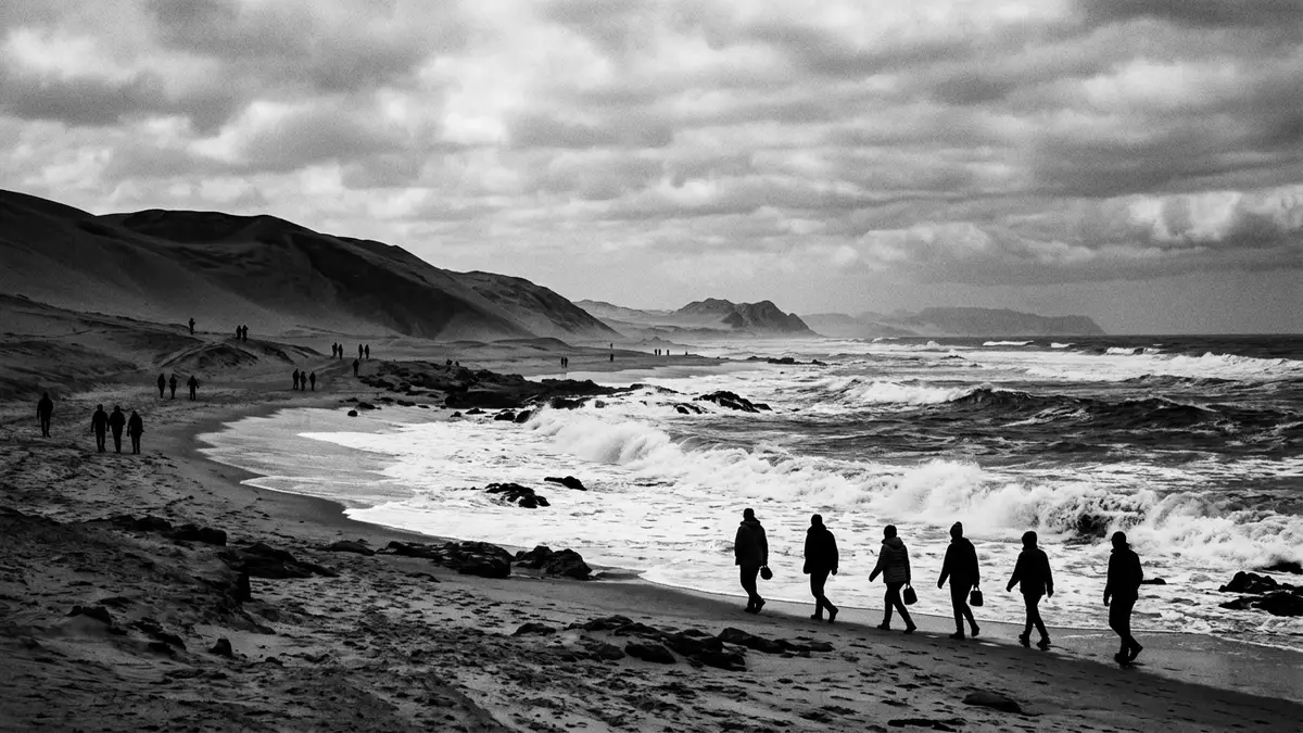
Along Namibia’s far north-western shoreline, the Skeleton Coast around Torra Bay forms a stark meeting line between the Namib Desert and the Atlantic Ocean, a narrow strip of sand, gravel plains and low dunes where dry land and cold surf sit side by side.
Desert and ocean in a narrow coastal corridor
The Skeleton Coast marks the northern stretch of Namibia’s Atlantic coastline, running between the Kunene River on the Angolan border and the Swakop River further south, with Torra Bay lying in its southern sector within a protected park corridor.northern stretch of Namibia’s Atlantic coastline This band of shore forms part of the wider Namib Desert, an ancient arid belt that fronts the Atlantic along this flank of Africa.
Within this corridor the Skeleton Coast National Park extends from the Ugab River in the south to the Kunene River in the north and reaches inland for tens of kilometres, covering more than 16,000 km² of desert and shoreline.extends from the Ugab River in the south for 500 kmcovers an area of 16,845 km² The park boundary runs along a strip where dunes, rocky outcrops and beaches face the Atlantic, creating a landscape in which sand and sea are equally present in almost every view.
A national park shaped by wind, fog and shipwrecks
Skeleton Coast National Park was established as a conservation area in 1971, securing this isolated stretch of Namibia’s shoreline and its surrounding desert.park was established in 1971 In its present form, proclaimed in 1973, it covers a wide corridor of sand and gravel plains that frame the Atlantic surf.proclaimed in its present form in 1973 The combination of cold ocean, coastal fog and minimal rainfall gives this coastline its reputation for harshness, yet supports hardy plant and animal life adapted to the desert and shore.
The coast gained its name from the many shipwrecks scattered along the beaches and offshore reefs, remnants of vessels that ran aground in heavy surf or became lost in fog along this Atlantic flank of southern Africa.shores dotted with shipwrecks In places the remains of hulls, masts and machinery sit on the sand above the tide line, with the desert stretching inland behind them, giving the Skeleton Coast a distinctive visual character that combines maritime history with an arid backdrop.
Torra Bay: a simple camp on a remote shore
Torra Bay lies in the southern part of Skeleton Coast National Park, within the accessible section of the park between the Ugab River corridor and the more tightly managed northern zone.southern part up to Torra Bay is freely accessible It functions as a modest camp and fishing area on the Atlantic shore, one of the few named points along a coastline otherwise marked largely by empty beaches and scattered wreck sites.Torra Bay is a seasonal fishing retreat inside the park
The camp area at Torra Bay is laid out as a basic settlement along compacted sand and gravel beside the ocean, with marked plots and simple service buildings arranged parallel to the beach.Torra Bay has camp sites, a shop and a fuel station Low desert hills rise inland, and the cold Benguela Current along this part of the Atlantic helps shape the weather and sea conditions that visitors encounter on the shore.
Visiting Skeleton Coast: what travellers from Western Europe should know
- The Skeleton Coast section around Torra Bay lies in north-west Namibia on the Atlantic shore, within Skeleton Coast National Park, reached by road routes such as the coastal C34 and inland connections like the C39 through Damaraland.
- The terrain around Torra Bay combines loose beach sand, compacted gravel plains and low dunes; walking away from the camp area involves uneven surfaces and exposure to wind from the Atlantic.
- Torra Bay sits within a remote protected area; fuel and basic supplies are available at the camp itself, but services outside the park lie at a considerable remove along inland routes.
- The official language is English and the currency is the Namibian dollar.
- Entry requirements depend on your nationality; UK travellers can check the FCDO travel advice at gov.uk/foreign-travel-advice, Irish travellers the Department of Foreign Affairs at ireland.ie.
Searching for Skeleton Coast on social platforms
These links open searches for Skeleton Coast on each platform.
Frequently asked questions about Skeleton Coast
Where is the Skeleton Coast around Torra Bay located?
This stretch of the Skeleton Coast lies in north-west Namibia on the Atlantic Ocean, within Skeleton Coast National Park, in the southern sector near Torra Bay.
What should visitors expect when visiting Torra Bay on the Skeleton Coast?
Visitors encounter a remote camp beside the Atlantic surf, surrounded by desert dunes and gravel plains, with simple facilities and a coastline known for shipwrecks.
What makes the Skeleton Coast at Torra Bay distinctive among Namibia’s coastal areas?
The combination of an arid desert, cold Atlantic waters, scattered wreck remains and an isolated campsite within a large national park gives this shore a character of its own.


