
Sete Cidades and its twin lakes above Ponta Delgada
Published on 09/08/2026 at 13:55 | Editorial responsibility: Rafael Müller, Editor-in-Chief AD HOC NEWS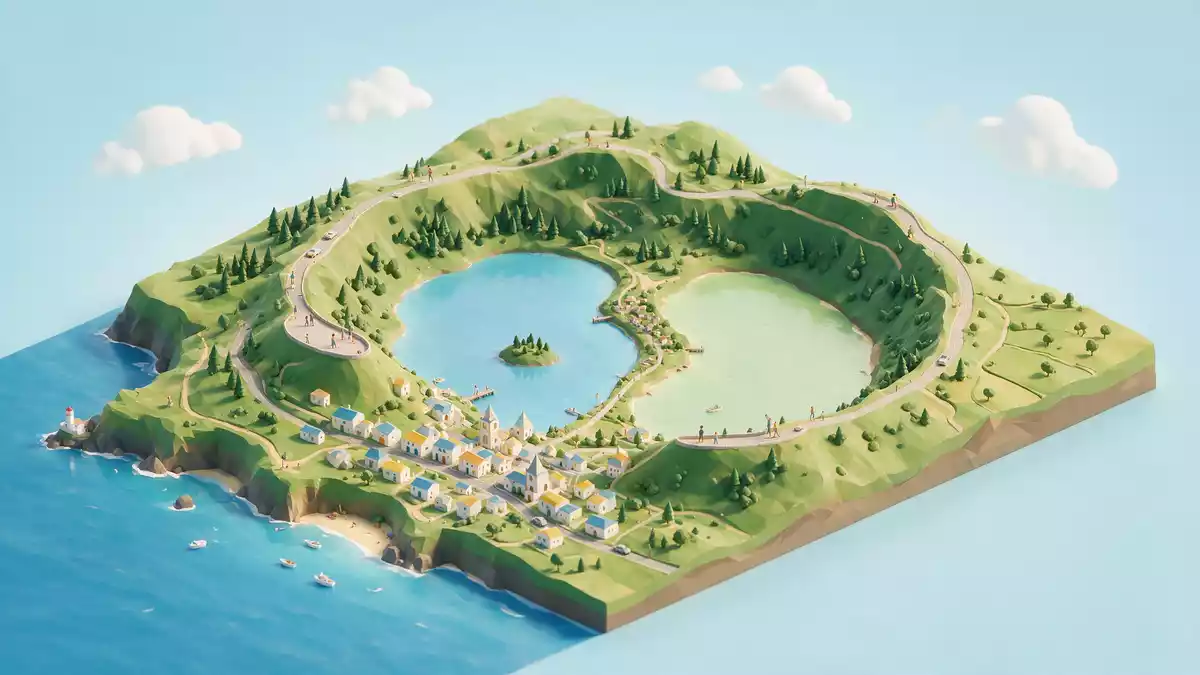
Sete Cidades on São Miguel in Portugal brings together a volcanic crater, a lakeside parish and one of the island’s most recognisable freshwater landscapes in a single enclosed basin. At the western end of the municipality of Ponta Delgada, the settlement lies inside a caldera whose floor is largely occupied by Lagoa das Sete Cidades, a twin lake system that has become a defining image of the Azores.
A volcanic basin filled with water and village life
Sete Cidades is both the name of a civil parish and of the caldera in which it sits, forming an unusual combination of inhabited village and enclosing volcanic landform. The parish belongs to the municipality of Ponta Delgada on São Miguel, part of the Azores archipelago in the Atlantic Oceanmunicipality of Ponta Delgada. The surrounding Sete Cidades Volcano marks the western end of São Miguel and is crowned by a collapse caldera with an average diameter of about 5.3 km (3.3 mi), a form created by the subsidence of the volcanic structurecollapse caldera with an average diameter of 5.3 km.
The floor of this basin is not an empty depression but a settled landscape of lakeshore, pasture and clustered houses. The parish of Sete Cidades occupies part of the interior, with the built-up area near the western margin of the main lake, its streets and low-rise buildings following the gentle slopes above the water’s edgeim Inneren der vulkanischen Caldeira Sete Cidades. Around it, the green interior of the caldera rises towards the rim, enclosing the parish in a continuous ring of higher ground that separates this western basin from the rest of São Miguel.
Lagoa das Sete Cidades and the twin lakes
Lagoa das Sete Cidades is the largest lake system in the Azores, occupying a significant part of the caldera floor and forming a single freshwater reservoir with two distinct named sectionslargest lake in the Azores. The overall water body extends for about 4.2 km (2.6 mi) and covers roughly 4.3 km² (1.7 sq mi), framed by the steep inner slopes of the volcanic wallsdiameter of 4.2 km and surface of about 4.3 km². Within this continuous surface, the northern expanse is referred to as Lagoa Azul, while the southern part is known as Lagoa Verde, the two linked by a narrow passage crossed by a road bridge that also functions as a local connection for traffic between lake marginstwo sub-lakes linked by a narrow passage.
From the rim of the caldera, viewpoints look down on the contrasting surfaces of Lagoa Azul and Lagoa Verde, the water lying far below in a broad depression encircled by the crater walls. The twin lakes sit within a protected landscape recognised under several conservation frameworks, including Ramsar status for wetlands and integration into the Azores UNESCO Global Geopark, which reflects both their ecological significance and geological interestRamsar Site and UNESCO Global Geopark. On the lakeshore, small piers, roads and grazing areas lie close to the water, while the slopes above carry patchwork fields and stands of vegetation that climb towards the rim.
Sete Cidades as protected landscape and parish
The wider Lagoa das Sete Cidades area forms part of a protected landscape at the west end of São Miguel, covering about 2,173 hectares (5,374 acres) that include the lake, the inner slopes and sections of the caldera rimprotected area of about 2,173 hectares. Within this setting, Sete Cidades functions as a parish with its own administrative identity, forming part of the network of freguesias on São Miguel and contributing to the inhabited character of the otherwise strongly natural basincivil parish in the municipality. The dual status of Sete Cidades as both living village and major landscape feature gives the area a layered identity: volcanic structure, freshwater resource and local community coexist within the same boundaries.
The volcano itself reaches an altitude of 856 m (2,808 ft) at Pico da Cruz on the rim, creating a substantial height difference between summit and lake surfacealtitude of 856 metres at Pico da Cruz. The caldera is described as having formed roughly 36,000 years ago, a timescale that places its origin in the late Pleistoceneformed around 36 thousand years ago. Within this long geological history, the nineteenth century brought recorded volcanic activity, with the last eruption dated to 1880, a reminder that the basin belongs to a dormant rather than extinct volcanic systemlast eruption dated to 1880.
Visiting Sete Cidades: what travellers from Western Europe should know
- Sete Cidades lies on the western side of São Miguel Island within the municipality of Ponta Delgada, reached by road from the city across high ground above the caldera.
- The terrain combines lake shore with rising inner slopes and the caldera rim, so moving between viewpoints and the parish involves gradients and sections of road or path that climb and descend.
- The wider landscape includes other named viewpoints and coastal areas on the western side of São Miguel, making Sete Cidades part of a broader circuit of volcanic and ocean-facing sites.
- The official language is Portuguese and the currency is the euro.
Searching for Sete Cidades on social platforms
These links open searches for Sete Cidades on each platform.Frequently asked questions about Sete Cidades
Where is Sete Cidades located?
Sete Cidades is on the western side of São Miguel Island in Portugal’s Azores, within the municipality of Ponta Delgada and inside the Sete Cidades volcanic caldera.
What should visitors expect when they arrive at Sete Cidades?
Visitors encounter a parish beside a large twin lake on the floor of a volcanic basin, with roads, paths and viewpoints tracing the enclosed landscape between lakeshore, village and crater rim.
What makes Sete Cidades distinctive among Azores landscapes?
Sete Cidades combines the largest lake system in the Azores with a collapse caldera and a functioning parish, creating a single site where geological structure, freshwater reservoir and settlement share one basin.


