
Seoraksan Gungnip Gongwon, granite peaks above Sokcho
Published on 09/04/2026 at 12:39 | Editorial responsibility: Rafael Müller, Editor-in-Chief AD HOC NEWS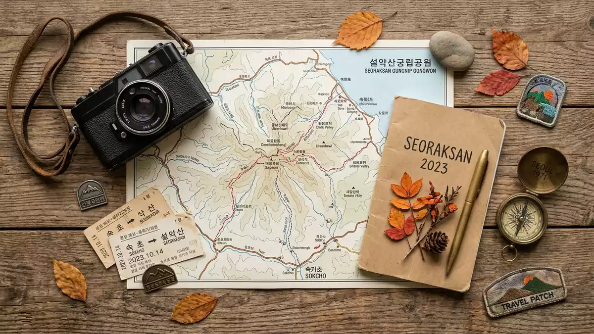
Seoraksan Gungnip Gongwon, known in English as Seoraksan National Park, stretches across the granite peaks and forested valleys of the Taebaek mountain range inland from Sokcho in north-eastern South Korea. The park centres on Seoraksan, the highest mountain in this part of Gangwon Province, and offers a compact introduction to Korean highland scenery within a protected landscape designated as a UNESCO biosphere reserve since 1982.
Granite ridges, deep valleys and the Taebaek backdrop
Seoraksan Gungnip Gongwon occupies a swathe of the Taebaek mountain range on the east-central Korean peninsula, where dissected granite and gneiss have been carved into rocky hills, high ridges and narrow valleys. The park forms part of the wider Mount Sorak biosphere reserve recognised under UNESCO’s Man and the Biosphere Programme, which notes the combination of steep slopes, exposed rock and forested basins in an area of more than 76,000 ha.Mount Sorak biosphere reserve Within this terrain, Seoraksan itself rises to 1,708 m (5,604 ft), making Daecheongbong peak one of the higher summits in South Korea and a prominent landmark above Sokcho and the surrounding districts of Gangwon Province.Daecheongbong peak at 1,708 m
The park’s boundaries take in much of the Seoraksan range and extend across several administrative areas, including Sokcho, Inje, Goseong and Yangyang, with a total area of around 398 km² recorded in official descriptions.approximately 398 km² From the lower valleys, sharp ridgelines rise in layers, creating a backdrop where bare rock outcrops stand above slopes of mixed woodland. In places the relief is particularly dramatic, such as the section known as Dinosaur Ridge, where a serrated skyline of peaks and cols forms an obvious target for experienced hikers. Elsewhere, more rounded hills and gentler inclines frame streams and lower forest paths, giving the park a range of landscapes within a relatively compact distance.
Outer Seorak, Inner Seorak and the gateway at Sokcho
For visiting travellers, Seoraksan Gungnip Gongwon is commonly understood through three broad sections: Outer Seorak on the eastern side near Sokcho, Inner Seorak further inland, and South Seorak extending towards the southern flanks of the range.division into Outer, Inner and South Seorak Outer Seorak, the area most immediately accessible from Sokcho, gathers a cluster of trailheads, viewpoints and visitor facilities around the Seorak-dong entrance, where valley floors open towards the higher cliffs and ridges. This section includes popular walking routes to low summits and waterfalls, as well as viewpoints reached by short paths from the main entrance.
Sokcho itself lies on the north-eastern coast of South Korea and functions as the urban gateway to Seoraksan Gungnip Gongwon, with roads and bus routes running inland to the park. Descriptions of the park note that its extent includes parts of Sokchosi and neighbouring counties such as Injegun and Yanyanggun, underlining how the protected area interlocks with settled districts along the Taebaek range.location in Gangwon Province From the approach valley at Seorak-dong, walking paths fan out towards temples, riverside sections and higher viewpoints, while longer hiking routes connect through to Inner Seorak and more remote areas of the park for those prepared for full-day excursions.
Protected status, cultural sites and hiking experiences
Seoraksan Gungnip Gongwon was designated as South Korea’s fifth national park in 1970, reflecting the significance of the Seorak range within the country’s protected-area system.fifth national park in 1970 Two decades later, in 1982, Mount Sorak and its surroundings received recognition as Korea’s first UNESCO biosphere reserve, a status that highlights both the ecological value of the park’s forests, streams and rock slopes and the interaction between the natural environment and the communities around Sokcho and neighbouring towns.Korea’s first UNESCO biosphere reserve
Within the park, walking routes connect natural scenery with cultural sites, including Buddhist temples that stand in the valleys beneath the ridges. Trails range from short, paved path sections near the main entrance to longer mountain routes on steeper ground, where hikers encounter rock steps, forest paths and exposed slopes. Some routes lead towards Daecheongbong and other high summits, while others loop through lower basins and river corridors, offering views of cliffs, gorges and seasonal colours in the forest canopy. For many visitors from Western Europe, Seoraksan Gungnip Gongwon therefore combines the appeal of a mountain hike with the chance to encounter elements of Korean religious architecture and sculpture set within a national park landscape.
Visiting Seoraksan Gungnip Gongwon: what travellers from Western Europe should know
- Seoraksan Gungnip Gongwon lies inland from Sokcho in Gangwon Province, on the east-central Korean peninsula, with road and bus connections linking the coastal city to the Seorak-dong entrance area.
- Terrain inside the park ranges from paved valley paths to steep mountain trails, with some routes involving long ascents on forest tracks or rocky sections where sure footing and appropriate footwear are important.
- The official language is Korean and the currency is the South Korean won.
- Entry requirements depend on your nationality; UK travellers can check the FCDO travel advice at gov.uk/foreign-travel-advice, Irish travellers the Department of Foreign Affairs at ireland.ie.
Searching for Seoraksan Gungnip Gongwon on social platforms
These links open searches for Seoraksan Gungnip Gongwon on each platform.
Frequently asked questions about Seoraksan Gungnip Gongwon
Where is Seoraksan Gungnip Gongwon located?
Seoraksan Gungnip Gongwon is in Gangwon Province on the east-central Korean peninsula, inland from the coastal city of Sokcho and forming part of the Taebaek mountain range.
What should visitors expect on a visit to Seoraksan Gungnip Gongwon?
Visitors encounter granite peaks, forested valleys and a network of trails ranging from short valley walks to longer mountain hikes, with cultural sites such as temples integrated into the national park landscape.
What makes Seoraksan Gungnip Gongwon distinctive among South Korean mountain parks?
The park combines the high summit of Seoraksan, UNESCO biosphere reserve status and the division into Outer, Inner and South Seorak sections, all within reach of Sokcho, making its Taebaek landscapes readily accessible.


