
Salar de Uyuni and the mirror salt desert of Bolivia
Published on 08/21/2026 at 20:14 | Editorial responsibility: Rafael Müller, Editor-in-Chief AD HOC NEWS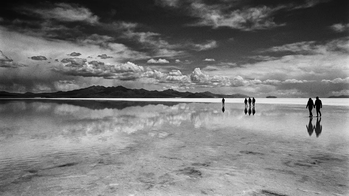
On the high plateau of southwest Bolivia, Salar de Uyuni spreads as a hard white crust that seems to erase edges, shadows and distance in every direction. Set on the Andean Altiplano near the town of Uyuni, this salt flat sits at an elevation of around 3,650 m (about 11,975 ft) and covers more than 10,000 square kilometres (about 3,900 square miles), making it the largest continuous salt flat on Earth.
A high-altitude salt crust that behaves like land and lake
Salar de Uyuni lies within the Daniel Campos Province of the Potosí Department in southwest Bolivia, close to the crest of the Andes.The Uyuni Salt Flat belongs to the Altiplano, the high plateau that runs between the main Andean ranges across this part of South America.Salar de Uyuni, Bolivia From above, satellite images show a geometric white patch, almost level across its surface.
Beneath the surface, the salt flat is saturated by brine, while the upper layer forms a hard crust that can support vehicles and long straight tracks across the plain.a thick, hard crust of salt Studies describe this crust as being made mainly of halite, the mineral form of sodium chloride, with thinner layers of other evaporite minerals and lacustrine sediments beneath.a hard and smooth halite crust The combination of high altitude, extreme flatness and reflective surface gives Salar de Uyuni a character closer to a bright frozen lake than to a typical desert basin.
Patterns, islands and horizons on the Bolivian Altiplano
On dry days, the salt surface shows an array of interlocking polygons, formed by the contraction and expansion of the crust as moisture moves through it.desiccation polygons These shapes are large enough to see clearly from ground level, giving the ground a cracked, tessellated appearance that repeats towards the horizon. In some areas, tracks from vehicles cut lines through this pattern, underlining how firm the surface can be.
Isolated hills and former volcanic cones, sometimes referred to as islands, rise from the salt and mark the transition between the blinding white surface and the darker surrounding mountains.Uyuni Salt Flat From these higher points, visitors see how the salt crust stretches towards distant Andean peaks, with almost no visible relief across its expanse. The scale can be disorientating: with clouds or nearby volcanoes reflected on the salt, it becomes difficult to judge where land ends and sky begins.
Salt, lithium and scientific interest beneath the white surface
The visible salt crust represents only part of Salar de Uyuni’s mineral wealth. Beneath it lies brine enriched in lithium and other dissolved salts, forming one of the world’s most significant lithium resources by volume.approximately 70% of the world’s lithium reserves Estimates speak of billions of tonnes of salt in total across the flat, with only a small proportion extracted in traditional saltworks at the margins.Ten billion tons of salt cover 10,582 square kilometers
Geologists see Salar de Uyuni as a record of changing lakes on the Altiplano during the Quaternary period, when large prehistoric lakes filled this high basin.the evaporation of Tauca paleolake Layers of halite and clays preserve information about past climate and water levels. The astonishing flatness and reliable reflectivity also mean that satellite operators use Salar de Uyuni as a natural calibration surface for remote sensing instruments, tying this remote plateau directly into global Earth observation networks.ideal for calibrating the altimeters of Earth observation satellites
Visiting Salar de Uyuni: what travellers from Western Europe should know
- Salar de Uyuni lies in southwest Bolivia near the town of Uyuni, which serves as the main gateway on the southern Altiplano.
- The salt flat stands at around 3,650 m (about 11,975 ft), so every visit involves high-altitude conditions on open, exposed terrain.
- Vehicle tracks lead far out onto the salt surface, and journeys across the flat cover long distances without natural shade or shelter.
- Within sight of the salt flat lie volcanic peaks and rocky islands, creating strong contrasts in altitude and terrain under the same Andean sky.
- The official language is Spanish and the currency is the Bolivian boliviano. Entry requirements depend on your nationality; UK travellers can check the FCDO travel advice at gov.uk/foreign-travel-advice, Irish travellers the Department of Foreign Affairs at ireland.ie.
Searching for Salar de Uyuni on social platforms
These links open searches for Salar de Uyuni on each platform.
Frequently asked questions about Salar de Uyuni
Where is Salar de Uyuni and how high is it?
Salar de Uyuni lies in the Daniel Campos Province of the Potosí Department in southwest Bolivia, on the Andean Altiplano at about 3,650 m above sea level.
What should visitors expect on a visit?
Visitors encounter a vast, exposed salt surface with polygon patterns, long vehicle tracks, high-altitude air and wide horizons broken only by volcanic islands and distant mountains.
What makes Salar de Uyuni distinctive among landscapes?
Its combination of great size, extreme flatness, bright salt crust and reflective surface under Andean skies creates a landscape where scale, distance and horizon feel radically altered.


