
Ruta de las Flores and Juayua’s highland towns
Published on 08/21/2026 at 15:37 | Editorial responsibility: Rafael Müller, Editor-in-Chief AD HOC NEWS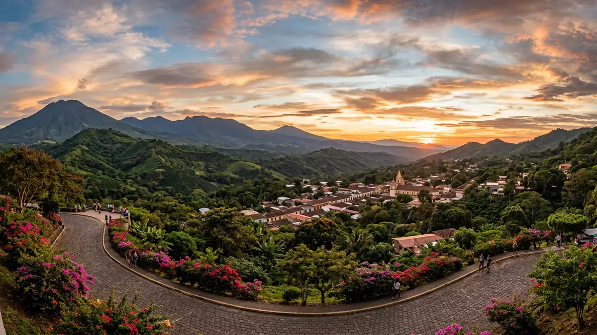
Ruta de las Flores threads through the western highlands of El Salvador, linking Juayua with a chain of small colonial towns set among coffee plantations and volcanic slopes. The road runs through the Apaneca-Ilamatepec mountain range in the departments of Sonsonate and Ahuachapán, creating a compact highland corridor where murals, flowers and mountain weather shape a distinct landscape.
A mountain road between coffee and volcanoes
Ruta de las Flores follows a highland road of around 35 km (22 mi), running between Sonsonate and Ahuachapán in western El Salvador along Highway CA-8.a highland road of around 35 km The route climbs through the Apaneca-Ilamatepec mountain range, an area where coffee fincas sit below a line of volcanic peaks and crater ridges.the Apaneca-Ilamatepec mountain range The road’s name refers to wildflowers along the verges, especially on stretches between the towns where hedges and banks stay green through much of the year.
Five colonial-era towns anchor Ruta de las Flores: Nahuizalco, Salcoatitán, Juayua, Apaneca and Concepción de Ataco.five colonial-era towns anchor Ruta de las Flores Smaller settlements and roadside stalls sit between them, but these towns mark the classic version of the route used in most guides.the classic version of the route Each town has its own balance of churches, plazas, low-rise houses and small markets, with the road itself functioning as a spine that keeps them connected.
Juayua as the highland hub
Juayua sits close to the centre of Ruta de las Flores and functions as a practical base for exploring the road’s towns. It lies in the department of Sonsonate at an elevation of around 1,000 m (3,281 ft), giving it cooler air than the coastal plains below.an elevation of around 1,000 m The town grew in the colonial period and its street grid centres on a plaza with a church, flanked by low buildings with tiled roofs.
Juayua’s main square and surrounding streets host a regular food market known locally as a gastronomic fair, which brings grills, seafood stands and stalls serving Salvadoran dishes into the open streets.a regular food market known locally as a gastronomic fair The town is also a departure point for short trips to coffee farms and to nearby waterfalls reached by paths descending from the built-up area into the surrounding ravines.
Towns, murals and coffee culture along the route
Each town on Ruta de las Flores has its own emphasis, but several threads repeat along the road. Streets in places such as Concepción de Ataco are known for painted facades and murals that depict rural scenes, legends and abstract patterns, giving otherwise modest buildings a strong visual presence.painted facades and murals Markets in Nahuizalco and other towns display handicrafts, while some squares feature large shade trees, including a ceiba in Salcoatitán that is described as centuries old.a ceiba in Salcoatitán
Coffee cultivation shapes the landscape throughout Ruta de las Flores, with plantations on the slopes above and below the towns and processing plants scattered along the road.coffee cultivation shapes the landscape Visitors encounter coffee at multiple points, from farms offering tours to cafes serving beans grown in the surrounding hills. The road’s alignment through the Apaneca-Ilamatepec range also brings it near volcanic features, including crater lakes above Apaneca that can be reached from the town by local roads and tracks.
Visiting Ruta de las Flores: what travellers from Western Europe should know
- Ruta de las Flores runs in western El Salvador between the towns of Sonsonate and Ahuachapán, and the road links Nahuizalco, Salcoatitán, Juayua, Apaneca and Concepción de Ataco.
- The terrain is hilly throughout, with towns sitting on slopes and short walks on uneven streets and stairways between plazas, viewpoints and bus stops.
- Juayua and the neighbouring towns stand at elevations of around 1,000 m (3,281 ft), so temperatures are generally lower than on the Pacific coast at sea level.
- The official language is Spanish and the currency is the United States dollar.
- Entry requirements depend on your nationality; UK travellers can check the FCDO travel advice at gov.uk/foreign-travel-advice, Irish travellers the Department of Foreign Affairs at ireland.ie.
Searching for Ruta de las Flores on social platforms
These links open searches for Ruta de las Flores on each platform.
Frequently asked questions about Ruta de las Flores
Where is Ruta de las Flores?
Ruta de las Flores is a highland road in western El Salvador that runs between Sonsonate and Ahuachapán and links five colonial towns in the Apaneca-Ilamatepec range.
What can visitors expect on Ruta de las Flores?
Visitors encounter small towns with plazas, churches, murals and markets, set among coffee plantations and volcanic slopes, with Juayua and other towns serving as bases for short excursions.
What makes Ruta de las Flores distinctive?
The combination of a compact mountain road, colonial-era towns such as Juayua and Concepción de Ataco, coffee landscapes and regular food and craft markets gives the route a character tied to both highland agriculture and small-town urban life.


