
Ruta de las Flores and Juayua on El Salvador’s highland coffee road
Published on 08/27/2026 at 07:35 | Editorial responsibility: Rafael Müller, Editor-in-Chief AD HOC NEWS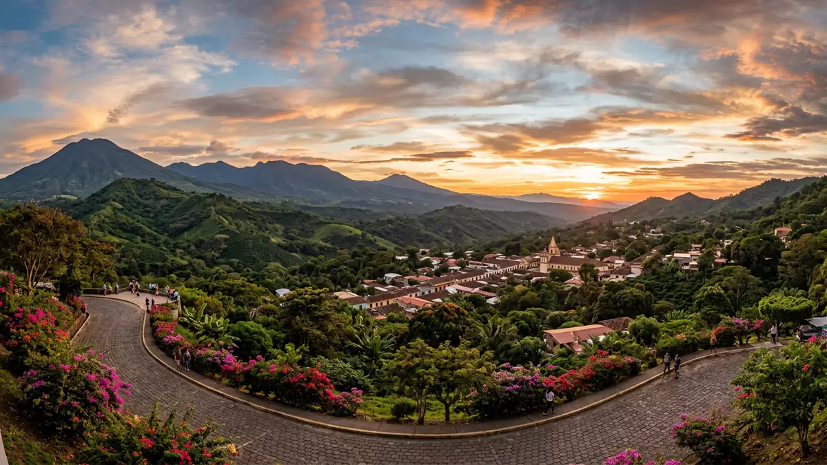
Ruta de las Flores in western El Salvador is a highland road that links the town of Juayua with other colonial-era settlements in the Apaneca-Ilamatepec mountains. Stretching for a little over 30 km between Sonsonate and Ahuachapan, it runs through coffee country where small plazas, painted facades and volcanic ridges sit along the same route.
A highland road between coffee towns
Ruta de las Flores is described as a scenic corridor through the western highlands of El Salvador, following Highway CA-8 between the larger towns of Sonsonate and Ahuachapan.Stretching between Sonsonate and Ahuachapan The road passes through a chain of small colonial towns set among coffee plantations, with the Apaneca-Ilamatepec mountain range forming the backdrop.A scenic corridor through the Apaneca-Ilamatepec range
Several guides describe the road as running for around 35 km and connecting five or six main towns, including Nahuizalco, Salcoatitán, Juayua, Apaneca and Concepción de Ataco.A 35 km route through western El Salvador The designation “Ruta de las Flores”, or Flower Route, refers both to the road itself and to this group of highland communities spread between the departments of Sonsonate and Ahuachapan.A named tourist corridor in the Apaneca-Ilamatepec range
Juayua and its neighbouring towns
Juayua sits roughly west of San Salvador in the department of Sonsonate, on the upland section of Ruta de las Flores where the road begins to climb into the coffee belt.Juayua in the highlands of Sonsonate It forms part of a chain of small towns along the route, each with its own plaza, church and streets lined with houses painted in bold colours.
Together with Nahuizalco, Salcoatitán, Apaneca and Concepción de Ataco, Juayua is consistently listed as one of the core settlements linked by Ruta de las Flores.Nahuizalco, Salcoatitán, Juayua, Apaneca and Concepción de Ataco Some descriptions add Sonsonate and Ahuachapan at either end of the road as additional points on the wider route, but the smaller highland towns form its recognisable core.Six towns linked by the Flower Route
Coffee landscape, murals and waterfalls
The landscape around Ruta de las Flores is characterised by steep hillsides planted with coffee, with the Apaneca-Ilamatepec mountain range recognised as a biosphere reserve that frames the route.Coffee plantations and volcanic peaks along the route From the road, travellers see rows of coffee bushes under taller shade trees, with volcanic ridges forming a visible horizon behind the towns.
Within the towns themselves, streets and facades carry murals and painted designs that have become a visual marker of this part of El Salvador.Murals and flower-lined streets in the highland towns Juayua is also described as a starting point for walks to nearby waterfalls, where paths lead from the edge of town into ravines cut into the volcanic plateau.Waterfall hikes starting from Juayua
Visiting Ruta de las Flores: what travellers from Western Europe should know
- Ruta de las Flores lies in western El Salvador, running through the Apaneca-Ilamatepec mountains between Sonsonate and Ahuachapan, with Juayua on the upland stretch of the route.
- The towns along the route sit on hilly terrain, and streets in Juayua and neighbouring settlements can include noticeable gradients and stairways between different levels.
- Buses link San Salvador and Santa Ana with Sonsonate, Juayua and other towns on the route, and the road itself follows Highway CA-8 through the highlands.
- The official language is Spanish and the currency is the United States dollar.
- Entry requirements depend on your nationality; UK travellers can check the FCDO travel advice at gov.uk/foreign-travel-advice, Irish travellers the Department of Foreign Affairs at ireland.ie.
Searching for Ruta de las Flores on social platforms
These links open searches for Ruta de las Flores on each platform.Frequently asked questions about Ruta de las Flores
Where is Ruta de las Flores and how is Juayua involved?
Ruta de las Flores runs through the western highlands of El Salvador between Sonsonate and Ahuachapan, and Juayua is one of the main towns along this road.
What can visitors expect on a journey along Ruta de las Flores?
Travellers encounter highland towns with plazas, churches, murals and coffee plantations, with Juayua providing a base among the hills and access to nearby waterfalls.
What makes this section of El Salvador distinctive compared with other regions?
The combination of a short named route, closely spaced colonial towns, coffee landscapes and volcanic ridges gives this highland corridor a compact mixture of settlements and scenery.


