
Rocky Mountain National Park on the divide
Published on 09/15/2026 at 15:39 | Editorial responsibility: Rafael Müller, Editor-in-Chief AD HOC NEWS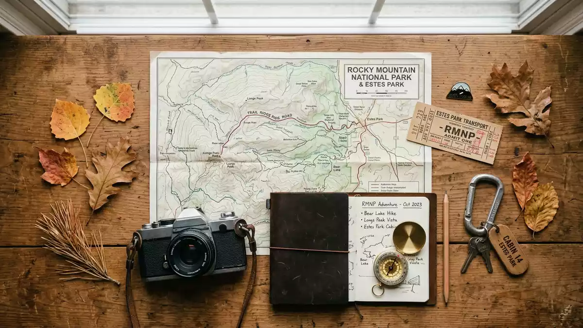
Rocky Mountain National Park, near Estes Park in Colorado, is defined by height, range and division. Its land rises from valley forests to Longs Peak, and the Continental Divide crosses the park’s centre. The park was established on 26 January 1915, and that date remains one of its clearest anchors. established on 26 January 1915
Longs Peak and the high backbone
Longs Peak rises to 4,346 m (14,259 ft), the highest point in the park, and it gives the landscape a hard vertical scale. Longs Peak anchors the eastern skyline, while the higher country carries alpine tundra above the tree line. The park’s elevation range runs from the valley floor to the summit, and that span is part of its character. elevation range
The park also carries a formal international designation as a biosphere reserve, which sits alongside its national park status. That designation adds another layer to the place’s identity, but the scene itself remains rugged and immediate: ridges, basins, forest, tundra and rock. The broad mountain frame is visible from many parts of the park, and the divide runs through that frame rather than around it. biosphere reserve
Trail Ridge Road across the alpine roof
Trail Ridge Road is the park’s most striking line, a paved route that crosses the mountains and reaches 3,713 m (12,183 ft). It runs for 48 miles and links the Estes Park side with Grand Lake, carrying traffic above the surrounding forest into open high country. The road is also the highest continuous paved road in North America. Trail Ridge Road
The road gives the park a second visual identity: not only peaks, but a crossing that sits high above them for long stretches. Above 11,000 ft, the landscape becomes alpine tundra, where the ground is low and exposed and trees disappear from the scene. That transition is one of the park’s defining features, and it changes the way the ridges and basins read from the road. alpine tundra
Bear Lake Road is another strong line in the park, a paved road 9.2 miles long that climbs from the Trail Ridge Road junction to the Bear Lake parking area. From there, short paths lead to water, forest edge and the surrounding trail network. The corridor gives a close view of the eastern side’s basins, slopes and lake country. Bear Lake Road
Rocky Mountain National Park in its historical frame
The park belongs to the early twentieth-century wave of American national park creation, and its 1915 establishment places it among the better-known examples of that period. President Woodrow Wilson signed the park act, and the name of the park has been fixed ever since. The date matters here because the protected landscape is part of a formal national system, not only a scenic mountain district. President Woodrow Wilson
Within that framework, Rocky Mountain National Park is less about a single building than about a sequence of landscapes. Forested valleys lead to open basins, then to ridges, then to the alpine zone. The Continental Divide cuts through the park and reinforces that sense of a landscape organised by altitude and watershed. Continental Divide
That mix of formal status, high mountain scale and sharply changing terrain is what gives the park its strongest identity. The place does not need embellishment: the heights, the road over the ridge and the divide through the core provide enough structure on their own. For travellers moving through western Colorado, it is a landscape of direct lines and abrupt elevation. high mountain scale
Visiting Rocky Mountain National Park: what travellers from Western Europe should know
- The park lies in northern Colorado, with Estes Park on the east side and Grand Lake on the west side. Trail Ridge Road and U.S. Highway 36 serve the eastern approach, while the park’s roads connect the main access points. The official language is English and the currency is the US dollar.
- The terrain is steep, high and exposed in the upper park, and Longs Peak rises to 4,346 m (14,259 ft). Bear Lake Road climbs from 8,200 feet to 9,475 feet, so altitude is part of the experience even before the high passes.
- Trail Ridge Road crosses the alpine zone, where the park’s tundra begins above about 11,000 feet. The route reaches 12,183 feet and carries the park’s most open mountain views.
- Bear Lake Road leads into a dense corridor of lakes, trailheads and mountain faces. The road ends at Bear Lake parking area and trailhead, with short paths leading from there.
Searching for Rocky Mountain National Park on social platforms
These links open searches for Rocky Mountain National Park on each platform.
Frequently asked questions about Rocky Mountain National Park
Where is Rocky Mountain National Park?
It lies in northern Colorado near Estes Park, with Grand Lake on the western side. The Continental Divide runs through the park and the landscape rises quickly into high mountain country.
What should a visit expect?
Expect steep altitude changes, a high paved road and a second road corridor around Bear Lake. The park combines forest, lakes, alpine tundra and some of the highest ground in the state.
What makes it distinctive?
Its most distinctive features are Longs Peak, the Continental Divide and Trail Ridge Road. Those elements give the park a strong vertical structure and a clear route across the mountains.


