
Ras Mohammed National Park’s reefs, faults and mangroves
Published on 09/07/2026 at 10:33 | Editorial responsibility: Rafael Müller, Editor-in-Chief AD HOC NEWS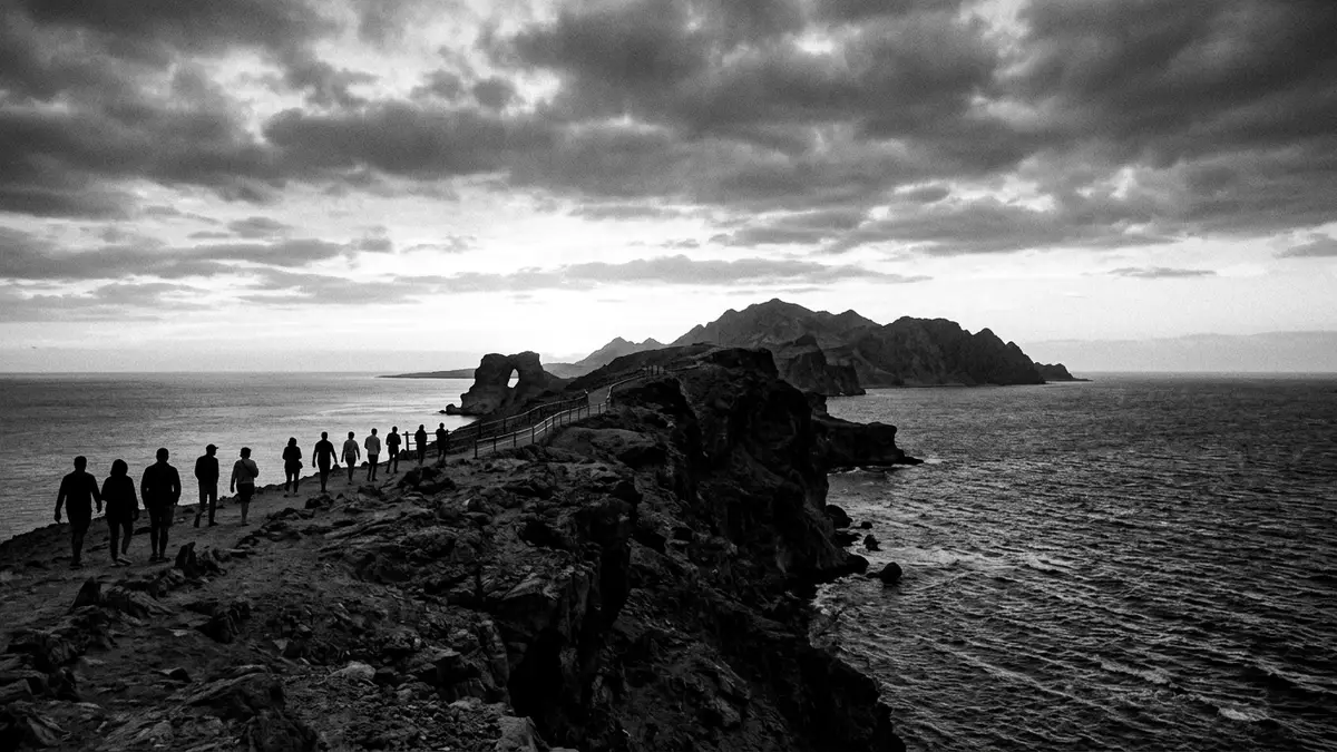
Ras Mohammed National Park sits at the southern tip of the Sinai Peninsula, where the Gulf of Suez meets the Gulf of Aqaba. Declared in 1983, it combines reef, desert and mangrove in one protected headland and sea landscapedeclared in 1983.
Coral walls and bare limestone
The park’s most immediate contrast is between the red-brown desert headland and the blue water around it. Coral reefs fringe the coast, while fossil coral and raised terraces mark the land beside the searaised terraces.
The terrain is shaped by faults and exposed rock. At ground level, that means broken limestone surfaces, shallow channels and coastal edges that feel sharply geological rather than decorativefaults and cliffs.
Desert plants, tidal water and birdlife
Ras Mohammed is not only a reef site. Mangroves grow in sheltered water, and the park also contains marine, coastal and terrestrial habitats that sit close together on the same headlandmarine, coastal and terrestrial habitats.
The combination gives the park its character as a place of edges: water against rock, salt-tolerant trees against arid ground, and open sea beside a narrow peninsula. That mix makes the landscape easy to read in layers, even without a long walk inlandmangroves and bays.
Ras Mohammed in Egypt’s conservation history
Ras Mohammed was established in 1983 and is regarded as Egypt’s first national park. The formal protection covers about 480 km², with marine waters forming the larger part of the area480 km².
Its status reflects a landscape that combines geology and ecology rather than a single scenic feature. Coral reefs, desert surfaces and mangroves sit side by side, giving the park a clear identity in the southern Sinaisouthern Sinai.
Visiting Ras Mohammed National Park: what travellers from Western Europe should know
- Ras Mohammed lies south of Scharm asch-Schaich on the Sinai Peninsula. The park is reached by road from the resort city, and several travel pages place it at the peninsula’s southern tip.
- The ground is uneven in places, with exposed rock, shoreline edges and shallow channels. The landscape includes reef platforms and fractured surfaces rather than a flat coastal plain.
- The park spans both land and sea, so its character changes between the desert headland and the underwater reefs. Mangrove patches add a third visible layer to the scenery.
- The official language is Arabic and the currency is the Egyptian pound.
- Entry requirements depend on your nationality; UK travellers can check the FCDO travel advice at gov.uk/foreign-travel-advice, Irish travellers the Department of Foreign Affairs at ireland.ie.
Searching for Ras Mohammed National Park on social platforms
These links open searches for Ras Mohammed National Park on each platform.
Frequently asked questions about Ras Mohammed National Park
Where is Ras Mohammed National Park?
It lies at the southern tip of the Sinai Peninsula, near Scharm asch-Schaich. The park faces both the Gulf of Suez and the Gulf of Aqaba.
What can be seen there?
The park brings together coral reefs, mangroves, desert ground and raised fossil coral formations. Its scenery is a mix of shoreline, rock and shallow coastal water.
What makes it distinctive?
Its defining feature is the combination of marine and desert landscapes in one protected area. The 1983 designation and the park’s first-national-park status in Egypt add historical weight to that setting.


