
Queen Elizabeth National Park between lakes, savanna and volcanoes
Published on 09/02/2026 at 19:19 | Editorial responsibility: Rafael Müller, Editor-in-Chief AD HOC NEWS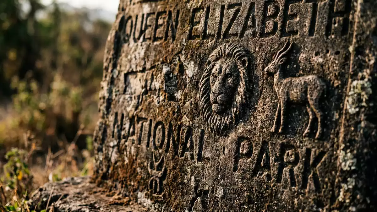
Queen Elizabeth National Park in western Uganda spreads across a broad sweep of savanna, lakeshore and volcanic crater country between Kasese and the frontier with the Democratic Republic of the Congo. Established in 1952 and renamed in 1954 to honour Queen Elizabeth II, it has become a cornerstone of Uganda’s protected landscapes in the Albertine Rift Valley.
A park shaped by the Rift Valley and the lakes
Queen Elizabeth National Park covers about 1,978 km² (764 sq mi) in the western arm of the East African Rift, lying between Lake George to the north-east and Lake Edward to the south-west, which are linked by the Kazinga Channel running through the centre of the protected area.Kazinga Channel The park straddles the equator and occupies rolling plains and low hills south of the Rwenzori Mountains, whose high peaks rise just beyond its northern boundary.rolling plains east of Lake Edward
The protected area spans several districts, including Kasese, Kamwenge, Rubirizi and Rukungiri, with Kasese town lying close to the park’s northern edge and acting as a common access point.spans the districts of Kasese, Kamwenge, Rubirizi, and Rukungiri Within its boundaries the land ranges roughly from 910 to 1,390 m (2,985 to 4,560 ft) above sea level, taking in low-lying lake basins, undulating grasslands and elevated crater rims.altitudinal range of 910 to 1,390 metres
Ecosystems from crater lakes to forest
The park is recognised as a UNESCO Biosphere Reserve, reflecting the density of habitats packed into a relatively compact area and the way conservation is linked with surrounding communities.UNESCO Biosphere Reserve Landscapes here include grassy savanna with scattered trees, Acacia-dominated woodlands, patches of tropical forest, papyrus-lined wetlands and volcanic craters whose basins hold lakes or bare ash and rock.Albertine Rift Valley Along the Kazinga Channel and the shores of Lake George and Lake Edward, broad belts of wetland and open water sit beside dry plains, creating sharp transitions over short distances.
The protected area also incorporates linked reserves and forests, such as Kyambura and Kigezi wildlife reserves and the Maramagambo Forest, which add further lowland forest and riverine habitat to the mix.includes the game reserves of Kigezi and Kyambura Crater fields in the northern sector create a distinctive landscape of circular depressions and short steep slopes, while in the south the Ishasha River marks part of the boundary and brings gallery forest and open floodplain to the park’s southern reaches.bounded by the Ishasha River and Lake Edward
Wildlife in a dense savanna and wetland mosaic
Queen Elizabeth National Park holds a broad range of large herbivores, including African elephants, buffalo, hippopotamus, Uganda kob, waterbuck and topi, which move between grassland, woodland and wetland zones.Large herbivore species include hippopotamus, elephant, buffalo, Uganda kob, waterbuck and topi Lions, leopards and spotted hyenas represent the main large carnivores, and some lions in the Ishasha sector are known for resting in trees, a behaviour that has become closely associated with this part of the park.Tree Climbing lions
Primates, including chimpanzees in the Kyambura Gorge area, add a forest dimension to wildlife viewing alongside the plains species.chimpanzee (Pan troglodytes) Birdlife is notably varied, with hundreds of species recorded in the wider reserve, from waterbirds concentrated along the Kazinga Channel and crater lakes to raptors and grassland species in the open plains.over 600 species of birds The mix of savanna, wetland, forest and crater habitats means wildlife-viewing routes can move between very different settings within a single day.
Visiting Queen Elizabeth National Park: what travellers from Western Europe should know
- Queen Elizabeth National Park lies in western Uganda between Lake George and Lake Edward, with the Kazinga Channel crossing the park and Kasese town to the north acting as a common arrival point by road.
- The terrain combines low-lying lake basins and river plains with undulating savanna and short, steeper slopes around volcanic craters, so some viewpoints and crater rims involve walking on uneven ground.
- Within Uganda the park sits in the Western Region and is reached by road from Kampala and Entebbe or by domestic flights to airstrips near the park, with road access continuing from Kasese and other towns.
- The official language is English and the currency is the Ugandan shilling.
- Entry requirements depend on your nationality; UK travellers can check the FCDO travel advice at gov.uk/foreign-travel-advice, Irish travellers the Department of Foreign Affairs at ireland.ie.
Searching for Queen Elizabeth National Park on social platforms
These links open searches for Queen Elizabeth National Park on each platform.
Frequently asked questions about Queen Elizabeth National Park
Where is Queen Elizabeth National Park?
Queen Elizabeth National Park lies in western Uganda, spanning districts including Kasese, Rubirizi, Kamwenge and Rukungiri between Lake George and Lake Edward.
What should visitors expect on a visit?
Visitors encounter a mix of savanna, wetlands, crater landscapes and forest patches, with routes that bring views of large mammals, primates and varied birdlife in different habitats.
What makes Queen Elizabeth National Park distinctive?
The combination of two large lakes linked by the Kazinga Channel, crater fields, a recognised biosphere reserve status and dense wildlife across multiple ecosystems gives the park a distinctive character.


