
Qal'at al-Bahrain, layered capital and coastal fort near Manama
Published on 09/12/2026 at 18:43 | Editorial responsibility: Rafael Müller, Editor-in-Chief AD HOC NEWS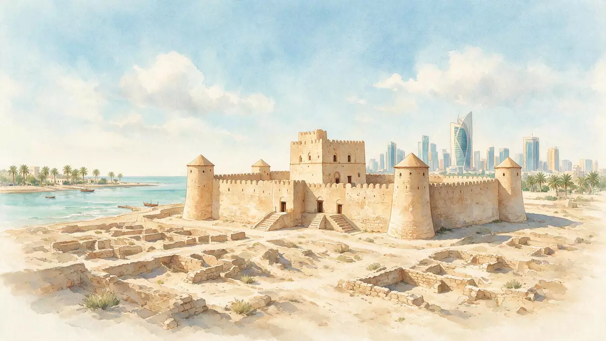
Qal'at al-Bahrain on the northern shore of Bahrain Island is both an archaeological mound and a coastal fort, forming a layered record of settlement near Manama. The site preserves traces of the ancient land of Dilmun alongside later Islamic and Portuguese defences, and has been recognised as a UNESCO World Heritage Site since 2005.
A tell by the Gulf with a Portuguese fort on its crown
Qal'at al-Bahrain occupies a broad artificial hill beside the Gulf, where centuries of building and rebuilding have created a tell rising above the fertile coastal plain west of Manama. The mound extends over more than 16 hectares and forms a roughly rectangular plateau, with archaeological layers that testify to continuous human presence from about 2,300 BC to the 16th century AD.continuous human presence from about 2,300 BC The northern shoreline lies close at hand, linking the site to long-distance sea routes across the Gulf and towards the wider Indian Ocean world.
Sitting on the crown of the mound is a substantial stone fortification whose walls and towers dominate the skyline above the surrounding palm groves. This fort dates from the 16th century, when Portuguese power was established at key harbours along the Gulf, and its presence gave the whole site its Arabic name, with “qal'a” meaning fort.mound topped by a Portuguese fort Within this fort a network of passages, courtyards and defensive platforms sits directly above much older structures buried in the tell below.
Ancient harbour of Dilmun and layered urban fabric
Long before the Portuguese walls were raised, Qal'at al-Bahrain functioned as the principal harbour of Bahrain and the capital of the land known as Dilmun, an important civilisation of the Gulf from the end of the third to the middle of the first millennium BC.capital of the land of Dilmun Archaeological excavations have revealed residential quarters, public buildings and commercial spaces arranged in dense urban patterns, illustrating how the settlement grew around a thriving port that received goods from Mesopotamia and regions further east.
The tell preserves successive fortifications and palaces, creating a vertical sequence in which defensive works from around the third century BC stand beneath the later fortress above.fortifications and palaces from ca. 2,300 BCE to the 16th century Stone foundations, mud-brick walls and street layouts display changes in building technique and civic organisation over millennia, while the arrangement of houses and temples reflects the changing social and religious life of the harbour city. Finds from these levels, including inscriptions and trade goods, are presented in the nearby site museum, which interprets the long span of occupation and the role of Dilmun in regional exchange.
Landscape setting between palm groves, sea tower and reef channel
Beyond the main mound, Qal'at al-Bahrain forms part of a wider cultural landscape that ties the settlement to the sea and surrounding agriculture. Palm groves fringe the base of the tell, creating a band of cultivation between the archaeological hill and the coastline and recalling the importance of date palms and irrigation to life on Bahrain’s north coast.palm-groves adjacent to the tell Paths across the site reveal the relationship between housing quarters on the mound and fields below.
Out in the Gulf a short distance from the shore stands a separate sea tower, aligned with a natural channel cut through the coral reef. This offshore structure lies about 1,600 m north-west of the tell and marks the entrance to a sea channel of almost the same area as the main mound, emphasising the maritime character of the settlement and its role as an ancient harbour.sea tower and reef channel near the tell Together, the tell, sea tower, channel and palm groves form a single World Heritage property that illustrates how urban life, agriculture and navigation were interwoven along Bahrain’s northern coast.
Visiting Qal'at al-Bahrain: what travellers from Western Europe should know
- Qal'at al-Bahrain lies on Bahrain’s north coast in the Northern Governorate, a few kilometres west of Manama, and is reached by road through the Al Qalah and Karbabad districts.
- The archaeological mound rises several metres above the surrounding plain and paths within the fort and settlement include uneven surfaces, low steps and areas of exposed stone.
- The site stands beside the shore with palm groves at its base, so walking routes cross open ground with little shade between the parking area, the tell and the coastal edge.
- The official language is Arabic and the currency is the Bahraini dinar.
- Entry requirements depend on your nationality; UK travellers can check the FCDO travel advice at gov.uk/foreign-travel-advice, Irish travellers the Department of Foreign Affairs at ireland.ie.
Searching for Qal'at al-Bahrain on social platforms
These links open searches for Qal'at al-Bahrain on each platform.
Frequently asked questions about Qal'at al-Bahrain
Where is Qal'at al-Bahrain located in relation to Manama?
Qal'at al-Bahrain stands on Bahrain’s northern coast in the Northern Governorate, several kilometres west of central Manama and close to the Al Qalah district.
What should visitors expect when exploring Qal'at al-Bahrain?
Visitors encounter a broad archaeological mound with excavated streets and foundations, topped by a substantial 16th-century Portuguese fort and bordered by palm groves and shoreline.
What makes Qal'at al-Bahrain distinctive among Gulf heritage sites?
Qal'at al-Bahrain combines a long sequence of occupation from about 2,300 BC to the 16th century with its role as harbour and capital of Dilmun, all preserved beneath and within one coastal fort.


